Old Maps of Covenant Life, Alaska for Academic Research
Study the evolution of Covenant Life with 5 high-resolution historic maps. Whether you're teaching, researching, or modeling changes in land use, these maps provide essential visual documentation of urban, environmental, and geographic change.
- Analyze long-term change: Track patterns in development, transportation, and natural features.
- Ideal for environmental or urban studies: Support academic projects with primary historical map data.
- Use in the classroom or lab: Educators and researchers rely on these maps to bring historical context to life.
These maps are a powerful tool for teaching, research, and visualizing how Covenant Life has changed over the decades.
Covenant Life, AK maps
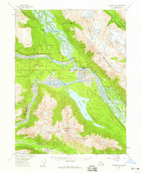
(5)- 1952 Map of Skagway, 1953 Print
 1952 Skagway1953 Print · USGSThe northern reaches of the Alaska Panhandle come alive in the early fifties, showing the vital rail and road links to the Yukon. Trace the historic White Pass & Yukon Route or locate remote camps like Pleasant Camp and Klukwan.4 unique versions available
 - 1954 Map of Skagway B-3, 1959 Print
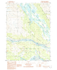
 1954 Skagway B-31959 Print · USGSSoutheast Alaska in the mid-fifties reveals a landscape of glacial rivers and historic transit routes near the Canadian border. Genealogists and historians can trace the paths of the Indian Trail and Dalton Trail past the settlement of Klukwan and the cabins at Wells.2 unique versions available
 - 1961 Map of Skagway, 1967 Print
 1961 Skagway1967 Print · USGSThe northern reaches of the Panhandle and the rugged border with British Columbia come into focus in the early sixties. Researchers can trace the historic Chilkoot Trail, the White Pass and Yukon Railway, and coastal outposts like Klukwan.4 unique versions available
 - 1991 Map of Skagway B-3 NW
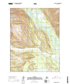
 1991 Skagway B-3 NW1991 Print · USGSThe northern reaches of the Alaska Panhandle are documented here during the early nineties at the junction of three major glacial rivers. Historians can trace the Dalton Trail alongside the Klehini River and locate the Mosquito Lake State Recreation Site.
 - 2017 Map of Skagway B-3 NW, 2017 Print
 2017 Skagway B-3 NW2017 Print · USGSNear Haines in the late 2010s, this area shows the vital river systems and small communities of the northern Panhandle. Trace local land use and hydrology along the Chilkat River, Mosquito Lake, and the junction of the Haines Highway.
End of results
Showing maps 1-5 of 5
Top cities near Covenant Life
Frequently asked questions
- What are the different types of historical maps available for Covenant Life?
- What is the oldest map of Covenant Life?
- Where can I purchase historical maps of Covenant Life for my home or office?
- Where can I download high-res historical maps of Covenant Life?
- Are there historical topographic maps available for Covenant Life?
- Is there historical aerial imagery available for Covenant Life?
- Where are historical maps of Covenant Life sourced from?