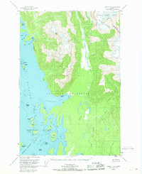
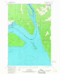
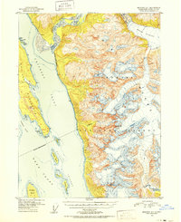
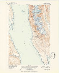
Old Maps of Haines, Alaska
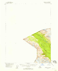
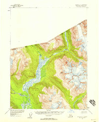
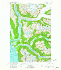
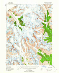
Explore 194 old maps of Haines, spanning from 1948 to today. These high-resolution historic maps reveal how streets, neighborhoods, landmarks, and natural features evolved over time — perfect for genealogy, metal detecting, research, and local history exploration.
What you can do with these maps:
- See how Haines changed over time: Compare historical maps to modern-day views to trace roads, homesites, rail lines & more.
- View detailed metadata: Each map includes creators, publishers, year, scale, and archive source.
- Overlay maps with satellite & LiDAR: Visualize the past alongside modern tools to explore terrain & human change.
- Trusted historical sources: Maps sourced from the USGS, Library of Congress, and other archives.
- Access maps your way: View online, download high-res files, or order prints for personal or research use.
Start exploring old maps of Haines to uncover forgotten places, hidden landmarks, and the deep history beneath your feet.
Haines, AK maps
(194)- 1948 Map of Juneau C-5, 1956 Print
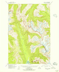 1948 Juneau C-51956 Print · USGSThe Chilkat Range and Glacier Bay wilderness are captured here during the late 1940s, highlighting the border of the Tongass National Forest. Researchers can trace the rugged divide from Volcanic Peak down to the Tidal Flat at Excursion Inlet.2 unique versions available
 - 1948 Map of Juneau B-4, 1956 Print
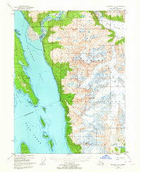
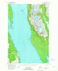
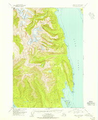 1948 Juneau B-41956 Print · USGSSoutheast Alaska’s coastal wilderness is captured in the late 1940s, showing the meeting of mountain and sea before modern infrastructure. Trace the shoreline of Lynn Canal to find isolated landmarks like Pt Howard, Lincoln Island, and the Lynn Sisters.2 unique versions available
 - 1948 Map of Juneau C-4, 1956 Print
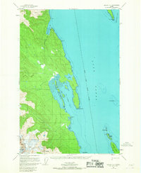
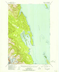 1948 Juneau C-41956 Print · USGSThe waters of the northern Alexander Archipelago are captured here in the late 1940s, highlighting the maritime navigation and coastal terrain of Southeast Alaska. Maritime historians and researchers can trace landmarks like Vanderbilt Reef Light, the small Cabin sites, and the islands of Lincoln Island and the Lynn Sisters.
 - 1948 Map of Juneau A-4, 1956 Print
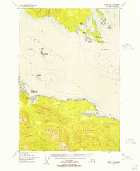 1948 Juneau A-41956 Print · USGSThe maritime junction of Southeast Alaska is captured here in the mid-twentieth century as navigation and coastal life relied on isolated outposts. Researchers can locate early coastal landmarks such as the Light at Swanson Harbor, Pt Couverden, and a Cem on the northern shore.4 unique versions available
 - 1948 Map of Juneau C-6, 1956 Print
 1948 Juneau C-61956 Print · USGSSoutheast Alaska’s coastal wilderness comes into focus in the late 1940s, documenting a time of significant glacial and maritime transition. Researchers can trace the intricate shorelines of the Beardslee Islands and the tidal reaches of the Salmon River.
 - 1948 Map of Juneau B-5, 1956 Print
 1948 Juneau B-51956 Print · USGSCoastal life in Southeast Alaska at the end of the 1940s centers on the deep waters of Excursion Inlet and the edge of Glacier Bay National Monument. Researchers can find early maritime landmarks like the Aero Light and trace local history at the Indian Cem and Military Cem.
 - 1948 Map of Skagway C-4, 1958 Print
 1948 Skagway C-41958 Print · USGSThe international border near the turn of the decade is defined by high peaks and glacial river systems. Researchers can trace the wild topography of the Kelsall River valley and locate landmarks like Hiteshitak Mountain and Mt Prinsep.
 - 1948 Map of Skagway C-3, 1958 Print
 1948 Skagway C-31958 Print · USGSThe northern wilderness near the Canadian border comes into focus in this late 1940s survey of the Coast Mountains. Researchers can trace the braided glacial channels of the Chilkat River and Tahini River beneath peaks like Mt Raymond.
 - 1948 Map of Juneau D-3, 1964 Print
 1948 Juneau D-31964 Print · USGSCoastal Alaska in the late 1940s is defined here by the convergence of glacial rivers into Berners Bay within the Tongass National Forest. Researchers can trace the wild paths of the Lace River and Antler River past a lonely Cabin on the shoreline.3 unique versions available
 - 1948 Map of Skagway C-2, 1964 Print
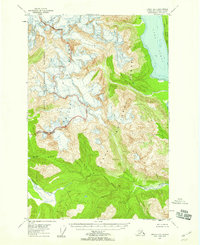
 1948 Skagway C-21964 Print · USGSThe international border between Alaska and British Columbia is frozen in time in this mid-century survey of the high Coast Range. Researchers can trace the massive paths of the Chilkat Glacier and Ferebee Glacier as they appeared just after the war.3 unique versions available
 - 1948 Map of Skagway A-1, 1964 Print
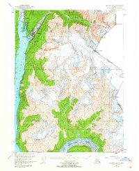
 1948 Skagway A-11964 Print · USGSSoutheast Alaska’s maritime and glacial terrain comes alive in the late 1940s as the Chilkoot Peninsula separates deep inlets. Trace the icy expanse of Meade Glacier or locate landmarks like Battery Point and the Chilkat Islands.3 unique versions available
 - 1949 Map of Atlin, 1958 Print
 1949 Atlin1958 Print · USGSThe high borderlands of the Alaskan panhandle are captured here just after the war, detailing the glaciated terrain of the Coast Mountains. Researchers can trace the international boundary as it passes Meade Glacier and prominent summits like Mt Canning and Mt Poletica.
 - 1949 Map of Juneau D-6, 1959 Print
 1949 Juneau D-61959 Print · USGSSoutheast Alaska was a wilderness of shifting ice and federal forest lands when this survey was finalized. Researchers can trace the mid-century extent of Casement Glacier and the remote terrain of Glacier Bay National Monument.3 unique versions available
 - 1949 Map of Juneau D-5, 1959 Print
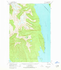
 1949 Juneau D-51959 Print · USGSThe Alaskan Panhandle's wilderness is captured at the close of the 1940s, showing a world of ice and deep water before statehood. Researchers can trace the rugged Chilkat Range and find landmarks like Mt Young and the deep Lynn Canal.3 unique versions available
 - 1949 Map of Skagway B-1, 1964 Print
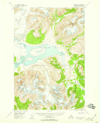
 1949 Skagway B-11964 Print · USGSSkagway at the midpoint of the century remains a vital link between the sea and the interior, dominated by its maritime and rail infrastructure. Researchers can trace the White Pass and Yukon Route railway and find local landmarks like Reid Falls and the Ferry Terminal.3 unique versions available
 - 1949 Map of Juneau D-4, 1965 Print
 1949 Juneau D-41965 Print · USGSThe mining camps and coastal outposts of the Lynn Canal corridor come into focus in this mid-century survey. Genealogists and industrial historians can trace the foundations of the Kensington Mine, the Eldred Rock Lighthouse, and the remote settlement at Comet.3 unique versions available
 - 1949 Map of Juneau C-4, 1967 Print
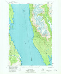
 1949 Juneau C-41967 Print · USGSThe Lynn Canal and the rugged coastline of the Chilkat Range are captured here in the late 1940s. Maritime researchers can trace essential navigational landmarks like Vanderbilt Reef Light and the remote shores of St James Bay.2 unique versions available
 - 1949 Map of Juneau D-3, 1971 Print
 1949 Juneau D-31971 Print · USGSThe eastern coast of Lynn Canal in the late 1940s reveals a landscape defined by industrial mining and maritime safety. Researchers can trace historic operations at the Kensington Mine, locate the Eldred Rock lighthouse, or find the small settlement at Sherman.
 - 1949 Map of Juneau B-4, 1974 Print
 1949 Juneau B-41974 Print · USGSCoastal wilderness in the Chilkat Range appears here as it was surveyed shortly after the war, showing a landscape defined by water and rock rather than roads. Researchers can trace the maritime geography of Lynn Canal and landmarks like Mount Golub and Lincoln Island.2 unique versions available
 - 1950 Map of Juneau C-6, 1968 Print
 1950 Juneau C-61968 Print · USGSCoastal Alaska at mid-century reveals a wilderness of glacial inlets and island chains within the Glacier Bay National Monument. Researchers can trace the complex shoreline of the Beardslee Islands and the courses of the Salmon River and Beartrack River.3 unique versions available
 - 1950 Map of Juneau B-5, 1968 Print
 1950 Juneau B-51968 Print · USGSSoutheast Alaska’s coastal wilderness comes into focus in the mid-twentieth century as maritime commerce and federal conservation intersect. Researchers can locate the Cannery at Excursion Inlet and trace heritage sites like the Indian Cem.2 unique versions available
 - 1951 Map of Juneau
 1951 Juneau1951 Print · USGSJuneau and the industrial waterfront of the Gastineau Channel are shown here at the start of the 1950s. Researchers can trace the mid-century footprint of Juneau, the mining history of Treadwell, and remote maritime outposts like Hoonah and Gustavus.4 unique versions available
 - 1951 Map of Skagway A-1, 1952 Print
 1951 Skagway A-11952 Print · USGSThe northern reaches of the Alaska Panhandle come into sharp focus in the early 1950s as a land of glaciers and deep-water inlets. Researchers can trace the maritime landscape from the Battery Point Light down to Sullivan Island and the mouth of the Katzehin River.2 unique versions available
 - 1951 Map of Atlin, 1952 Print
 1951 Atlin1952 Print · USGSThe international boundary between Alaska and British Columbia is charted here at the middle of the century, dominated by the Tongass National Forest. Researchers can trace the rugged border line across high peaks like Mt Poletica and the massive flow of Meade Glacier.
 - 1951 Map of Juneau D-4, 1952 Print
 1951 Juneau D-41952 Print · USGSSoutheast Alaska’s maritime and mining frontiers meet along Lynn Canal in the early fifties. Genealogists and industrial historians can trace the dormant gold works at Kensington Mine and the isolated Eldred Rock Lighthouse.2 unique versions available
Showing maps 1-25 of 194
Top cities of Haines
Frequently asked questions
- What are the different types of historical maps available for Haines?
- What is the oldest map of Haines?
- Where can I purchase historical maps of Haines for my home or office?
- Where can I download high-res historical maps of Haines?
- Are there historical topographic maps available for Haines?
- Is there historical aerial imagery available for Haines?
- Where are historical maps of Haines sourced from?