
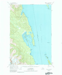
1949 Map of Juneau C-4
USGS Topo · Published 1967About this map
Lynn Canal dominates this maritime survey, showcasing the complex coastline of Southeast Alaska as it was recorded shortly after the war. The topography highlights the steep transition from the waters of St James Bay to the high peaks of the Chilkat Range, including Nun Mountain. Navigational aids of the era are clearly marked, such as Vanderbilt Reef Light and Little Islands Light, which guided vessels through these narrow passages toward Juneau. Along the western shore, the Glacier Bay National Monument boundary indicates the protected status of the wilderness area. Evidence of the region's glacial geography is seen in the Tidal Flat areas near Boat Harbor and the mouth of the Beardslee River. Islands such as Lincoln Island and Ralston Island sit at the southern edge of the sheet, providing a detailed record of the shoreline and maritime hazards before later mid-century updates.
Find a feature on this map
23 named features on this map. Tap any name to fly to it.
Don’t see what you’re looking for? This feature index may not catch every label — zoom into the map to look around manually.
Map Details
Editions of this 1949 Juneau C-4 Map
2 editions found
Other maps of this area

1947 · Juneau B-3
USGS Topo · 1:63,360

1948 · Juneau C-5
USGS Topo · 1:63,360

1948 · Juneau B-4
USGS Topo · 1:63,360

1948 · Juneau C-4
USGS Topo · 1:63,360

1948 · Juneau B-5
USGS Topo · 1:63,360

1948 · Juneau D-3
USGS Topo · 1:63,360

1949 · Juneau B-3
USGS Topo · 1:62,500

1949 · Juneau D-5
USGS Topo · 1:63,360

1949 · Juneau D-4
USGS Topo · 1:63,360

1949 · Juneau D-3
USGS Topo · 1:63,360