Old Maps of Mosquito Lake, Alaska for Genealogy
Trace your family roots with 5 historic maps of Mosquito Lake. These high-res maps reveal old neighborhoods, homesites, landmarks, and streets — helping you uncover where your ancestors lived and how the area evolved over time.
- Explore historic neighborhoods: Identify where your relatives may have lived in the 1800s or 1900s.
- Compare maps over time: Trace the changes in streets, buildings, and landmarks for multi-generational research.
- Perfect for genealogy & ancestry research: Used by family historians and researchers to map out lineage and migration.
These maps are an incredible resource for exploring your personal connection to Mosquito Lake's past.
Mosquito Lake, AK maps
(5)- 1952 Map of Skagway, 1953 Print
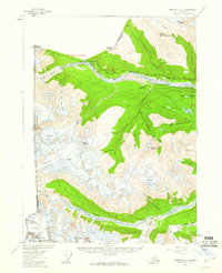
 1952 Skagway1953 Print · USGSThe northern reaches of the Alaska Panhandle come alive in the early fifties, showing the vital rail and road links to the Yukon. Trace the historic White Pass & Yukon Route or locate remote camps like Pleasant Camp and Klukwan.4 unique versions available
 - 1954 Map of Skagway B-4, 1960 Print
 1954 Skagway B-41960 Print · USGSThe international border and the mountain passes above Haines were being transformed by mid-century infrastructure as the highway and pipeline were established. Researchers can trace early settlements and natural landmarks from Pleasant Camp to the now Porcupine site near the Klehini River.2 unique versions available
 - 1961 Map of Skagway, 1967 Print
 1961 Skagway1967 Print · USGSThe northern reaches of the Panhandle and the rugged border with British Columbia come into focus in the early sixties. Researchers can trace the historic Chilkoot Trail, the White Pass and Yukon Railway, and coastal outposts like Klukwan.4 unique versions available
 - 1992 Map of Skagway B-4 NE
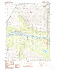 1992 Skagway B-4 NE1992 Print · USGSThe international borderlands of Haines and British Columbia are shown here in the early 1990s as modern transit met historic routes. Researchers can trace the Dalton Trail (Historic-Indefinite) past Porcupine and along the Klehini River.
 - 2017 Map of Skagway B-4 NE, 2017 Print
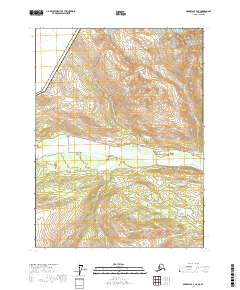 2017 Skagway B-4 NE2017 Print · USGSThe Klehini River valley and the international boundary near Haines appear here during the late 2010s. Trace the transition from the Haines Highway to local landmarks like Covenant Life, Mosquito Lake, and Mt Cheetdeekahyu.
End of results
Showing maps 1-5 of 5
Top cities near Mosquito Lake
Frequently asked questions
- What are the different types of historical maps available for Mosquito Lake?
- What is the oldest map of Mosquito Lake?
- Where can I purchase historical maps of Mosquito Lake for my home or office?
- Where can I download high-res historical maps of Mosquito Lake?
- Are there historical topographic maps available for Mosquito Lake?
- Is there historical aerial imagery available for Mosquito Lake?
- Where are historical maps of Mosquito Lake sourced from?