Old Maps of Funny River, Alaska for Metal Detecting
Plan your next treasure hunt with 10 historic maps of Funny River. Find old homesites, ghost towns, trails, and gathering spots that may be lost to time — perfect for identifying promising metal detecting locations.
- Locate forgotten sites: Uncover places like long-lost settlements, abandoned rail lines, or gathering spots.
- Plan better hunts: Use map overlays combined with LiDAR or satellite views to narrow in on historically rich areas.
- Made for detectorists: Thousands of hobbyists use these maps to discover relics, coins, and hidden history.
Use these historic maps to boost your research and find new opportunities beneath the surface of Funny River.
Funny River, AK maps
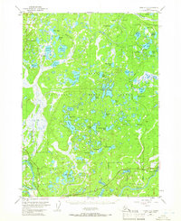
(10)- 1944 Map of Kenai, 1954 Print
 1944 Kenai1954 Print · USGSThe Kenai Peninsula and Cook Inlet are captured here during a period of postwar growth, just as the regional road system began to expand. Genealogists and historians can trace early settlements and family landmarks such as Salamatoff, Stelters Ranch, and the Snug Harbor Cannery.4 unique versions available
 - 1950 Map of Kenai
 1950 Kenai1950 Print · USGSThe Kenai Peninsula and Cook Inlet appear here during a pivotal era of mid-century growth and road construction. Researchers can trace the early layout of Soldotna, locate the Snug Harbor Cannery, and see the footprint of Salamatof.2 unique versions available
 - 1950 Map of Kenai C-3, 1959 Print
 1950 Kenai C-31959 Print · USGSThe Kenai Peninsula in the early fifties shows a burgeoning wilderness frontier at the dawn of modern settlement. Trace the early layout of Sterling and the Sterling Highway alongside remote landmarks like Mackeys Lakes and the Kenai River.
 - 1951 Map of Kenai C-3, 1966 Print
 1951 Kenai C-31966 Print · USGSThe Kenai Peninsula at the start of the 1950s shows the early growth of Sterling and the industrial activity of the Oil Field. Researchers can trace old transportation routes like the Sterling Highway and find remote landmarks such as the Landing Strip.4 unique versions available
 - 1952 Map of Kenai C-3, 1954 Print
 1952 Kenai C-31954 Print · USGSThe central Kenai Peninsula appears here in the early fifties as the modern road network was first being established. Researchers can trace early settlements at Naptowne and Soldotna or locate primitive cabins along the Kenai River and Whisper Lake.
 - 1958 Map of Kenai, 1967 Print
 1958 Kenai1967 Print · USGSThe Kenai Peninsula and Cook Inlet are captured here during a period of mid-century growth and wilderness management. Researchers can trace early settlements and infrastructure like Nikishka No 1, Salamatof, and the Wildwood Military Reservation.6 unique versions available
 - 1986 Map of Kenai C-3 SE
 1986 Kenai C-3 SE1986 Print · USGSThe Kenai Peninsula’s riverfront and lake country are captured here in the mid-eighties as the community of Sterling grew along the Kenai River. Trace local history through detailed infrastructure including Landing Strips, Gravel Pits, and numerous named waters like Scout Lake.
 - 1992 Map of Kenai C-3, 2002 Print
 1992 Kenai C-32002 Print · USGSThe Kenai Peninsula at the start of the 1990s shows a complex landscape of oil extraction and conservation. Researchers can trace the development of Sterling and Soldotna or locate specific landmarks like Eagle Rock and the Swanson River Oil Field.
 - 2014 Map of Kenai C-3 SE, 2014 Print
 2014 Kenai C-3 SE2014 Print · USGSCovers Funny River, including Sterling, Kenai Peninsula, and other nearby areas
 - 2024 Map of Kenai C-3 SE, 2024 Print
 2024 Kenai C-3 SE2024 Print · USGSThe Kenai Peninsula community of Sterling is shown here in the 2020s as a junction of river life and aviation. Researchers can trace local development around Scout Lake and Longmere Lake or locate bush pilot landmarks like the Dahler Homestead Airport and Sterling Air Park.
End of results
Showing maps 1-10 of 10
Top cities near Funny River
Frequently asked questions
- What are the different types of historical maps available for Funny River?
- What is the oldest map of Funny River?
- Where can I purchase historical maps of Funny River for my home or office?
- Where can I download high-res historical maps of Funny River?
- Are there historical topographic maps available for Funny River?
- Is there historical aerial imagery available for Funny River?
- Where are historical maps of Funny River sourced from?