Old Maps of Gilpatricks, Alaska for Academic Research
Study the evolution of Gilpatricks with 8 high-resolution historic maps. Whether you're teaching, researching, or modeling changes in land use, these maps provide essential visual documentation of urban, environmental, and geographic change.
- Analyze long-term change: Track patterns in development, transportation, and natural features.
- Ideal for environmental or urban studies: Support academic projects with primary historical map data.
- Use in the classroom or lab: Educators and researchers rely on these maps to bring historical context to life.
These maps are a powerful tool for teaching, research, and visualizing how Gilpatricks has changed over the decades.
Gilpatricks, AK maps
(8)- 1951 Map of Seward
 1951 Seward1951 Print · USGSThe Kenai Peninsula and Prince William Sound come to life in the early 1950s as the rail and maritime networks linked remote coastal outposts. Genealogists and historians can trace the Alaska Railroad corridor through Seward, find the Jesse Lee Indian School, and locate isolated camps like Latouche and Chenega.4 unique versions available
 - 1951 Map of Seward C-7, 1969 Print
 1951 Seward C-71969 Print · USGSThe Kenai Peninsula was a hub of mining and transit in the mid-twentieth century as new highways reached into the Chugach interior. Local historians and genealogists can trace early claims like the Independence Mine and old landmarks such as the Granite Creek Guard Station.2 unique versions available
 - 1953 Map of Seward C-7, 1954 Print
 1953 Seward C-71954 Print · USGSThe Kenai Peninsula in the early fifties shows a rugged landscape of mining camps and rail siding settlements. Trace the history of the Chugach National Forest through features like Moose Pass, the Frenchy Creek Mine, and the Glacier Ski Lodge.3 unique versions available
 - 1953 Map of Seward, 1956 Print
 1953 Seward1956 Print · USGSThe Kenai Peninsula and Prince William Sound are documented in the early 1950s as the rail and road networks expanded. Trace the route of the Alaska Railroad and find early settlements like Seward, Moose Pass, and Latouche.12 unique versions available
 - 1959 Map of Seward
 1959 Seward1959 Print · USGSThe Kenai Peninsula and Prince William Sound are captured here during the mid-century, showing the vital transit corridor between Seward and the interior. Researchers can trace the Alaska Railroad through Whittier and locate historic coastal settlements like Chenega and Latouche.
 - 1994 Map of Seward C-7, 1998 Print
 1994 Seward C-71998 Print · USGSThe Kenai Peninsula's interior high country comes into focus in the mid-1990s, where mining history and highway development meet. Local researchers can trace old workings at the Dahl Placer Mine, find the cemetery near Dahl, and follow the historic Johnson Pass Trail.
 - 2018 Map of Seward C-7 SW, 2018 Print
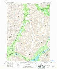
 2018 Seward C-7 SW2018 Print · USGSCovers Gilpatricks, including Kenai Peninsula, United States, and other nearby areas
 - 2023 Map of Seward C-7 SW, 2023 Print
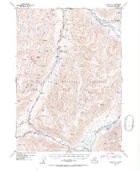
 2023 Seward C-7 SW2023 Print · USGSThe Kenai Peninsula high country comes into focus in this recent survey of the Chugach mountains and river valleys. Outdoor historians and researchers can trace the routes of the Summit Creek Trl and Devil's Creek Trl as they converge near Gilpatricks and Tern Lake.
End of results
Showing maps 1-8 of 8
Frequently asked questions
- What are the different types of historical maps available for Gilpatricks?
- What is the oldest map of Gilpatricks?
- Where can I purchase historical maps of Gilpatricks for my home or office?
- Where can I download high-res historical maps of Gilpatricks?
- Are there historical topographic maps available for Gilpatricks?
- Is there historical aerial imagery available for Gilpatricks?
- Where are historical maps of Gilpatricks sourced from?