Old Maps of Kustatan, Alaska for Hiking & Exploration
Hike through history with 5 historic maps of Kustatan. Explore old trails, ghost towns, and forgotten backroads — perfect for outdoor adventurers and local explorers.
- Rediscover forgotten places: Map out old mining camps, roads, and footpaths that no longer exist on modern maps.
- Layer with modern tools: Combine with LiDAR or satellite views to plan hikes through historical terrain.
- Made for exploration: Popular among hikers, overlanders, and local history lovers.
Use these maps to find adventure and explore the hidden past of Kustatan.
Kustatan, AK maps
(5)- 1944 Map of Kenai, 1954 Print
 1944 Kenai1954 Print · USGSThe Kenai Peninsula and Cook Inlet are captured here during a period of postwar growth, just as the regional road system began to expand. Genealogists and historians can trace early settlements and family landmarks such as Salamatoff, Stelters Ranch, and the Snug Harbor Cannery.4 unique versions available
 - 1950 Map of Kenai
 1950 Kenai1950 Print · USGSThe Kenai Peninsula and Cook Inlet appear here during a pivotal era of mid-century growth and road construction. Researchers can trace the early layout of Soldotna, locate the Snug Harbor Cannery, and see the footprint of Salamatof.2 unique versions available
 - 1958 Map of Kenai C-5, 1963 Print
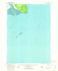 1958 Kenai C-51963 Print · USGSCoastal Alaska in the late 1950s reveals a wilderness of shifting tides and sparse settlements along the western Kenai Peninsula. Researchers can trace the early footprint of Kustatan and explore the shoreline of Trading Bay and the Kustatan River.2 unique versions available
 - 1958 Map of Kenai, 1967 Print
 1958 Kenai1967 Print · USGSThe Kenai Peninsula and Cook Inlet are captured here during a period of mid-century growth and wilderness management. Researchers can trace early settlements and infrastructure like Nikishka No 1, Salamatof, and the Wildwood Military Reservation.6 unique versions available
 - 2018 Map of Kenai C-5 NW, 2018 Print
 2018 Kenai C-5 NW2018 Print · USGSThe Kenai Peninsula coastline comes into focus in the late twenty-tens, centering on the landing at Kustatan. Researchers can trace the maritime landscape from the heights of West Foreland down to the tidal reaches of Redoubt Bay and Trading Bay.
End of results
Showing maps 1-5 of 5
Frequently asked questions
- What are the different types of historical maps available for Kustatan?
- What is the oldest map of Kustatan?
- Where can I purchase historical maps of Kustatan for my home or office?
- Where can I download high-res historical maps of Kustatan?
- Are there historical topographic maps available for Kustatan?
- Is there historical aerial imagery available for Kustatan?
- Where are historical maps of Kustatan sourced from?