Old Maps of Naptowne, Alaska for Academic Research
Study the evolution of Naptowne with 9 high-resolution historic maps. Whether you're teaching, researching, or modeling changes in land use, these maps provide essential visual documentation of urban, environmental, and geographic change.
- Analyze long-term change: Track patterns in development, transportation, and natural features.
- Ideal for environmental or urban studies: Support academic projects with primary historical map data.
- Use in the classroom or lab: Educators and researchers rely on these maps to bring historical context to life.
These maps are a powerful tool for teaching, research, and visualizing how Naptowne has changed over the decades.
Naptowne, AK maps
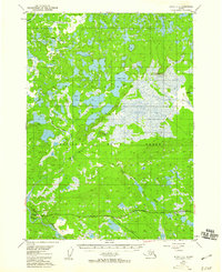
(9)- 1944 Map of Kenai, 1954 Print
 1944 Kenai1954 Print · USGSThe Kenai Peninsula and Cook Inlet are captured here during a period of postwar growth, just as the regional road system began to expand. Genealogists and historians can trace early settlements and family landmarks such as Salamatoff, Stelters Ranch, and the Snug Harbor Cannery.4 unique versions available
 - 1950 Map of Kenai
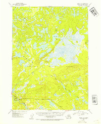
 1950 Kenai1950 Print · USGSThe Kenai Peninsula and Cook Inlet appear here during a pivotal era of mid-century growth and road construction. Researchers can trace the early layout of Soldotna, locate the Snug Harbor Cannery, and see the footprint of Salamatof.2 unique versions available
 - 1951 Map of Kenai C-2, 1960 Print
 1951 Kenai C-21960 Print · USGSThe Kenai Peninsula at the start of the 1950s was a landscape defined by its waterways and early highway development. Researchers can trace the path of the Sterling Highway past Naptowne Lodge and the expansive Kenai Moose National Range.3 unique versions available
 - 1952 Map of Kenai C-2, 1954 Print
 1952 Kenai C-21954 Print · USGSThe Kenai Peninsula's interior was largely wild in the early fifties, centering on the massive Kenai National Moose Range. Trace early aviation and roadside commerce at the Naptowne Lodge and its Landing Strip along the Sterling Highway.2 unique versions available
 - 1958 Map of Kenai, 1967 Print
 1958 Kenai1967 Print · USGSThe Kenai Peninsula and Cook Inlet are captured here during a period of mid-century growth and wilderness management. Researchers can trace early settlements and infrastructure like Nikishka No 1, Salamatof, and the Wildwood Military Reservation.6 unique versions available
 - 1986 Map of Kenai C-2 SW
 1986 Kenai C-2 SW1986 Print · USGSThe Kenai Peninsula in the mid-eighties shows a rugged frontier landscape where the Sterling community meets the Kenai National Wildlife Refuge. Researchers can trace early infrastructure like the Landing Strip, Pumping Station, and the churning Naptowne Rapids on the Kenai River.
 - 1992 Map of Kenai C-2, 2002 Print
 1992 Kenai C-22002 Print · USGSThe Kenai Peninsula's interior comes into focus during the early nineties, centered on the highway settlements of Sterling and Naptowne. Researchers can trace the era's infrastructure through the Landing Strip, Gravel Pits, and a Pumping Sta located near the Kenai Wilderness.
 - 2014 Map of Kenai C-2 SW, 2014 Print
 2014 Kenai C-2 SW2014 Print · USGSCovers Naptowne, including Kenai Peninsula, United States, and other nearby areas
 - 2024 Map of Kenai C-2 SW, 2024 Print
 2024 Kenai C-2 SW2024 Print · USGSThe Kenai Peninsula comes alive in this detailed record of the riverside communities and wilderness areas during the early twenty-first century. Researchers can trace the development of Sterling, find local landmarks like Naptowne Rapids, and locate small bush strips including Alaska Airpark.
End of results
Showing maps 1-9 of 9
Top cities near Naptowne
Frequently asked questions
- What are the different types of historical maps available for Naptowne?
- What is the oldest map of Naptowne?
- Where can I purchase historical maps of Naptowne for my home or office?
- Where can I download high-res historical maps of Naptowne?
- Are there historical topographic maps available for Naptowne?
- Is there historical aerial imagery available for Naptowne?
- Where are historical maps of Naptowne sourced from?