1980s Maps of Seward, Alaska
Explore 4 historic maps of Seward from the 1980s. These maps offer a rare glimpse into what life looked like during the 1980s — showing old roads, neighborhoods, homes, and landmarks that have changed or disappeared over time.
Whether you're researching your family's past, planning a metal detecting trip, or studying how Seward's landscape evolved across the 1980s, these high-resolution maps are a powerful tool for exploring the history of this region.
- Focus on a specific era: All maps on this page are from the 1980s, giving you a focused view of this time period.
- See what’s changed: Compare century-old streets, trails, and buildings to today's modern landscape using overlays and satellite layers.
- Research with precision: Use these maps for genealogy, historical research, land use analysis, or educational projects.
- View, download, or print: Maps are fully viewable online in high resolution, and can be downloaded or printed for your own records.
Start exploring Seward's history through authentic maps from the 1980s. This is your window into the past.
Seward, AK maps
(4)- 1983 Map of Seward A-7 SE
 1983 Seward A-7 SE1983 Print · USGSThe eastern coast of the Kenai Peninsula is captured here in the early eighties, showing the town of Seward where it meets the waters of Resurrection Bay. Researchers can trace the drainage of Godwin Glacier and explore the shoreline from Lowell Point to the Thumb Cove inlet.
 - 1983 Map of Seward A-7 NW
 1983 Seward A-7 NW1983 Print · USGSThe Kenai Peninsula's glacial valleys and high peaks are captured here in the early eighties as federal land boundaries were being defined. Trace the wilderness limits of the Kenai Fjords National Monument and landmarks like Mount Benson.
 - 1983 Map of Seward A-7 SW
 1983 Seward A-7 SW1983 Print · USGSSeward and the northeastern edge of the Kenai Fjords are captured in the early eighties as the town sits between the mountains and the sea. Researchers can trace the coastal landscape from Lowell Point to Derby Cove and locate landmarks like Marathon Mountain and the Bear Glacier.
 - 1983 Map of Seward A-7 NE
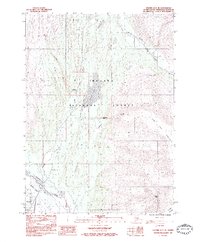 1983 Seward A-7 NE1983 Print · USGSSeward and the Resurrection River valley are captured in the early eighties as the coastal hub continued its northern expansion. Researchers can trace the path of the Seward Highway past Woodrow and the waters of Bear Lake toward the icy reaches of the Godwin Glacier.2 unique versions available
End of results
Showing maps 1-4 of 4
Frequently asked questions
- What are the different types of historical maps available for Seward?
- What is the oldest map of Seward?
- Where can I purchase historical maps of Seward for my home or office?
- Where can I download high-res historical maps of Seward?
- Are there historical topographic maps available for Seward?
- Is there historical aerial imagery available for Seward?
- Where are historical maps of Seward sourced from?