Old Maps of Shirleyville, Alaska for Metal Detecting
Plan your next treasure hunt with 6 historic maps of Shirleyville. Find old homesites, ghost towns, trails, and gathering spots that may be lost to time — perfect for identifying promising metal detecting locations.
- Locate forgotten sites: Uncover places like long-lost settlements, abandoned rail lines, or gathering spots.
- Plan better hunts: Use map overlays combined with LiDAR or satellite views to narrow in on historically rich areas.
- Made for detectorists: Thousands of hobbyists use these maps to discover relics, coins, and hidden history.
Use these historic maps to boost your research and find new opportunities beneath the surface of Shirleyville.
Shirleyville, AK maps
(6)- 1949 Map of Tyonek, 1954 Print
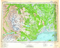
 1949 Tyonek1954 Print · USGSUpper Cook Inlet and the Alaska Range appear here in the mid-twentieth century as a landscape of massive glaciers and river-bound outposts. Researchers can trace the early rail corridor through Willow, locate the Moquawkie Indian Reservation, and find the site of McDougall.2 unique versions available
 - 1951 Map of Tyonek
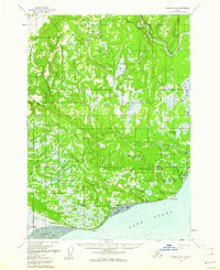
 1951 Tyonek1951 Print · USGSThe Cook Inlet and the Alaska Range come into focus in the early fifties as the region's rail and trail networks evolved. Trace the path of the Alaska Railroad through Willow or locate the historic Iditarod Trail near Susitna.
 - 1958 Map of Tyonek A-4, 1961 Print
 1958 Tyonek A-41961 Print · USGSThe western Cook Inlet shoreline comes to life in the late 1950s, showing the intersection of coastal settlements and the vast Beluga River delta. Genealogists and historians can trace the foundations of Tyonek, the Tobona ruins, and the local Winter Trail.3 unique versions available
 - 1958 Map of Tyonek, 1964 Print
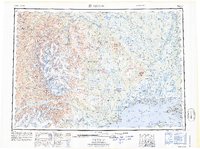
 1958 Tyonek1964 Print · USGSUpper Cook Inlet and the Susitna River valley are shown in the late fifties, capturing a period of transition between coastal village life and inland development. Researchers can trace the Winter Trail and Tractor Trail paths to settlements like Alexander and Susitna.6 unique versions available
 - 1965 Map of Tyonek
 1965 Tyonek1965 Print · USGSUpper Cook Inlet in the mid-sixties reveals a landscape defined by massive glaciers and the early footprints of coastal settlements. Trace the rail-and-river network from The Alaska Railroad to isolated outposts like Old Tyonek, Ladd, and the Moquawkie (Tyonek) Indian Reservation.
 - 2016 Map of Tyonek A-4 SW, 2016 Print
 2016 Tyonek A-4 SW2016 Print · USGSThe northern shores of the Kenai Peninsula meet the Cook Inlet in this mid-2010s survey of the Tyonek region. Modern researchers can trace the coastal geography of Trading Bay and locate wilderness landmarks like Nikolai Creek Airport and Granite Point.
End of results
Showing maps 1-6 of 6
Frequently asked questions
- What are the different types of historical maps available for Shirleyville?
- What is the oldest map of Shirleyville?
- Where can I purchase historical maps of Shirleyville for my home or office?
- Where can I download high-res historical maps of Shirleyville?
- Are there historical topographic maps available for Shirleyville?
- Is there historical aerial imagery available for Shirleyville?
- Where are historical maps of Shirleyville sourced from?