Old Maps of Beaver Falls, Alaska for Academic Research
Study the evolution of Beaver Falls with 7 high-resolution historic maps. Whether you're teaching, researching, or modeling changes in land use, these maps provide essential visual documentation of urban, environmental, and geographic change.
- Analyze long-term change: Track patterns in development, transportation, and natural features.
- Ideal for environmental or urban studies: Support academic projects with primary historical map data.
- Use in the classroom or lab: Educators and researchers rely on these maps to bring historical context to life.
These maps are a powerful tool for teaching, research, and visualizing how Beaver Falls has changed over the decades.
Beaver Falls, AK maps
(7)- 1952 Map of Ketchikan, 1953 Print
 1952 Ketchikan1953 Print · USGSThe Ketchikan region of Southeast Alaska is mapped here in the early fifties, documenting the remote settlements and deep-water inlets of the southern panhandle. Genealogists and historians can trace the foundations of Ketchikan, Metlakatla, and Saxman alongside lonely backcountry cabins.4 unique versions available
 - 1954 Map of Ketchikan B-5, 1955 Print
 1954 Ketchikan B-51955 Print · USGSCoastal life in the mid-fifties is captured here, centered on the busy waterways of the Tongass Narrows. Researchers can locate the Mahoney Mine, the historic Bayview Cem, and early industrial sites like the Cannery.2 unique versions available
 - 1955 Map of Ketchikan, 1966 Print
 1955 Ketchikan1966 Print · USGSSoutheast Alaska’s maritime character is captured in the mid-fifties, showing the vital waterways and remote outposts of the Alexander Archipelago. Researchers can trace the waterfronts of Ketchikan and Metlakatla or locate isolated spots like Hyder and Loring.3 unique versions available
 - 1955 Map of Ketchikan B-5, 1971 Print
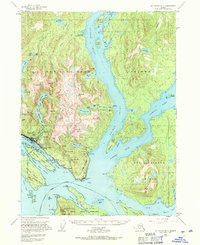 1955 Ketchikan B-51971 Print · USGSSoutheast Alaska’s maritime character is on full display in the mid-fifties, centered on the busy waterfronts of Ketchikan and Saxman. Researchers can trace the era’s industry and community through the Mahoney Mine, China Town, and the Beaver Falls Power House.3 unique versions available
 - 1994 Map of Ketchikan B-5, 1998 Print
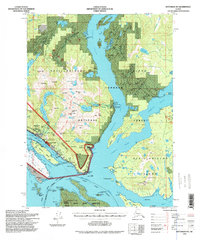 1994 Ketchikan B-51998 Print · USGSThe Ketchikan waterfront and neighboring Saxman are captured here in the mid-nineties, showing a coastline defined by maritime industry and indigenous heritage. Researchers can trace the development of China Town on Annette Island or locate the site of the Mahoney Mine.
 - 2017 Map of Ketchikan B-5 NE, 2017 Print
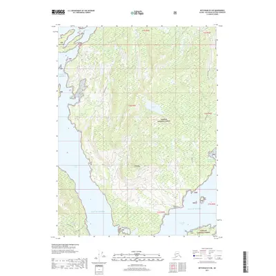 2017 Ketchikan B-5 NE2017 Print · USGSCovers Beaver Falls, including Ketchikan Gateway, United States, and other nearby areas
 - 2021 Map of Ketchikan B-5 NE, 2021 Print
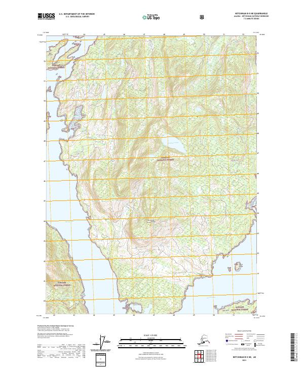 2021 Ketchikan B-5 NE2021 Print · USGSThe Alexander Archipelago at the start of the 2020s remains a wilderness of deep inlets and national forest. Researchers can trace remote coastal access via Coon Cove Road and identify landmarks like Buckhorn Lake and Hume Island.
End of results
Showing maps 1-7 of 7
Top cities near Beaver Falls
Frequently asked questions
- What are the different types of historical maps available for Beaver Falls?
- What is the oldest map of Beaver Falls?
- Where can I purchase historical maps of Beaver Falls for my home or office?
- Where can I download high-res historical maps of Beaver Falls?
- Are there historical topographic maps available for Beaver Falls?
- Is there historical aerial imagery available for Beaver Falls?
- Where are historical maps of Beaver Falls sourced from?