Old Maps of Bell Island Hot Springs, Alaska
Explore 6 old maps of Bell Island Hot Springs, spanning from 1952 to today. These high-resolution historic maps reveal how streets, neighborhoods, landmarks, and natural features evolved over time — perfect for genealogy, metal detecting, research, and local history exploration.
What you can do with these maps:
- See how Bell Island Hot Springs changed over time: Compare historical maps to modern-day views to trace roads, homesites, rail lines & more.
- View detailed metadata: Each map includes creators, publishers, year, scale, and archive source.
- Overlay maps with satellite & LiDAR: Visualize the past alongside modern tools to explore terrain & human change.
- Trusted historical sources: Maps sourced from the USGS, Library of Congress, and other archives.
- Access maps your way: View online, download high-res files, or order prints for personal or research use.
Start exploring old maps of Bell Island Hot Springs to uncover forgotten places, hidden landmarks, and the deep history beneath your feet.
Bell Island Hot Springs, AK maps
(6)- 1952 Map of Ketchikan, 1953 Print
 1952 Ketchikan1953 Print · USGSThe Ketchikan region of Southeast Alaska is mapped here in the early fifties, documenting the remote settlements and deep-water inlets of the southern panhandle. Genealogists and historians can trace the foundations of Ketchikan, Metlakatla, and Saxman alongside lonely backcountry cabins.4 unique versions available
 - 1952 Map of Ketchikan D-5, 1963 Print
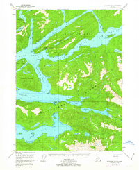 1952 Ketchikan D-51963 Print · USGSSoutheast Alaska's intricate coastline is mapped here in the early fifties, showing the isolated outposts and remote waterways of the Alexander Archipelago. Researchers can locate the Seaplane Ramp at Bell Island Hot Springs or trace the drainage from Lake Shelokum to Bailey Bay.3 unique versions available
 - 1953 Map of Ketchikan D-5, 1955 Print
 1953 Ketchikan D-51955 Print · USGSCoastal life in Southeast Alaska centered on isolated outposts and intricate waterways in the years following World War II. Researchers can locate remote cabins and early infrastructure like the Bell Island Hot Springs and its Seaplane Ramp.
 - 1955 Map of Ketchikan, 1966 Print
 1955 Ketchikan1966 Print · USGSSoutheast Alaska’s maritime character is captured in the mid-fifties, showing the vital waterways and remote outposts of the Alexander Archipelago. Researchers can trace the waterfronts of Ketchikan and Metlakatla or locate isolated spots like Hyder and Loring.3 unique versions available
 - 2017 Map of Ketchikan D-5 NW, 2017 Print
 2017 Ketchikan D-5 NW2017 Print · USGSCovers Bell Island Hot Springs, including Ketchikan Gateway, United States, and other nearby areas
 - 2021 Map of Ketchikan D-5 NW, 2021 Print
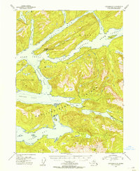
 2021 Ketchikan D-5 NW2021 Print · USGSThe wilderness of Southeast Alaska is documented here during the early twenty-first century, centered on the unique Bell Island Hot Springs. Researchers can trace remote coastal navigation points and interior water bodies like Hassler Pass, Behm Canal, and Lake Shelokum.
End of results
Showing maps 1-6 of 6
Frequently asked questions
- What are the different types of historical maps available for Bell Island Hot Springs?
- What is the oldest map of Bell Island Hot Springs?
- Where can I purchase historical maps of Bell Island Hot Springs for my home or office?
- Where can I download high-res historical maps of Bell Island Hot Springs?
- Are there historical topographic maps available for Bell Island Hot Springs?
- Is there historical aerial imagery available for Bell Island Hot Springs?
- Where are historical maps of Bell Island Hot Springs sourced from?