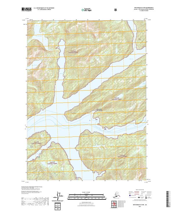
2021 Map of Ketchikan D-5 NW
USGS Topo · Published 2021About this map
Bell Island Hot Springs sits at the heart of this coastal wilderness within the Tongass National Forest, marking a rare geothermal landmark amidst the deep maritime channels of Southeast Alaska. The intricate coastline is defined by the massive Behm Canal and its branching waterways, including the narrow Bell Arm and Sealed Passage. These cold glacial waters surround significant landmasses like Hassler Island and Black Island, separated by the treacherous Blind Pass and Hassler Pass.
Find a feature on this map
25 named features on this map. Tap any name to fly to it.
Don’t see what you’re looking for? This feature index may not catch every label — zoom into the map to look around manually.
Map Details
Editions of this 2021 Ketchikan D-5 NW Map
This is the sole edition of this map. No revisions or reprints were ever made.
Other maps of this area

1951 · Bradfield Canal
USGS Topo · 1:250,000

1952 · Ketchikan
USGS Topo · 1:250,000

1952 · Ketchikan D-5
USGS Topo · 1:63,360

1952 · Ketchikan D-6
USGS Topo · 1:63,360

1953 · Ketchikan D-5
USGS Topo · 1:63,360

1953 · Ketchikan D-6
USGS Topo · 1:63,360

1954 · Bradfield Canal
USGS Topo · 1:250,000

1955 · Bradfield canal A-6
USGS Topo · 1:63,360

1955 · Bradfield Canal A-5
USGS Topo · 1:63,360

1955 · Ketchikan
USGS Topo · 1:250,000