Old Maps of Larsen Bay, Alaska for Academic Research
Study the evolution of Larsen Bay with 10 high-resolution historic maps. Whether you're teaching, researching, or modeling changes in land use, these maps provide essential visual documentation of urban, environmental, and geographic change.
- Analyze long-term change: Track patterns in development, transportation, and natural features.
- Ideal for environmental or urban studies: Support academic projects with primary historical map data.
- Use in the classroom or lab: Educators and researchers rely on these maps to bring historical context to life.
These maps are a powerful tool for teaching, research, and visualizing how Larsen Bay has changed over the decades.
Larsen Bay, AK maps
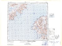
(10)- 1951 Map of Karluk, 1952 Print
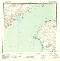 1951 Karluk1952 Print · USGSThe Kodiak archipelago and the rugged Katmai coast are shown in the early fifties before statehood. Genealogists and historians can trace the early industrial footprint of the Cannery at Larsen Bay and the isolated settlement at Karluk.
 - 1952 Map of Kodiak, 1953 Print
 1952 Kodiak1953 Print · USGSKodiak Island in the early fifties shows a landscape of strategic military bases and coastal fishing villages. Researchers can trace the layout of the Naval Reservation, the whaling station at Port Hobron, and remote settlements like Old Harbor.12 unique versions available
 - 1952 Map of Karluk, 1957 Print
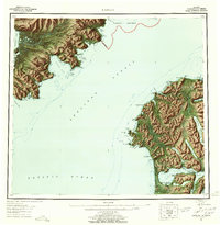 1952 Karluk1957 Print · USGSShelikof Strait and the shores of Kodiak Island appear here in the early fifties, documenting a landscape of remote settlements and maritime industry. Trace the locations of a Cannery, an Oil Well near Kanatak, and the Seaplane Airport that connected these coastal outposts.7 unique versions available
 - 1952 Map of Karluk C-1, 1967 Print
 1952 Karluk C-11967 Print · USGSThe western coast of Kodiak Island is captured here in the early fifties, showing the pristine reaches of the Kodiak National Wildlife Refuge. Researchers can trace the Karluk River and find isolated Cabins at Larsen Bay.2 unique versions available
 - 1952 Map of Kodiak C-6, 1967 Print
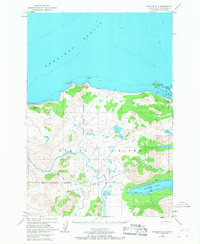
 1952 Kodiak C-61967 Print · USGSKodiak Island’s western fjords and coastal outposts are captured here in the early fifties, centering on the maritime industry at Larsen Bay. Trace the layout of the local Cannery, the Seaplane Base, and nearby Cabins scattered along the shores of Uyak Bay.3 unique versions available
 - 1954 Map of Kodiak C-6, 1955 Print
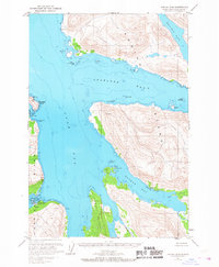
 1954 Kodiak C-61955 Print · USGSKodiak Island’s rugged western coastline is captured here in the mid-fifties, during a time of active maritime industry and coastal settlement. Researchers can trace the layout of Larsen Bay, locate a shoreside Cannery, and find isolated Cabins near Browns Lagoon.
 - 1954 Map of Karluk C-1, 1955 Print
 1954 Karluk C-11955 Print · USGSKodiak Island’s remote shoreline and wildlife refuge are captured here during the mid-fifties, showing the intersection of maritime navigation and rugged wilderness. Researchers can find old coastal structures like abandoned cabins, the trail near Larsen Bay, and markers on Harvester Island.
 - 1964 Map of Karluk
 1964 Karluk1964 Print · USGSKodiak Island and the Alaska Peninsula meet across the Shelikof Strait in the early sixties, a time when commercial fishing and wildlife management defined the region. Researchers can locate remote outposts like the Fish and Wildlife Service Upper Station and the Cannery at Larsen Bay.
 - 2021 Map of Karluk C-1 SE, 2021 Print
 2021 Karluk C-1 SE2021 Print · USGSKodiak Island at the start of the 2020s shows a landscape of deep coastal waters and salmon-rich drainages. Researchers can trace the path of the Karluk River and the shoreline of Larsen Bay alongside the modern Landfill Access Road.
 - 2021 Map of Kodiak C-6 SW, 2021 Print
 2021 Kodiak C-6 SW2021 Print · USGSCoastal life on Kodiak Island is captured here in the early twenty-first century, centered on the isolated village of Larsen Bay. Researchers can trace the local grid of First Street and Second Street or locate the vital regional link at Larsen Bay Airport.
End of results
Showing maps 1-10 of 10
Frequently asked questions
- What are the different types of historical maps available for Larsen Bay?
- What is the oldest map of Larsen Bay?
- Where can I purchase historical maps of Larsen Bay for my home or office?
- Where can I download high-res historical maps of Larsen Bay?
- Are there historical topographic maps available for Larsen Bay?
- Is there historical aerial imagery available for Larsen Bay?
- Where are historical maps of Larsen Bay sourced from?