1950s Maps of Womens Bay, Alaska
Explore 3 historic maps of Womens Bay from the 1950s. These maps offer a rare glimpse into what life looked like during the 1950s — showing old roads, neighborhoods, homes, and landmarks that have changed or disappeared over time.
Whether you're researching your family's past, planning a metal detecting trip, or studying how Womens Bay's landscape evolved across the 1950s, these high-resolution maps are a powerful tool for exploring the history of this region.
- Focus on a specific era: All maps on this page are from the 1950s, giving you a focused view of this time period.
- See what’s changed: Compare century-old streets, trails, and buildings to today's modern landscape using overlays and satellite layers.
- Research with precision: Use these maps for genealogy, historical research, land use analysis, or educational projects.
- View, download, or print: Maps are fully viewable online in high resolution, and can be downloaded or printed for your own records.
Start exploring Womens Bay's history through authentic maps from the 1950s. This is your window into the past.
Womens Bay, AK maps
(3)- 1952 Map of Kodiak, 1953 Print
 1952 Kodiak1953 Print · USGSKodiak Island in the early fifties shows a landscape of strategic military bases and coastal fishing villages. Researchers can trace the layout of the Naval Reservation, the whaling station at Port Hobron, and remote settlements like Old Harbor.12 unique versions available
 - 1952 Map of Kodiak C-3, 1964 Print
 1952 Kodiak C-31964 Print · USGSKodiak Island’s interior and rugged southern coast are captured here in the early fifties, before modern development touched these remote drainages. Map collectors can trace the pristine flows of the Russian River and find landmarks like Crown Mountain and Saltery Cove.3 unique versions available
 - 1954 Map of Kodiak C-3, 1955 Print
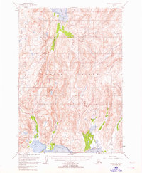
 1954 Kodiak C-31955 Print · USGSKodiak Island in the early fifties remains a rugged wilderness of protected refuges and deep coastal inlets. Researchers can trace the interior boundaries of the Kodiak National Wildlife Refuge and locate remote features like Hidden Basin and Crown Mountain.
End of results
Showing maps 1-3 of 3
Top cities near Womens Bay
Frequently asked questions
- What are the different types of historical maps available for Womens Bay?
- What is the oldest map of Womens Bay?
- Where can I purchase historical maps of Womens Bay for my home or office?
- Where can I download high-res historical maps of Womens Bay?
- Are there historical topographic maps available for Womens Bay?
- Is there historical aerial imagery available for Womens Bay?
- Where are historical maps of Womens Bay sourced from?