1900s (20th Century) Maps of Chulitna, Alaska
Explore 7 historic maps of Chulitna from the 1900s (20th Century). These maps offer a rare glimpse into what life looked like during the 1900s — showing old roads, neighborhoods, homes, and landmarks that have changed or disappeared over time.
Whether you're researching your family's past, planning a metal detecting trip, or studying how Chulitna's landscape evolved across the 1900s, these high-resolution maps are a powerful tool for exploring the history of this region.
- Focus on a specific era: All maps on this page are from the 1900s, giving you a focused view of this time period.
- See what’s changed: Compare century-old streets, trails, and buildings to today's modern landscape using overlays and satellite layers.
- Research with precision: Use these maps for genealogy, historical research, land use analysis, or educational projects.
- View, download, or print: Maps are fully viewable online in high resolution, and can be downloaded or printed for your own records.
Start exploring Chulitna's history through authentic maps from the 1900s. This is your window into the past.
Chulitna, AK maps
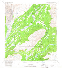
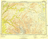
(7)- 1949 Map of Talkeetna Mountains D-6, 1956 Print
 1949 Talkeetna Mountains D-61956 Print · USGSThe Alaska interior at the close of the 1940s reveals a wilderness defined by the winding path of The Alaska Railroad. Map collectors and historians can trace remote rail stops like Hurricane, Gold Creek, and Canyon alongside the glacial waters of the Chulitna River.
 - 1950 Map of Talkeetna Mountains
 1950 Talkeetna Mountains1950 Print · USGSThe Matanuska-Susitna region at mid-century was defined by its remote mountain peaks and the vital link of the Alaska Railroad. Researchers can trace early rail-side settlements like Gold Creek and Sherman or locate high-altitude landmarks such as Mt Watana 6320.2 unique versions available
 - 1951 Map of Talkeetna Mountains D-6, 1966 Print
 1951 Talkeetna Mountains D-61966 Print · USGSThe Alaska interior comes into focus during the early 1950s as the rail corridor links remote settlements along the river valleys. Follow the path of The Alaska Railroad to find Hurricane, trace the Sled Road, or locate the Gaging Sta near Gold Creek.4 unique versions available
 - 1952 Map of Talkeetna Mountains D-6
 1952 Talkeetna Mountains D-61952 Print · USGSThe Alaska rail corridor was the primary lifeline through the Matanuska-Susitna region in the early fifties. Local historians can trace the remote tracks and stop points from Hurricane down to Gold Creek, while locating early backcountry cabins and a Sled Road.2 unique versions available
 - 1954 Map of Talkeetna Mountains, 1956 Print
 1954 Talkeetna Mountains1956 Print · USGSThe Matanuska-Susitna region during the mid-fifties centers on the vital Alaska Railroad line and its remote mountain outposts. Trace the rail-side growth of Curry and Hurricane or locate glacial features like the Chickaloon Glacier and Talkeetna Glacier.7 unique versions available
 - 1957 Map of Talkeetna Mountains
 1957 Talkeetna Mountains1957 Print · USGSCentral Alaska in the mid-fifties is defined here by the thin line of the Alaska Railroad winding through the high interior. Trace early rail stops like Sherman and Gold Creek or the remote drainages of the Susitna River.
 - 1966 Map of Talkeetna Mountains
 1966 Talkeetna Mountains1966 Print · USGSThe Alaska Railroad pushes through the western river valleys during the mid-1960s, connecting small rail stops in a largely roadless interior. Genealogists and historians can trace early settlements like Curry, Deadhorse, and Gold Creek along the rail line.
End of results
Showing maps 1-7 of 7
Frequently asked questions
- What are the different types of historical maps available for Chulitna?
- What is the oldest map of Chulitna?
- Where can I purchase historical maps of Chulitna for my home or office?
- Where can I download high-res historical maps of Chulitna?
- Are there historical topographic maps available for Chulitna?
- Is there historical aerial imagery available for Chulitna?
- Where are historical maps of Chulitna sourced from?