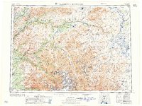
1957 Map of Talkeetna Mountains
USGS Topo · Published 1957About this map
The Alaska Railroad corridor defines the western edge of this 1957 survey, providing a vital transport link through the high interior terrain. Following the Chulitna River, the rail line connects small settlements including Hurricane, Chulitna, Canyon, and Gold Creek. The landscape is dominated by the Talkeetna Mountains and a complex drainage system where the Susitna River and Talkeetna River carve through the Third Judicial Division. High-altitude water bodies like Stephan Lake, Fog Lakes, and Watana Lake are scattered across the plateau, while the eastern reaches are marked by the Maclaren River and the Oshetna River. This sheet documents a remote Alaskan wilderness at mid-century, prior to the large-scale developments of the late 20th century, capturing the precise locations of small station stops and isolated mountain peaks like Mt Watana and Tsusena Butte.
Find a feature on this map
65 named features on this map. Tap any name to fly to it.
Don’t see what you’re looking for? This feature index may not catch every label — zoom into the map to look around manually.
Map Details
Editions of this 1957 Talkeetna Mountains Map
This is the sole edition of this map. No revisions or reprints were ever made.
Other maps of this area

1948 · Anchorage D-3
USGS Topo · 1:63,360

1948 · Anchorage D-2
USGS Topo · 1:63,360

1948 · Anchorage D-4
USGS Topo · 1:63,360

1948 · Anchorage D-1
USGS Topo · 1:63,360

1949 · Tyonek
USGS Topo · 1:250,000

1949 · Talkeetna Mountains D-6
USGS Topo · 1:63,360

1949 · Anchorage D-5
USGS Topo · 1:63,360

1949 · Anchorage D-7
USGS Topo · 1:63,360

1949 · Talkeetna Mountains B-6
USGS Topo · 1:63,360

1949 · Talkeetna Mountains A-1
USGS Topo · 1:63,360