
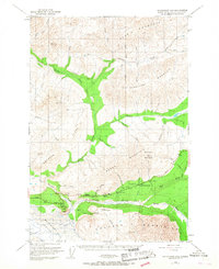
1948 Map of Anchorage D-2
USGS Topo · Published 1958About this map
Matanuska River valley travelers in the late 1940s relied on a handful of crucial outposts like the Meeking Roadhouse and Sheep Mountain Inn along the Glenn Highway. This landscape is dominated by massive geological formations, from the sprawling Matanuska Glacier and Rock Glacier in the south to the high peaks of the Talkeetna Mountains and Horn Mountains in the north. The presence of an Airstrip and a Tractor Trail near Caribou Creek indicates the early mechanical footprints in this wilderness, while the distinct Lion Head formation stands as a landmark for navigation.
Find a feature on this map
52 named features on this map. Tap any name to fly to it.
Don’t see what you’re looking for? This feature index may not catch every label — zoom into the map to look around manually.
Map Details
Editions of this 1948 Anchorage D-2 Map
4 editions found
Other maps of this area

1948 · Anchorage D-3
USGS Topo · 1:63,360

1948 · Anchorage D-1
USGS Topo · 1:63,360

1949 · Talkeetna Mountains A-1
USGS Topo · 1:63,360

1950 · Talkeetna Mountains
USGS Topo · 1:250,000

1951 · Anchorage
USGS Topo · 1:250,000

1951 · Anchorage D-1
USGS Topo · 1:63,360

1951 · Talkeetna Mountains A-2
USGS Topo · 1:63,360

1952 · Anchorage D-2
USGS Topo · 1:63,360

1952 · Anchorage D-3
USGS Topo · 1:63,360
1952 · Talkeetna Mountains A-1
USGS Topo · 1:63,360