
1951 Map of Talkeetna Mountains A-2
USGS Topo · Published 1962About this map
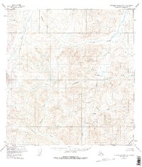
The Oshetna River and Little Oshetna River dominate this high-altitude landscape of the Talkeetna Mountains as it appeared in the early 1950s. This unpopulated terrain is defined by complex drainage networks and significant topographic transitions, notably at Horsepasture Pass and Limestone Gap. The map captures a moment when the interior remained largely untouched by roads or trails, with place names often reflecting early prospecting or geographical identifiers like Gold Creek, Conglomerate Creek, and Mazuma Creek.
Find a feature on this map
23 named features on this map. Tap any name to fly to it.
Don’t see what you’re looking for? This feature index may not catch every label — zoom into the map to look around manually.
Map Details
Editions of this 1951 Talkeetna Mountains A-2 Map
3 editions found
Other maps of this area

1948 · Anchorage D-3
USGS Topo · 1:63,360

1948 · Anchorage D-2
USGS Topo · 1:63,360

1949 · Talkeetna Mountains A-1
USGS Topo · 1:63,360

1950 · Talkeetna Mountains
USGS Topo · 1:250,000

1951 · Anchorage
USGS Topo · 1:250,000

1951 · Talkeetna Mountains B-1
USGS Topo · 1:63,360

1951 · Talkeetna Mountains B-3
USGS Topo · 1:63,360

1951 · Talkeetna Mountains A-3
USGS Topo · 1:63,360

1951 · Talkeetna Mountains B-2
USGS Topo · 1:63,360

1952 · Anchorage D-2
USGS Topo · 1:63,360