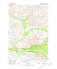
1948 Map of Anchorage D-2
USGS Topo · Published 1977About this map
Matanuska Glacier and the Matanuska River dominate the southern reach of this landscape, where the ice and water carved out the dramatic geography of the Chugach Mountains. The 1948 survey documents the vital transportation corridor along the Glenn Highway, a route punctuated by essential traveler stops like the Meekins Roadhouse and Sheep Mountain Lodge. These establishments represent the mid-century infrastructure of the Alaskan interior, providing refuge and supplies along the mountain pass.
Find a feature on this map
50 named features on this map. Tap any name to fly to it.
Don’t see what you’re looking for? This feature index may not catch every label — zoom into the map to look around manually.
Map Details
Editions of this 1948 Anchorage D-2 Map
4 editions found
Other maps of this area

1948 · Anchorage D-3
USGS Topo · 1:63,360

1948 · Anchorage D-2
USGS Topo · 1:63,360

1948 · Anchorage D-1
USGS Topo · 1:63,360

1949 · Talkeetna Mountains A-1
USGS Topo · 1:63,360

1950 · Talkeetna Mountains
USGS Topo · 1:250,000

1951 · Anchorage
USGS Topo · 1:250,000

1951 · Anchorage D-1
USGS Topo · 1:63,360

1951 · Talkeetna Mountains A-2
USGS Topo · 1:63,360

1952 · Anchorage D-2
USGS Topo · 1:63,360

1952 · Anchorage D-3
USGS Topo · 1:63,360