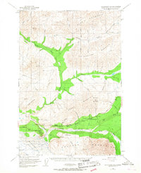
1948 Map of Anchorage D-2
USGS Topo · Published 1967About this map
Matanuska River valley life in the late 1940s is centered along the developing corridor of the Glenn Highway. This mountain landscape, dominated by the Matanuska Glacier and the towering Chugach Mountains, shows a transitional era of Alaskan travel. The presence of the Meekins Roadhouse and the Sheep Mountain Inn marks essential stops for travelers on the remote road system between Anchorage and the interior.
Find a feature on this map
50 named features on this map. Tap any name to fly to it.
Don’t see what you’re looking for? This feature index may not catch every label — zoom into the map to look around manually.
Map Details
Editions of this 1948 Anchorage D-2 Map
4 editions found
Other maps of this area

1948 · Anchorage D-3
USGS Topo · 1:63,360

1948 · Anchorage D-2
USGS Topo · 1:63,360

1948 · Anchorage D-1
USGS Topo · 1:63,360

1949 · Talkeetna Mountains A-1
USGS Topo · 1:63,360

1950 · Talkeetna Mountains
USGS Topo · 1:250,000

1951 · Anchorage
USGS Topo · 1:250,000

1951 · Anchorage D-1
USGS Topo · 1:63,360

1951 · Talkeetna Mountains A-2
USGS Topo · 1:63,360

1952 · Anchorage D-2
USGS Topo · 1:63,360

1952 · Anchorage D-3
USGS Topo · 1:63,360