1900s (20th Century) Maps of Houston, Alaska
Explore 11 historic maps of Houston from the 1900s (20th Century). These maps offer a rare glimpse into what life looked like during the 1900s — showing old roads, neighborhoods, homes, and landmarks that have changed or disappeared over time.
Whether you're researching your family's past, planning a metal detecting trip, or studying how Houston's landscape evolved across the 1900s, these high-resolution maps are a powerful tool for exploring the history of this region.
- Focus on a specific era: All maps on this page are from the 1900s, giving you a focused view of this time period.
- See what’s changed: Compare century-old streets, trails, and buildings to today's modern landscape using overlays and satellite layers.
- Research with precision: Use these maps for genealogy, historical research, land use analysis, or educational projects.
- View, download, or print: Maps are fully viewable online in high resolution, and can be downloaded or printed for your own records.
Start exploring Houston's history through authentic maps from the 1900s. This is your window into the past.
Houston, AK maps
(11)- 1950 Map of Anchorage C-8, 1958 Print
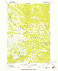 1950 Anchorage C-81958 Print · USGSThe Matanuska-Susitna valley comes alive in the early statehood era as a hub of rail-side industry and wilderness settlement. Genealogists and historians can trace early residents near Houston and Pittman, or locate industrial landmarks like the Coal Mine and Alaska Railroad.3 unique versions available
 - 1951 Map of Anchorage
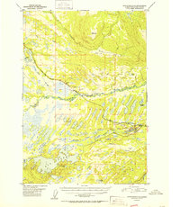
 1951 Anchorage1951 Print · USGSMid-century Anchorage and the Matanuska Valley are seen here during a period of rapid strategic growth. Trace the development of Fort Richardson, early rail stops at Wasilla, and established mining operations like the Independence Mine or Premier Mine.4 unique versions available
 - 1952 Map of Anchorage C-8
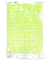
 1952 Anchorage C-81952 Print · USGSThe Matanuska-Susitna region's rail and mining corridor comes alive in the early fifties as the postwar economy expands. Researchers can trace the industrial footprint of the Coal Mine at Houston and the vast lake systems of Big Lake and Nancy Lake.2 unique versions available
 - 1962 Map of Anchorage, 1966 Print
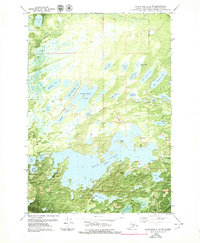
 1962 Anchorage1966 Print · USGSThe Anchorage bowl and Matanuska Valley appear in this mid-century survey during a period of significant military and industrial expansion. Researchers can trace the Alaska Railroad through Sutton and Jonesville or locate historic stops like Meekins Roadhouse and the Watertower Inn.6 unique versions available
 - 1979 Map of Anchorage C-8 NE
 1979 Anchorage C-8 NE1979 Print · USGSMatanuska-Susitna during the late 1970s reveals a landscape of river-based utility and seasonal trails. Researchers can trace the Winter Trail and locate early infrastructure like the Landing Strip and Gravel Pit near the Little Susitna River.2 unique versions available
 - 1979 Map of Anchorage, 1980 Print
 1979 Anchorage1980 Print · USGSThe Anchorage bowl and Matanuska Valley appear in the late seventies as the region's transportation and military infrastructure matured. Genealogists and historians can trace rail and road evolution through Wasilla, the Matanuska Branch line, and Jonesville.
 - 1979 Map of Anchorage C-8 SW, 1980 Print
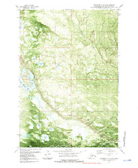
 1979 Anchorage C-8 SW1980 Print · USGSBig Lake and the Houston boundary appear here during the late seventies as the region's recreational and transport hubs were taking shape. Researchers can trace the path of The Alaska RR and locate early aviation landmarks like the Big Lake No 2 Airport and several lakeside campgrounds.5 unique versions available
 - 1979 Map of Anchorage C-8 SE, 1980 Print
 1979 Anchorage C-8 SE1980 Print · USGSThe Meadow Lakes region of the Matanuska-Susitna Borough comes into focus during the late seventies as transportation and aviation infrastructure expanded. Researchers can trace the path of The Alaska Railroad past Pittman, locate the Big Lake No 2 Airport, and identify dozens of named water bodies like Bear Paw Lake and Visnaw Lake.
 - 1979 Map of Anchorage C-8 NW, 1981 Print
 1979 Anchorage C-8 NW1981 Print · USGSThe Matanuska-Susitna region shows a landscape of rail-connected wilderness and lakeside recreation in the late seventies. You can trace the path of The Alaska Railroad as it passes Nancy Lake, identifying local landmarks like the Seaplane Base and Houston Lake.2 unique versions available
 - 1992 Map of Anchorage C-8 SE
 1992 Anchorage C-8 SE1992 Print · USGSThe Susitna Valley in the early nineties shows a landscape of expanding settlements and bush aviation. Genealogists and local historians can trace the growth of Houston and Pittman or locate family properties near Threemile Lake and Settlers Bay Landing Strip.
 - 1994 Map of Anchorage C-8, 2002 Print
 1994 Anchorage C-82002 Print · USGSThe Matanuska-Susitna valley comes into focus during the mid-nineties, showing the critical transport links between Houston and Pittman. Researchers can trace the development of lakeside communities and recreation sites like Big Lake and the Nancy Lake State Recreation Area.
End of results
Showing maps 1-11 of 11
Top cities near Houston
Frequently asked questions
- What are the different types of historical maps available for Houston?
- What is the oldest map of Houston?
- Where can I purchase historical maps of Houston for my home or office?
- Where can I download high-res historical maps of Houston?
- Are there historical topographic maps available for Houston?
- Is there historical aerial imagery available for Houston?
- Where are historical maps of Houston sourced from?