Old Maps of Sunshine, Alaska for Hiking & Exploration
Hike through history with 10 historic maps of Sunshine. Explore old trails, ghost towns, and forgotten backroads — perfect for outdoor adventurers and local explorers.
- Rediscover forgotten places: Map out old mining camps, roads, and footpaths that no longer exist on modern maps.
- Layer with modern tools: Combine with LiDAR or satellite views to plan hikes through historical terrain.
- Made for exploration: Popular among hikers, overlanders, and local history lovers.
Use these maps to find adventure and explore the hidden past of Sunshine.
Sunshine, AK maps
(10)- 1950 Map of Talkeetna, 1954 Print
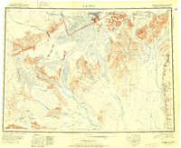
 1950 Talkeetna1954 Print · USGSThe Susitna Valley and the foothills of the Alaska Range appear in this mid-century survey as a frontier of remote lodges and rail-side outposts. You can trace the path of The Alaska Railroad through Talkeetna and locate vanished settlements like Sunflower.2 unique versions available
 - 1951 Map of Talkeetna
 1951 Talkeetna1951 Print · USGSInterior Alaska in the early fifties shows a wilderness being opened by the Alaska Railroad and bush aviation. You can trace early backcountry outposts like Chelatna Lodge, the riverside community of Talkeetna, and the high peaks of Mount Mc Kinley National Park.
 - 1952 Map of Talkeetna A-1
 1952 Talkeetna A-11952 Print · USGSThe Susitna River valley comes into focus during the early 1950s as the rail line connected remote interior outposts. Genealogists and historians can trace the early footprints of Sunshine and Montana, alongside the routes of The Alaska Railroad and Question Creek.2 unique versions available
 - 1958 Map of Talkeetna A-1, 1961 Print
 1958 Talkeetna A-11961 Print · USGSThe Susitna Valley in the late fifties was a landscape of rail outposts and river crossings centered on the Alaska Railroad. Local historians can trace early transportation routes like the Tractor Trail near Sunshine or locate family-named features like Rockys Lakes and Parker.5 unique versions available
 - 1958 Map of Talkeetna, 1964 Print
 1958 Talkeetna1964 Print · USGSThe Susitna Valley and Alaska Range meet in this mid-century survey of the rugged interior during a period of steady rail expansion. Historians can trace the Old Iditarod Trail, remote settlements like Collinsville, and the infrastructure of the Alaska Railroad.5 unique versions available
 - 1965 Map of Talkeetna
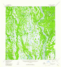
 1965 Talkeetna1965 Print · USGSAlaska's interior wilderness meets the steel of the Alaska Railroad during the mid-1960s. Genealogists and historians can trace remote settlements and cabins like Petersville, Collinsville, and the Sexton House tucked between the Alaska Range and the Yentna River.
 - 1987 Map of Talkeetna A-1 NE
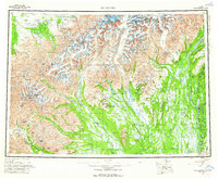
 1987 Talkeetna A-1 NE1987 Print · USGSThe braided channels of the Susitna River and the vital corridor of the Alaska Railroad define this Matanuska-Susitna landscape in the late eighties. Researchers can trace historical routes like the Tractor Trail or locate water bodies like Montana Lake and Question Lake.2 unique versions available
 - 1994 Map of Talkeetna A-1, 2002 Print
 1994 Talkeetna A-12002 Print · USGSThe Susitna River valley in the mid-1990s shows a landscape defined by the George Parks Highway and a network of interior trails. Researchers can trace remote settlements and unique local landmarks like Section House, the Birch Creek Slough, and Question Lake.
 - 2016 Map of Talkeetna A-1 NE, 2016 Print
 2016 Talkeetna A-1 NE2016 Print · USGSCovers Sunshine, including Matanuska-Susitna, United States, and other nearby areas
 - 2023 Map of Talkeetna A-1 NE, 2023 Print
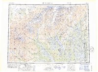
 2023 Talkeetna A-1 NE2023 Print · USGSThe Susitna River valley comes alive in this 2023 Alaska topography, showing the growth of Trapper Creek and Sunshine along the modern Parks Highway corridor. Genealogists and historians can trace local river access points like Birch Creek Landing and Carl's Landing or locate numerous named water bodies including Question Lake and Montana Lake.
End of results
Showing maps 1-10 of 10
Top cities near Sunshine
Frequently asked questions
- What are the different types of historical maps available for Sunshine?
- What is the oldest map of Sunshine?
- Where can I purchase historical maps of Sunshine for my home or office?
- Where can I download high-res historical maps of Sunshine?
- Are there historical topographic maps available for Sunshine?
- Is there historical aerial imagery available for Sunshine?
- Where are historical maps of Sunshine sourced from?