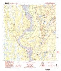
1987 Map of Talkeetna A-1 NE
USGS Topo · Published 1987About this map
The Susitna River dominates this portion of the Matanuska-Susitna Borough, its braided channels and sandbars creating a complex network that includes the Birch Creek Slough. Running parallel to the river's eastern bank, The Alaska Railroad serves as the primary industrial artery through the territory, passing near Section House Lake. This 1980s landscape is characterized by its dense concentration of small water bodies, including uniquely named features like Question Lake, Little Question Lake, and the nearby Answer Creek. The eastern portion of the quadrangle shows signs of local resource activity with a Gravel Pit near Sunshine Lakes, while the lower reach is defined by the confluence of Montana Creek and its namesake Montana Lake. To the west, several lakes such as Rockys Lakes and Queer Creek drain the low-lying terrain towards the main river channel.
Find a feature on this map
32 named features on this map. Tap any name to fly to it.
Don’t see what you’re looking for? This feature index may not catch every label — zoom into the map to look around manually.
Map Details
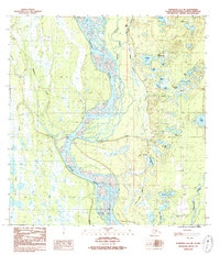
Editions of this 1987 Talkeetna A-1 NE Map
2 editions found
Other maps of this area

1949 · Talkeetna Mountains B-6
USGS Topo · 1:63,360

1950 · Talkeetna Mountains
USGS Topo · 1:250,000

1950 · Talkeetna
USGS Topo · 1:250,000

1950 · Talkeetna Mountains A-6
USGS Topo · 1:63,360

1951 · Talkeetna
USGS Topo · 1:250,000

1951 · Talkeetna B-1
USGS Topo · 1:63,360

1952 · Talkeetna Mountains B-6
USGS Topo · 1:63,360

1952 · Talkeetna A-1
USGS Topo · 1:63,360
1952 · Talkeetna Mountains A-6
USGS Topo · 1:63,360

1954 · Talkeetna Mountains
USGS Topo · 1:250,000