
1952 Map of Talkeetna A-1
USGS Topo · Published 1952About this map
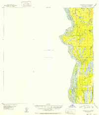
The Alaska Railroad serves as the primary artery through this Alaskan corridor, running parallel to the massive braided channels of the Susitna River. Recorded in the post-war years, the map reveals a landscape defined by the intersection of water and rail, with small settlements like Sunshine and Montana situated as pivotal stops along the line. To the east, the terrain is etched with numerous waterways, including the curiously named Question Creek and Question Lake, as well as Montana Creek and Goose Creek. A notable amount of the western portion of this quadrangle remains unmapped due to a lack of aerial photo coverage, highlighting the mid-century challenges of documenting this remote territory. Local industrial activity is evidenced by a Gravel Pit near the rail line, while nearby Tollison Lake and Fish Lake suggest a landscape dotted with subarctic water bodies.
Find a feature on this map
22 named features on this map. Tap any name to fly to it.
Don’t see what you’re looking for? This feature index may not catch every label — zoom into the map to look around manually.
Map Details
Editions of this 1952 Talkeetna A-1 Map
2 editions found
Other maps of this area

1949 · Tyonek
USGS Topo · 1:250,000

1949 · Talkeetna Mountains B-6
USGS Topo · 1:63,360

1949 · Anchorage D-8
USGS Topo · 1:63,360

1950 · Talkeetna Mountains
USGS Topo · 1:250,000

1950 · Talkeetna
USGS Topo · 1:250,000

1950 · Talkeetna Mountains A-6
USGS Topo · 1:63,360

1951 · Talkeetna
USGS Topo · 1:250,000

1951 · Talkeetna B-1
USGS Topo · 1:63,360

1951 · Anchorage
USGS Topo · 1:250,000

1951 · Tyonek
USGS Topo · 1:250,000