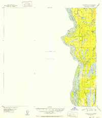
1952 Map of Talkeetna A-1
USGS Topo · Published 1952About this map
The Alaska Railroad serves as the primary corridor for human activity in this 1952 study, running parallel to the braided channels of the mighty Susitna River. Small settlements such as Sunshine and Montana are positioned along the tracks, serving as critical points in a landscape defined by its many water bodies. The terrain east of the rail line is a dense network of watercourses and lakes, including Birch Creek, Montana Creek, and Tollison Lake.
Find a feature on this map
26 named features on this map. Tap any name to fly to it.
Don’t see what you’re looking for? This feature index may not catch every label — zoom into the map to look around manually.
Map Details
Editions of this 1952 Talkeetna A-1 Map
2 editions found

Other maps of this area

1949 · Tyonek
USGS Topo · 1:250,000

1949 · Talkeetna Mountains B-6
USGS Topo · 1:63,360

1949 · Anchorage D-8
USGS Topo · 1:63,360

1950 · Talkeetna Mountains
USGS Topo · 1:250,000

1950 · Talkeetna
USGS Topo · 1:250,000

1950 · Talkeetna Mountains A-6
USGS Topo · 1:63,360

1951 · Talkeetna
USGS Topo · 1:250,000

1951 · Talkeetna B-1
USGS Topo · 1:63,360

1951 · Anchorage
USGS Topo · 1:250,000

1951 · Tyonek
USGS Topo · 1:250,000