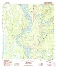
1987 Map of Talkeetna A-1 NE
USGS Topo · Published 1987About this map
The Susitna River dominates this landscape, its braided channels and gravel bars carving a complex path through the lowlands south of the Talkeetna Mountains. In the 1980s, the small settlement of Sunshine served as a key point of reference along The Alaska Railroad, which runs parallel to the river's eastern bank. This corridor highlights the critical infrastructure connecting the interior with the coast, showing how the rail line navigates the wetlands and numerous small water bodies like Section House Lake and Heritage Lake.
Find a feature on this map
33 named features on this map. Tap any name to fly to it.
Don’t see what you’re looking for? This feature index may not catch every label — zoom into the map to look around manually.
Map Details
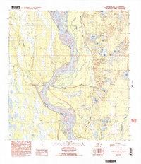
Editions of this 1987 Talkeetna A-1 NE Map
2 editions found
Other maps of this area

1949 · Talkeetna Mountains B-6
USGS Topo · 1:63,360

1950 · Talkeetna Mountains
USGS Topo · 1:250,000

1950 · Talkeetna
USGS Topo · 1:250,000

1950 · Talkeetna Mountains A-6
USGS Topo · 1:63,360

1951 · Talkeetna
USGS Topo · 1:250,000

1951 · Talkeetna B-1
USGS Topo · 1:63,360

1952 · Talkeetna Mountains B-6
USGS Topo · 1:63,360

1952 · Talkeetna A-1
USGS Topo · 1:63,360
1952 · Talkeetna Mountains A-6
USGS Topo · 1:63,360

1954 · Talkeetna Mountains
USGS Topo · 1:250,000