Old Maps of Umiat, Alaska for Hiking & Exploration
Hike through history with 5 historic maps of Umiat. Explore old trails, ghost towns, and forgotten backroads — perfect for outdoor adventurers and local explorers.
- Rediscover forgotten places: Map out old mining camps, roads, and footpaths that no longer exist on modern maps.
- Layer with modern tools: Combine with LiDAR or satellite views to plan hikes through historical terrain.
- Made for exploration: Popular among hikers, overlanders, and local history lovers.
Use these maps to find adventure and explore the hidden past of Umiat.
Umiat, AK maps
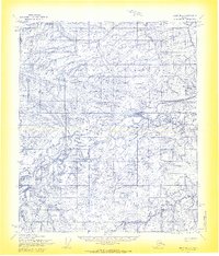
(5)- 1952 Map of Umiat
 1952 Umiat1952 Print · USGSNorth Slope exploration was in full swing during the early fifties, centered on the strategic outpost of Umiat. Researchers can trace the braided channels of the Colville River and identify remote landmarks like Sentinel Hill and Umiat Airport.
 - 1955 Map of Umiat B-4, 1970 Print
 1955 Umiat B-41970 Print · USGSThe North Slope landscape in the mid-fifties is defined by the remote settlement of Umiat and federal energy exploration. Researchers can trace early Arctic infrastructure including a Beacon, several Docks, and the specialized paths of the Tractor Trail.2 unique versions available
 - 1956 Map of Umiat, 1962 Print
 1956 Umiat1962 Print · USGSAlaska's North Slope during the mid-1950s reveals a wilderness being mapped for its energy potential. Trace the early infrastructure of the Gubik Gas Field and follow Tractor Trails connecting Umiat to the Anaktuvuk River.4 unique versions available
 - 1964 Map of Umiat
 1964 Umiat1964 Print · USGSThe North Slope landscape is captured here in the mid-1960s, centered on the strategic Naval Petroleum Reserve No 4. Researchers can trace the vast river systems of the Colville River and find landmarks like the Gubik Gas Field and Umiat Mountain.
 - 2016 Map of Umiat B-4 SW, 2016 Print
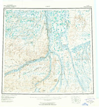
 2016 Umiat B-4 SW2016 Print · USGSThe Arctic outpost of Umiat is documented here in the mid-2010s, centered on its role as a transportation hub along the Colville River. Discover the remote landscape surrounding Umiat Airport and the prominent heights of Tattitgak Bluff.
End of results
Showing maps 1-5 of 5
Frequently asked questions
- What are the different types of historical maps available for Umiat?
- What is the oldest map of Umiat?
- Where can I purchase historical maps of Umiat for my home or office?
- Where can I download high-res historical maps of Umiat?
- Are there historical topographic maps available for Umiat?
- Is there historical aerial imagery available for Umiat?
- Where are historical maps of Umiat sourced from?