
1955 Map of Umiat B-4
USGS Topo · Published 1970About this map
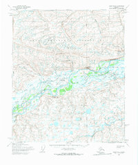
The Colville River carves a massive path through the Arctic landscape on this 1955 survey, where the remote settlement of Umiat stands as a vital outpost within the Naval Petroleum Reserve No 4. This area represents a mid-century frontier for energy exploration and logistical support, evidenced by the infrastructure of Docks and a Beacon near Umiat Lake. The topography is dominated by dramatic riverine features like Umiat Mountain and the steep slopes of Shivugak Bluff and Tattitgak Bluff which overlook the braided channels. Overland travel in this era relied on specialized routes, with several stretches of Winter Trail and Tractor Trail marked across the tundra to connect the settlement with its surrounding watershed, including Bearpaw Creek and Seabee Creek. The map reflects a period of intense federal interest in the North Slope's petroleum potential before major commercial developments transformed the region.
Find a feature on this map
14 named features on this map. Tap any name to fly to it.
Don’t see what you’re looking for? This feature index may not catch every label — zoom into the map to look around manually.
Map Details
Editions of this 1955 Umiat B-4 Map
2 editions found
Other maps of this area

1952 · Umiat
USGS Topo · 1:250,000

1955 · Umiat C-4
USGS Topo · 1:63,360

1955 · Umiat A-4
USGS Topo · 1:63,360

1955 · Umiat A-5
USGS Topo · 1:63,360

1955 · Umiat A-3
USGS Topo · 1:63,360

1955 · Umiat C-5
USGS Topo · 1:63,360

1955 · Umiat C-3
USGS Topo · 1:63,360

1955 · Umiat B-5
USGS Topo · 1:63,360

1955 · Umiat B-3
USGS Topo · 1:63,360

1956 · Umiat
USGS Topo · 1:250,000