
1955 Map of Umiat C-4
USGS Topo · Published 1970About this map
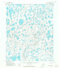
The Naval Petroleum Reserve No 4 dominates this Arctic landscape, mapped by the Army Map Service during the mid-1950s. This territory is characterized by a dense network of lakes and winding waterways, most notably the Kogosukruk River and its southern tributary, the Branch of Kogosukruk River. The presence of the Winter Trail and various stretches of Tractor Trail reflects the essential transport methods used for exploration and logistics in this permafrost environment, where permanent roads were non-existent. Smaller landmarks like Dogbone Lake and Heavy Creek provide specific points of reference for navigating the unsurveyed and unmarked locations predetermined by the Bureau of Land Management along the Umiat Meridian. The map captures a moment of early energy exploration when overland travel relied on seasonal trails across the North Slope.
Find a feature on this map
9 named features on this map. Tap any name to fly to it.
Don’t see what you’re looking for? This feature index may not catch every label — zoom into the map to look around manually.
Map Details
Editions of this 1955 Umiat C-4 Map
This is the sole edition of this map. No revisions or reprints were ever made.
Other maps of this area

1952 · Umiat
USGS Topo · 1:250,000

1955 · Umiat B-4
USGS Topo · 1:63,360

1955 · Umiat D-3
USGS Topo · 1:63,360
1955 · Umiat D-5
USGS Topo · 1:63,360
1955 · Umiat D-4
USGS Topo · 1:63,360

1955 · Umiat C-5
USGS Topo · 1:63,360

1955 · Umiat C-3
USGS Topo · 1:63,360

1955 · Umiat B-5
USGS Topo · 1:63,360

1955 · Umiat B-3
USGS Topo · 1:63,360

1956 · Umiat
USGS Topo · 1:250,000