Old Maps of Aleknagik, Alaska
Explore 11 old maps of Aleknagik, spanning from 1951 to today. These high-resolution historic maps reveal how streets, neighborhoods, landmarks, and natural features evolved over time — perfect for genealogy, metal detecting, research, and local history exploration.
What you can do with these maps:
- See how Aleknagik changed over time: Compare historical maps to modern-day views to trace roads, homesites, rail lines & more.
- View detailed metadata: Each map includes creators, publishers, year, scale, and archive source.
- Overlay maps with satellite & LiDAR: Visualize the past alongside modern tools to explore terrain & human change.
- Trusted historical sources: Maps sourced from the USGS, Library of Congress, and other archives.
- Access maps your way: View online, download high-res files, or order prints for personal or research use.
Start exploring old maps of Aleknagik to uncover forgotten places, hidden landmarks, and the deep history beneath your feet.
Aleknagik, AK maps
(11)- 1951 Map of Dillingham, 1952 Print
 1951 Dillingham1952 Print · USGSDillingham and the Bristol Bay river systems are captured here in the early fifties, showing a remote landscape linked by water and seasonal camps. Researchers can trace early settlements and post offices at New Stuyahok, Ekwok, and Kvichak.
 - 1952 Map of Dillingham A-8, 1963 Print
 1952 Dillingham A-81963 Print · USGSSouthwest Alaska during the early fifties reveals a landscape defined by the shifting waters of Lake Nunavaugaluk. Researchers can trace the meandering Snake River and locate remote Cabins along the water's edge.2 unique versions available
 - 1952 Map of Dillingham A-7, 1963 Print
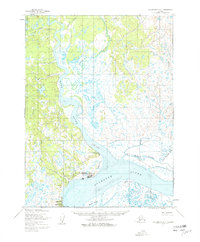 1952 Dillingham A-71963 Print · USGSDillingham and the surrounding Bristol Bay coastline are captured in the early fifties during a period of vital regional growth. Researchers can trace the layout of Dillingham, locate the Kanakanak hospital, and follow the Winter Trail through the tundra.2 unique versions available
 - 1954 Map of Dillingham, 1967 Print
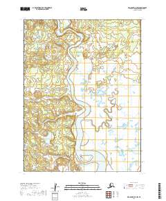
 1954 Dillingham1967 Print · USGSBristol Bay's interior river systems are mapped here in the mid-1950s, showing a landscape defined by water and winter travel. Researchers can trace remote settlements like Koliganek and Levelock or find family landmarks along the Nushagak River and Lake Aleknagik.3 unique versions available
 - 1954 Map of Dillingham B-7, 1968 Print
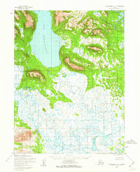
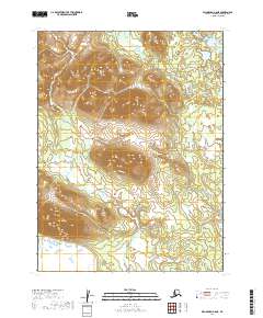
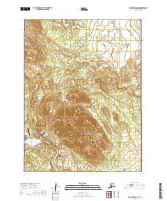
 1954 Dillingham B-71968 Print · USGSAleknagik and the surrounding Wood-Tikchik lake system are captured in the mid-fifties during an era of early aerial mapping and bush aviation. You can trace the wilderness infrastructure of the day, including a Landing Strip, a remote Mine, and the small settlement at Aleknagik.3 unique versions available
 - 1954 Map of Dillingham B-8, 1968 Print
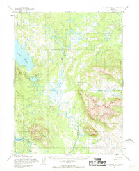
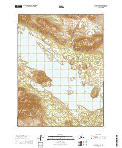
 1954 Dillingham B-81968 Print · USGSThe Bristol Bay wilderness is captured in the mid-1950s, showing the complex connections between the region's great glacial lakes. Researchers can locate seasonal outposts like Cabins and trace the flow of the Agulowak River between Lake Nerka and Lake Aleknagik.2 unique versions available
 - 2019 Map of Dillingham A-8 NE, 2019 Print
 2019 Dillingham A-8 NE2019 Print · USGSWestern Alaska near the Wood-Tikchik region is documented here in the late 2010s, focusing on the infrastructure around the lakefront. Researchers can trace the modern road system including Snake Lake Road and the connection to Aleknagik.
 - 2019 Map of Dillingham B-8 SE, 2019 Print
 2019 Dillingham B-8 SE2019 Print · USGSAleknagik and its surrounding mountain peaks are captured in this 2019 survey of southwest Alaska. Researchers can trace the local road network including Foxville Road and locate geographic landmarks like Mable Mtn and Lake Aleknagik.
 - 2019 Map of Dillingham B-8 SW, 2019 Print
 2019 Dillingham B-8 SW2019 Print · USGSDillingham's interior lakes and mountain ridges are documented here during the late 2010s. Modern researchers can trace the drainage of Ice Cr and Bear Cr as they flow from the high country toward Lake Aleknagik and Lake Nunavaugaluk.
 - 2019 Map of Dillingham A-7 NW, 2019 Print
 2019 Dillingham A-7 NW2019 Print · USGSThe intricate waterways north of Dillingham are captured here in the late twenty-first century. Trace the winding course of the Wood River and find the intersection of the Aleknagik Lake Road near Belt Cr.
 - 2019 Map of Dillingham B-7 SW, 2019 Print
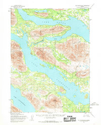
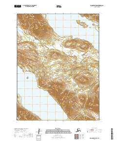
 2019 Dillingham B-7 SW2019 Print · USGSAleknagik and the surrounding Bristol Bay wilderness are mapped here in the late twenty-teens as the community's aviation and road networks expanded. Researchers can trace the layout of Aleknagik along the shore, identifying landmarks like the Aleknagik Mission Strip and the heights of Marsh Mtn.
End of results
Showing maps 1-11 of 11
Top cities near Aleknagik
Frequently asked questions
- What are the different types of historical maps available for Aleknagik?
- What is the oldest map of Aleknagik?
- Where can I purchase historical maps of Aleknagik for my home or office?
- Where can I download high-res historical maps of Aleknagik?
- Are there historical topographic maps available for Aleknagik?
- Is there historical aerial imagery available for Aleknagik?
- Where are historical maps of Aleknagik sourced from?