
1954 Map of Dillingham B-7
USGS Topo · Published 1968About this map
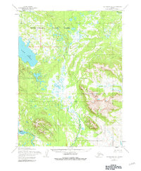
The Wood River and Muklung River systems dominate this landscape in the mid-1950s, weaving through a complex network of wetlands and tundra between the Muklung Hills and the massive waters of Lake Nerka. Near the southern edge, the settlement of Aleknagik serves as a focal point for activity on Lake Aleknagik, where a Landing Strip, a Landing Area, and a Gaging Sta indicate the importance of water and air transport in this roadless region. A lone Mine is tucked into the northern slopes of Marsh Mountain, suggesting early resource extraction efforts amidst the hills. The map also records scattered cabins, such as the one labeled Cabin on the shores of Lake Aleknagik, and names smaller waterways like Arcana Creek and Iowithla River that define the local drainage patterns.
Find a feature on this map
24 named features on this map. Tap any name to fly to it.
Don’t see what you’re looking for? This feature index may not catch every label — zoom into the map to look around manually.
Map Details
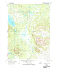
Editions of this 1954 Dillingham B-7 Map
3 editions found
Other maps of this area

1951 · Dillingham
USGS Topo · 1:250,000

1952 · Dillingham A-8
USGS Topo · 1:63,360

1952 · Dillingham A-6
USGS Topo · 1:63,360

1952 · Dillingham A-7
USGS Topo · 1:63,360

1954 · Dillingham
USGS Topo · 1:250,000

1954 · Dillingham C-6
USGS Topo · 1:63,360

1954 · Dillingham B-8
USGS Topo · 1:63,360

1954 · Dillingham B-6
USGS Topo · 1:63,360

1954 · Dillingham C-7
USGS Topo · 1:63,360

1954 · Dillingham C-8
USGS Topo · 1:63,360