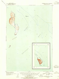
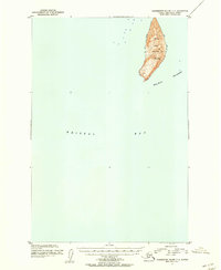
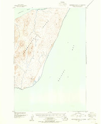
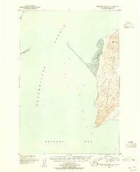
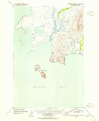
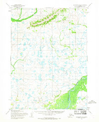
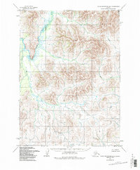
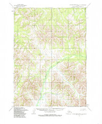
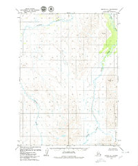
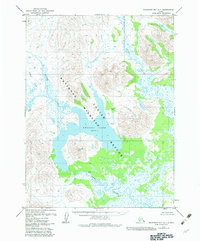
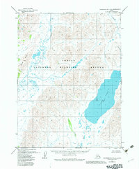
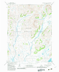
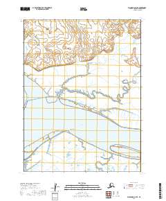
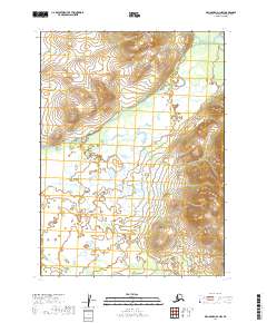
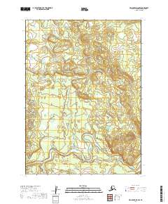
1954 Map of Dillingham B-7
USGS Topo · Published 1981About this map
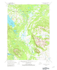
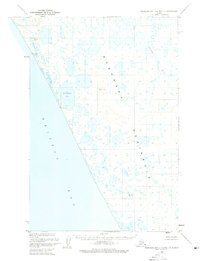
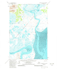
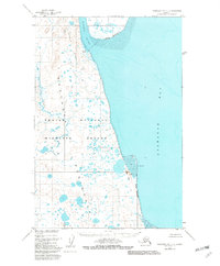
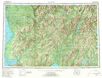
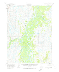
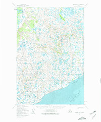
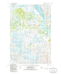
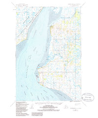
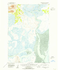
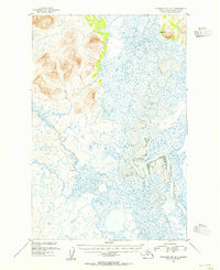
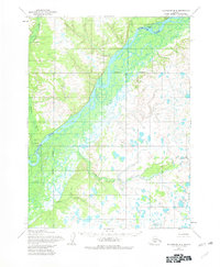
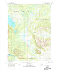
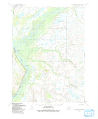
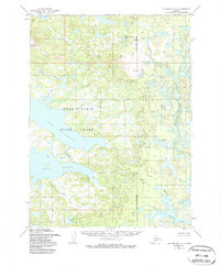
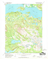
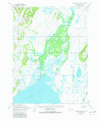
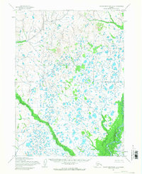
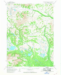
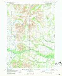
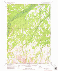
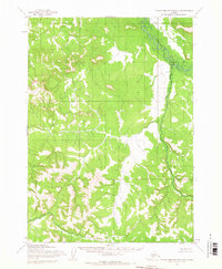
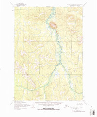
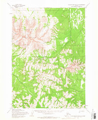
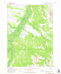
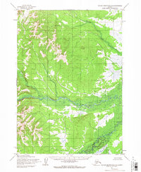
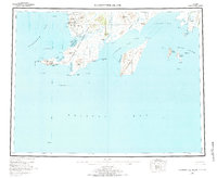
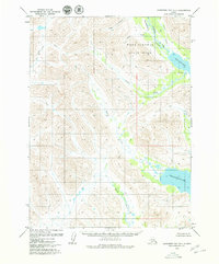
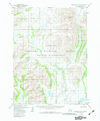
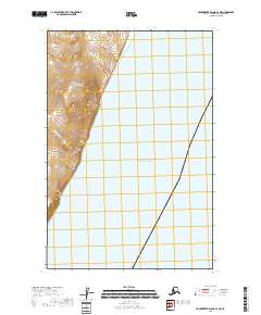
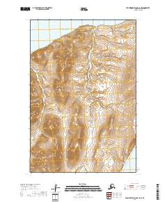
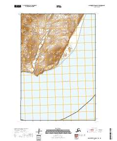
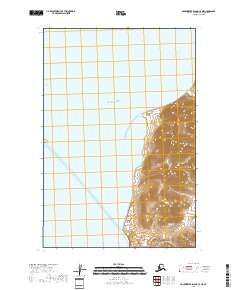
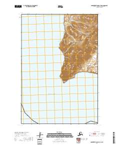
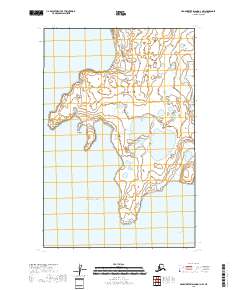
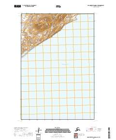
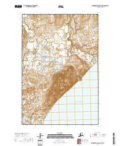
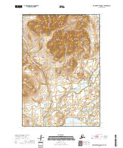
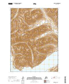
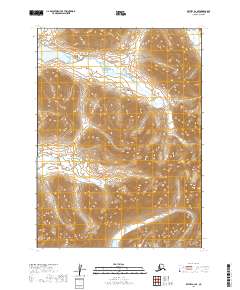
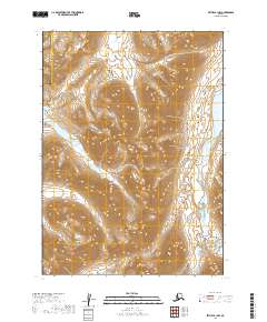
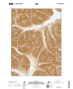
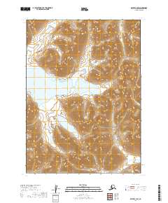
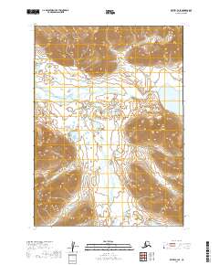
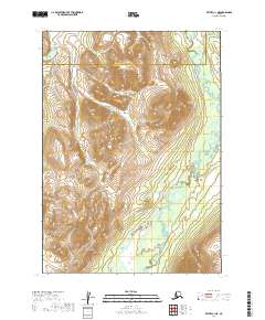
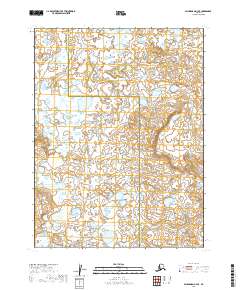
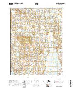
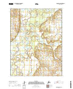
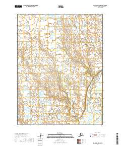
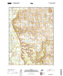
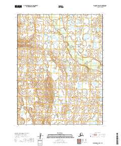
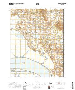
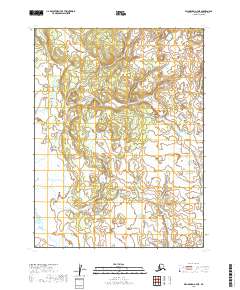
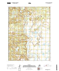
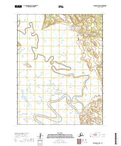
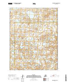
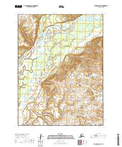
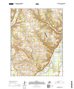
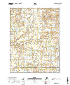
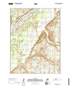
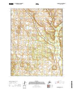
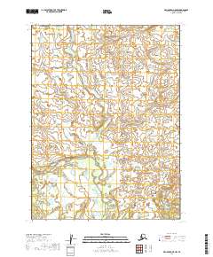
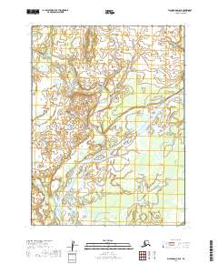
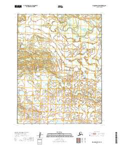
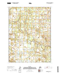
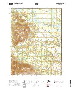
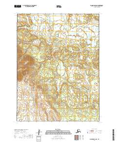
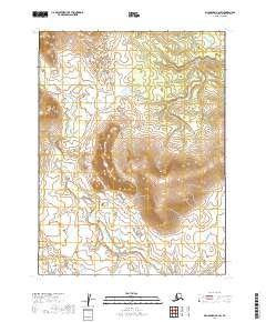
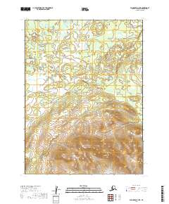
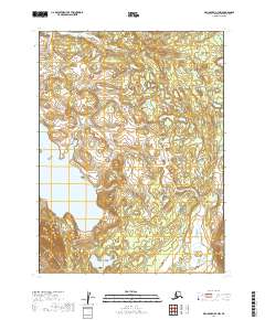
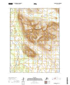
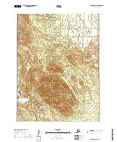
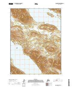
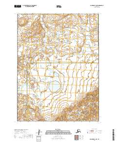
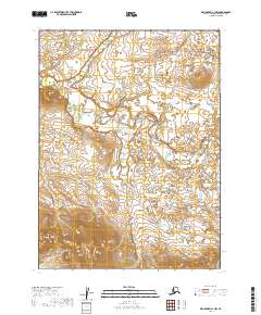
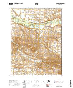
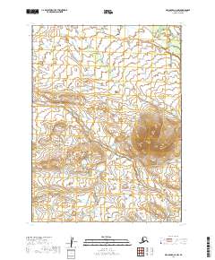
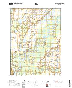
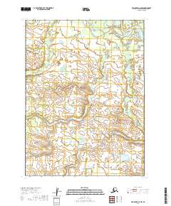
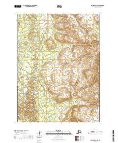
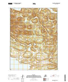
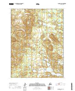
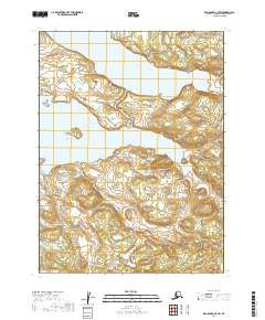
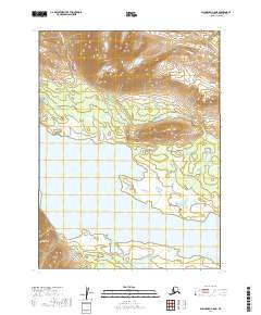
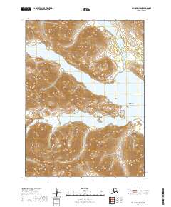
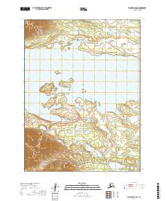
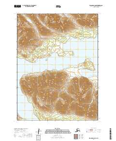
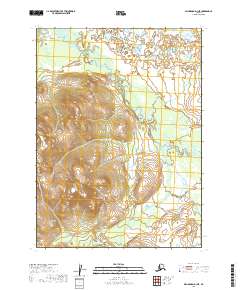
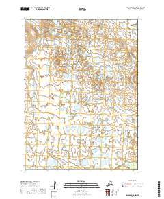
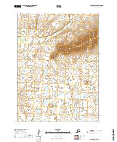
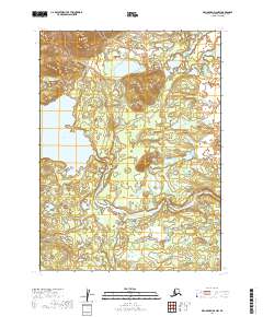
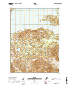
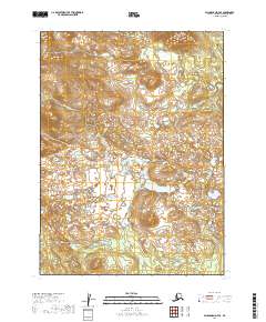
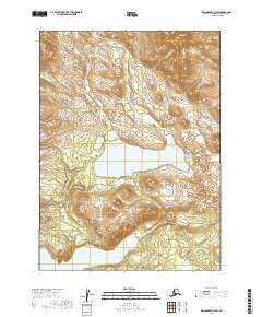
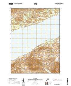
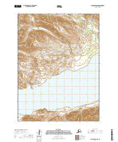
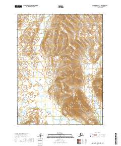
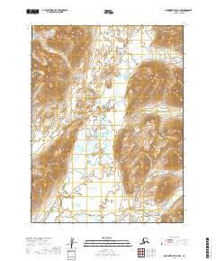
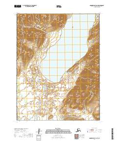
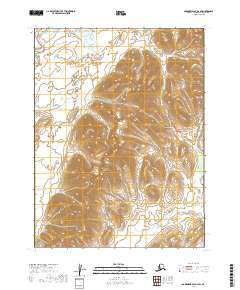
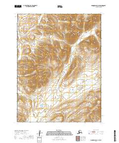
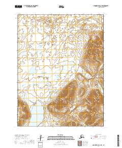
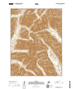
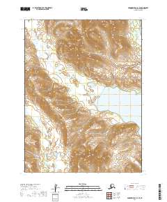
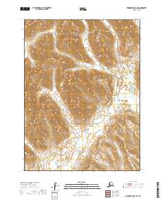
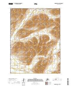
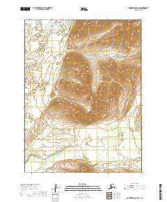
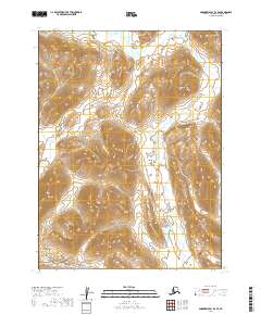
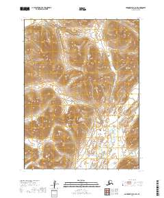
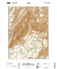
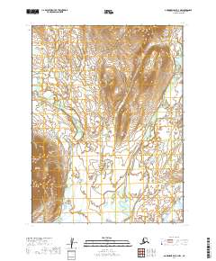
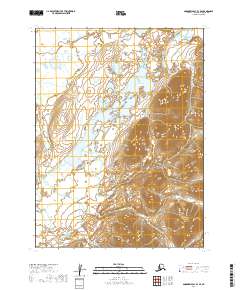
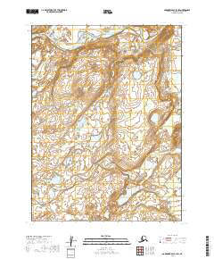
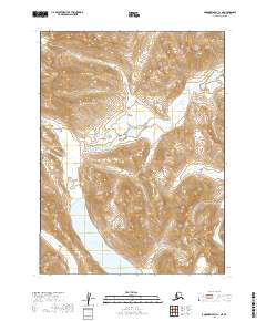
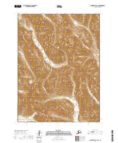
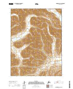
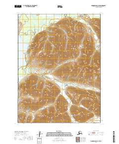
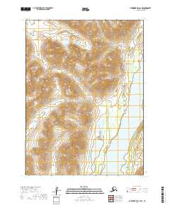
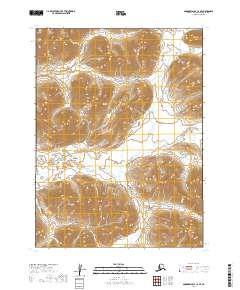
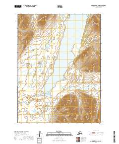
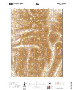
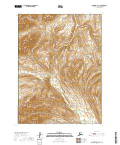
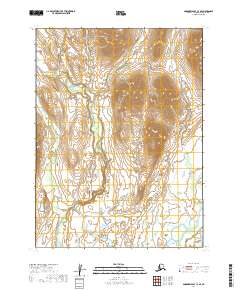
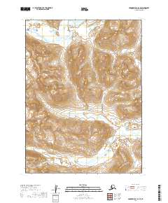
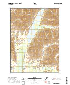
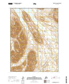
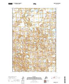
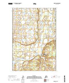
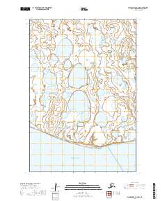
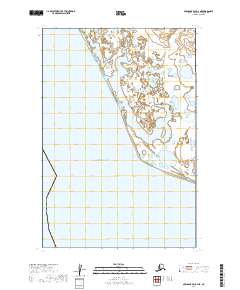
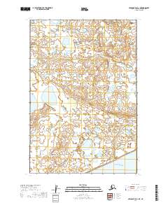
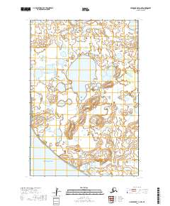
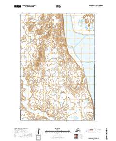
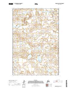
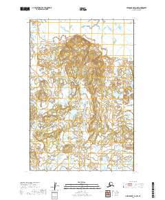
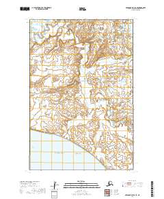
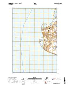
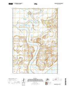
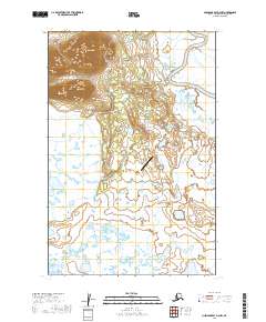
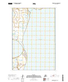
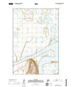
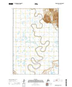
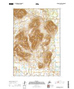
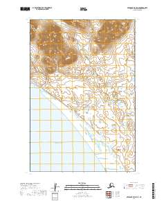
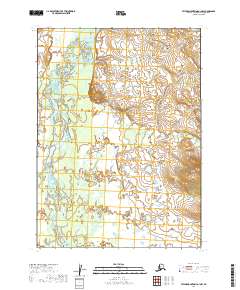
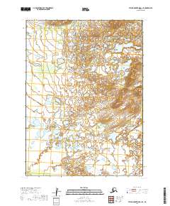
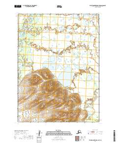
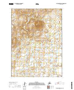
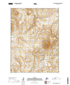
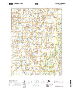
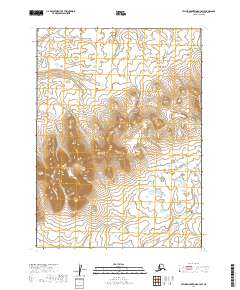
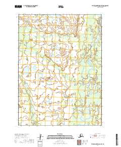
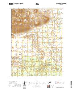
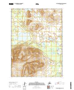
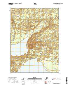
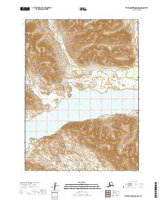
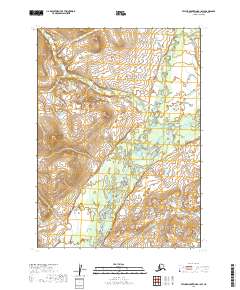
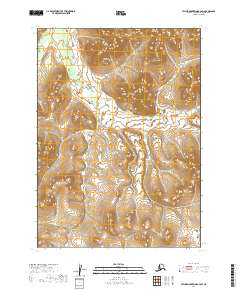
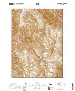
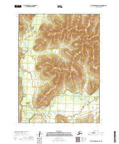
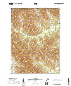
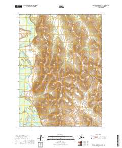
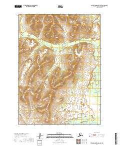
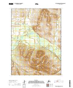
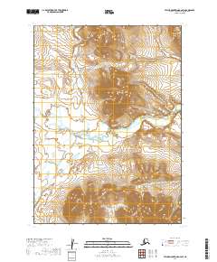
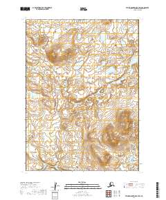
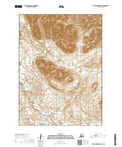
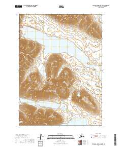
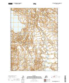
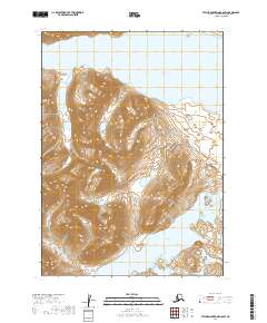
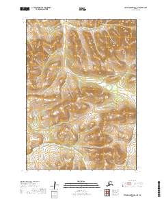
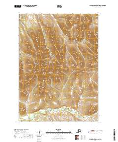
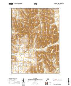
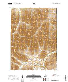
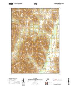
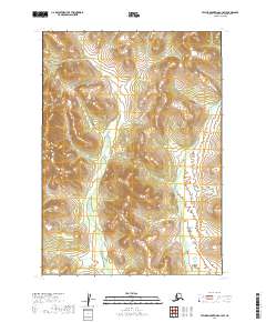
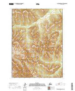
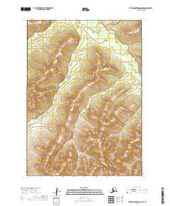
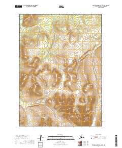
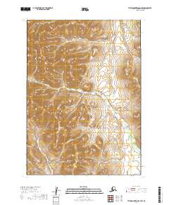
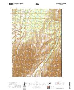
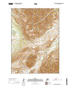
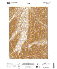
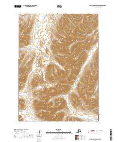
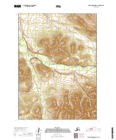
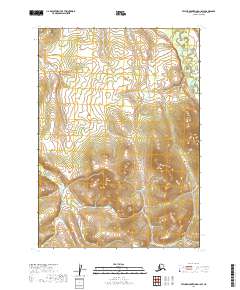
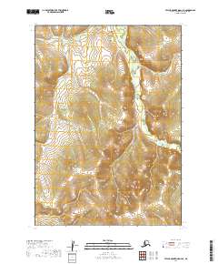
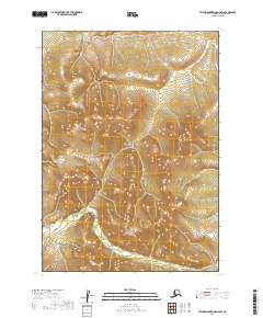
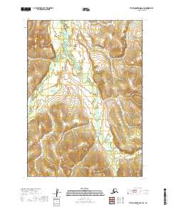
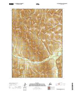
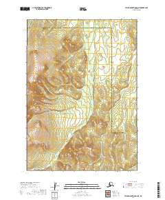
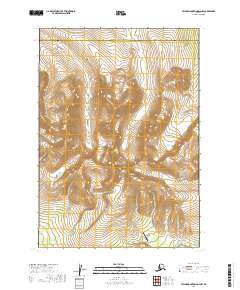
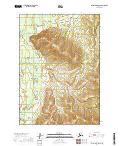
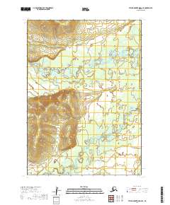
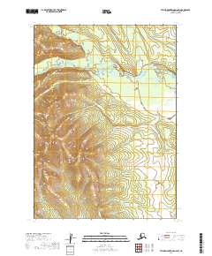
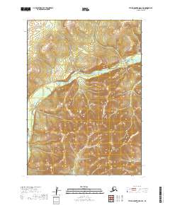
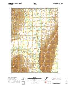
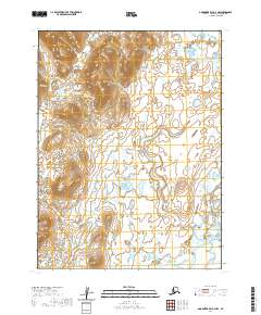
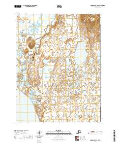
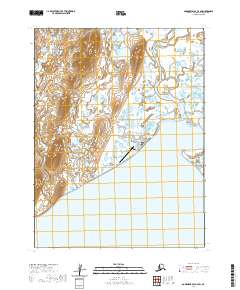
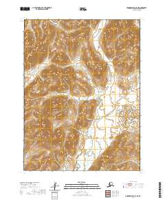
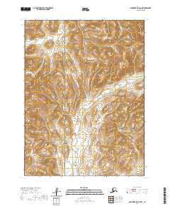
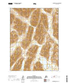
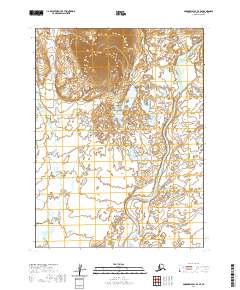
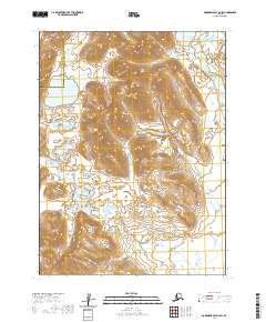
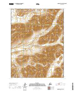
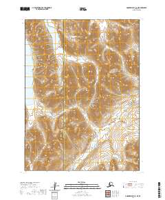
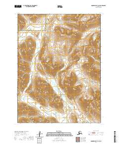
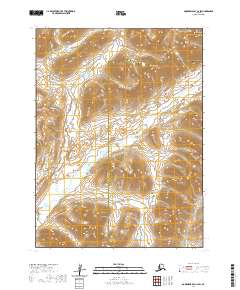
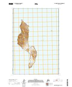
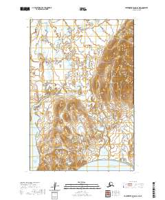
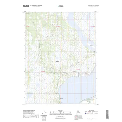
Aleknagik serves as a primary settlement point in this mid-century look at the Bristol Bay region, where the Wood River system meets the southeastern edge of the Wood-Tikchik State Park. The landscape is dominated by the massive Lake Nerka and the surrounding drainages of Stovall Creek and Pike Creek. Evidence of local aviation and wilderness access is visible near the settlement, where a Landing Area and Landing Strip are noted alongside Mosquito Point. The interior terrain rises sharply into the Muklung Hills and toward Marsh Mountain, providing a detailed look at the complex hydrology of the Muklung River and Iowithla River before they reach the main river valley. This survey provides a record of the area's infrastructure, including scattered Cabin locations, just as the state park system was being established in the following decades.
Find a feature on this map
23 named features on this map. Tap any name to fly to it.
Don’t see what you’re looking for? This feature index may not catch every label — zoom into the map to look around manually.
Map Details
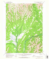
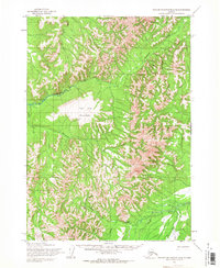
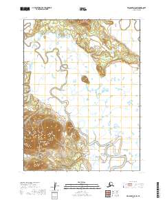
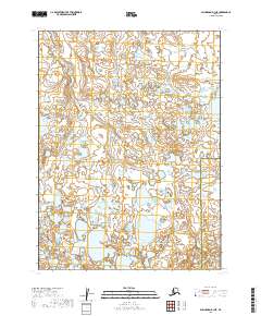
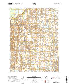
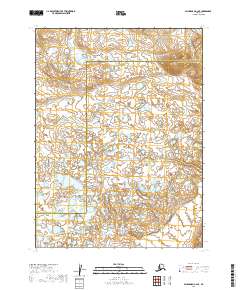
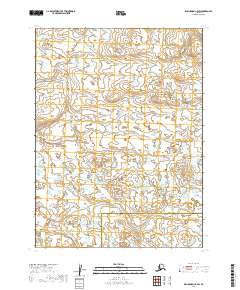
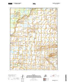
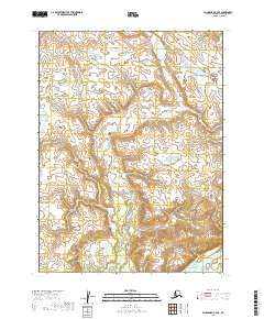
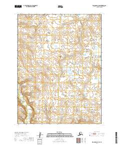
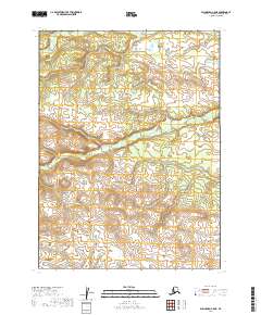
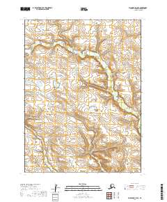
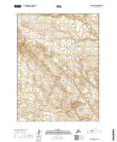
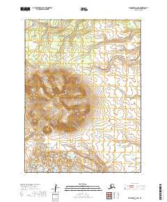
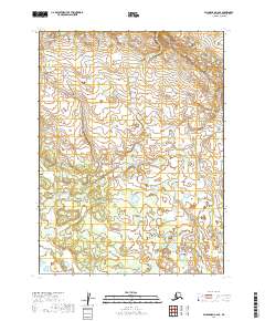
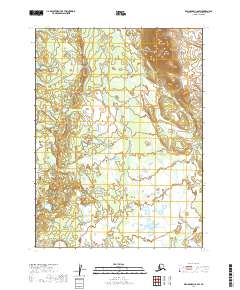
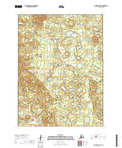
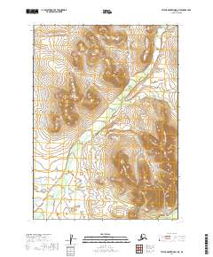
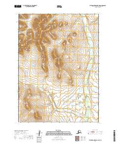
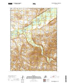
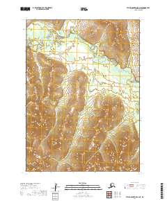
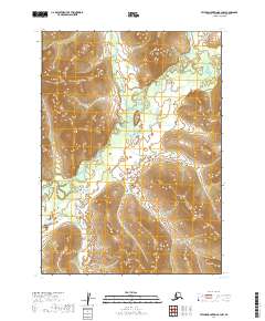
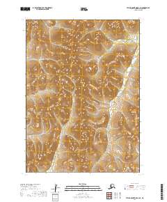
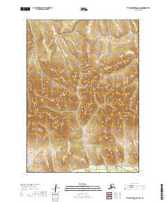
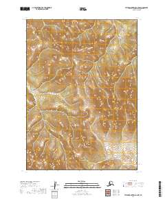
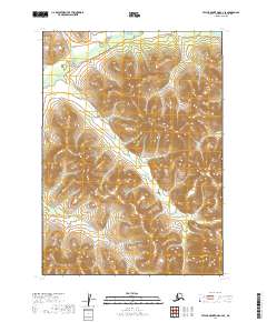
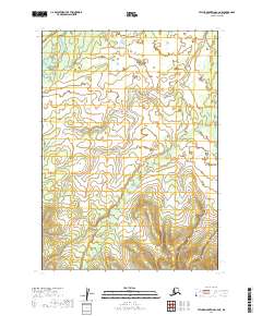
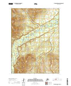
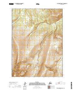
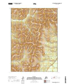
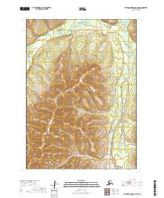
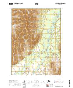
Editions of this 1954 Dillingham B-7 Map
3 editions found
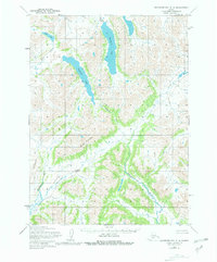
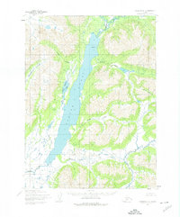
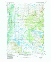
Historical Maps of Aleknagik Through Time
487 maps found
1947 Hagemeister Island D-2
Dillingham Borough, AK

1948 Hagemeister Island C-1
Dillingham Borough, AK
1948 Hagemeister Island C-2
Dillingham Borough, AK
1948 Hagemeister Island C-3
Dillingham Borough, AK
1948 Hagemeister Island C-4
Dillingham Borough, AK
1948 Hagemeister Island D-3
Dillingham Borough, AK
1948 Nushagak Bay C-4 And C-5
Dillingham Borough, AK
1948 Nushagak Bay D-3
Dillingham Borough, AK

1948 Nushagak Bay D-4
Dillingham Borough, AK
1950 Hagemeister Island D-1
Dillingham Borough, AK
1950 Nushagak Bay B-3
Dillingham Borough, AK
1950 Nushagak Bay B-4
Dillingham Borough, AK
1950 Nushagak Bay C-3
Dillingham Borough, AK
1950 Nushagak Bay C-4 And C-5
Dillingham Borough, AK
1950 Nushagak Bay D-5
Dillingham Borough, AK
1950 Nushagak Bay D-6
Dillingham Borough, AK

1950 Taylor Mountains
Dillingham Borough, AK
1951 Goodnews
Dillingham Borough, AK
1951 Hagemeister Island
Dillingham Borough, AK
1951 Taylor Mountains
Dillingham Borough, AK
1952 Dillingham A-4
Dillingham Borough, AK
1952 Dillingham A-5
Dillingham Borough, AK
1952 Dillingham A-6
Dillingham Borough, AK
1952 Dillingham A-7
Dillingham Borough, AK
1952 Dillingham A-8
Dillingham Borough, AK
1952 Hagemeister Island C-1
Dillingham Borough, AK
1952 Hagemeister Island C-2
Dillingham Borough, AK
1952 Hagemeister Island C-3
Dillingham Borough, AK
1952 Hagemeister Island C-4
Dillingham Borough, AK
1952 Hagemeister Island D-1
Dillingham Borough, AK
1952 Naknek D-5
Dillingham Borough, AK
1952 Naknek D-6
Dillingham Borough, AK
1952 Nushagak Bay C-1
Dillingham Borough, AK
1952 Nushagak Bay D-1
Dillingham Borough, AK
1952 Nushagak Bay D-2
Dillingham Borough, AK
1952 Nushagak Bay D-3
Dillingham Borough, AK
1952 Nushagak Bay D-4
Dillingham Borough, AK
1953 Hagemeister Island D-2
Dillingham Borough, AK
1954 Dillingham B-3
Dillingham Borough, AK
1954 Dillingham B-4
Dillingham Borough, AK

1954 Dillingham B-5
Dillingham Borough, AK
1954 Dillingham B-6
Dillingham Borough, AK
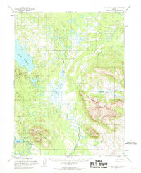
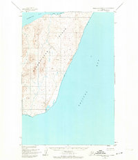
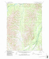
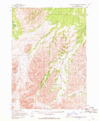
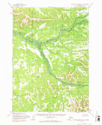
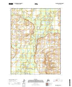
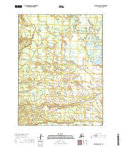
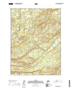
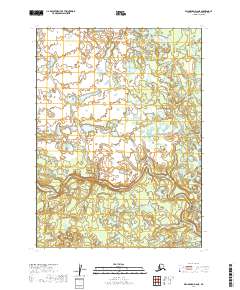
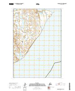
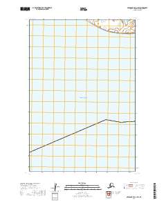
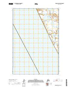
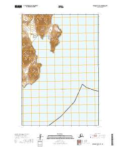
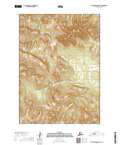
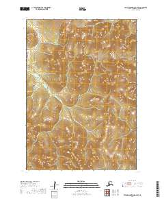
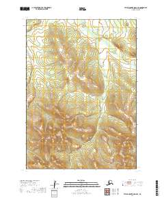
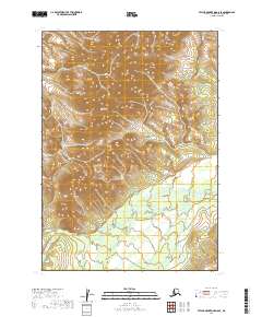
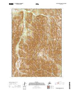
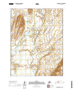
1954 Dillingham B-7
Dillingham Borough, AK
1954 Dillingham B-8
Dillingham Borough, AK
1954 Dillingham C-1
Dillingham Borough, AK
1954 Dillingham C-2
Dillingham Borough, AK
1954 Dillingham C-3
Dillingham Borough, AK
1954 Dillingham C-4
Dillingham Borough, AK
1954 Dillingham C-5
Dillingham Borough, AK
1954 Dillingham C-6
Dillingham Borough, AK
1954 Dillingham C-7
Dillingham Borough, AK
1954 Dillingham C-8
Dillingham Borough, AK
1954 Dillingham D-1
Dillingham Borough, AK
1954 Dillingham D-2
Dillingham Borough, AK
1954 Dillingham D-3
Dillingham Borough, AK
1954 Dillingham D-4
Dillingham Borough, AK
1954 Dillingham D-5
Dillingham Borough, AK
1954 Dillingham D-6
Dillingham Borough, AK
1954 Dillingham D-7
Dillingham Borough, AK
1954 Dillingham D-8
Dillingham Borough, AK
1954 Goodnews A-3
Dillingham Borough, AK
1954 Goodnews B-3
Dillingham Borough, AK
1954 Goodnews Bay A-4
Dillingham Borough, AK
1954 Goodnews Bay C-4
Dillingham Borough, AK
1954 Goodnews C-2
Dillingham Borough, AK
1954 Taylor Mountains A-1
Dillingham Borough, AK
1954 Taylor Mountains A-2
Dillingham Borough, AK
1954 Taylor Mountains A-3
Dillingham Borough, AK
1954 Taylor Mountains A-4
Dillingham Borough, AK
1954 Taylor Mountains A-5
Dillingham Borough, AK
1954 Taylor Mountains A-6
Dillingham Borough, AK
1954 Taylor Mountains A-7
Dillingham Borough, AK
1954 Taylor Mountains A-8
Dillingham Borough, AK
1954 Taylor Mountains B-1
Dillingham Borough, AK
1954 Taylor Mountains B-2
Dillingham Borough, AK
1954 Taylor Mountains B-3
Dillingham Borough, AK
1954 Taylor Mountains B-4
Dillingham Borough, AK
1954 Taylor Mountains B-5
Dillingham Borough, AK
1954 Taylor Mountains B-6
Dillingham Borough, AK
1954 Taylor Mountains B-7
Dillingham Borough, AK
1954 Taylor Mountains B-8
Dillingham Borough, AK
1954 Taylor Mountains C-1
Dillingham Borough, AK
1954 Taylor Mountains C-2
Dillingham Borough, AK
1954 Taylor Mountains C-3
Dillingham Borough, AK
1954 Taylor Mountains C-4
Dillingham Borough, AK
1954 Taylor Mountains C-5
Dillingham Borough, AK
1954 Taylor Mountains C-6
Dillingham Borough, AK
1954 Taylor Mountains C-7
Dillingham Borough, AK
1954 Taylor Mountains C-8
Dillingham Borough, AK
1954 Taylor Mountains D-1
Dillingham Borough, AK
1954 Taylor Mountains D-2
Dillingham Borough, AK
1954 Taylor Mountains D-3
Dillingham Borough, AK
1954 Taylor Mountains D-4
Dillingham Borough, AK
1954 Taylor Mountains D-5
Dillingham Borough, AK
1954 Taylor Mountains D-6
Dillingham Borough, AK
1954 Taylor Mountains D-7
Dillingham Borough, AK
1954 Taylor Mountains D-8
Dillingham Borough, AK
1954 Taylor Mountains
Dillingham Borough, AK
1957 Hagemeister Island
Dillingham Borough, AK
1979 Bethel A-1
Dillingham Borough, AK
1979 Bethel A-2
Dillingham Borough, AK
1979 Bethel B-1
Dillingham Borough, AK
1979 Bethel C-1
Dillingham Borough, AK
1979 Goodnews Bay A-1
Dillingham Borough, AK
1979 Goodnews Bay A-2
Dillingham Borough, AK
1979 Goodnews Bay A-5
Dillingham Borough, AK
1979 Goodnews Bay B-1
Dillingham Borough, AK
1979 Goodnews Bay B-2
Dillingham Borough, AK
1979 Goodnews Bay B-4
Dillingham Borough, AK
1979 Goodnews Bay C-1
Dillingham Borough, AK
1979 Goodnews Bay C-3
Dillingham Borough, AK
1979 Goodnews Bay D-1
Dillingham Borough, AK
1979 Goodnews Bay D-2
Dillingham Borough, AK
1979 Goodnews Bay D-3
Dillingham Borough, AK

1979 Goodnews Bay
Dillingham Borough, AK
2018 Hagemeister Island C-3 NE
Dillingham Borough, AK
2018 Hagemeister Island C-3 NW
Dillingham Borough, AK
2018 Hagemeister Island C-3 SW
Dillingham Borough, AK
2018 Hagemeister Island C-4 NE
Dillingham Borough, AK
2018 Hagemeister Island C-4 SE
Dillingham Borough, AK
2018 Hagemeister Island D-1 NW
Dillingham Borough, AK
2018 Hagemeister Island D-2 NW
Dillingham Borough, AK
2018 Hagemeister Island D-3 NE
Dillingham Borough, AK
2018 Hagemeister Island D-3 NW
Dillingham Borough, AK
2018 Hagemeister Island D-3 SE
Dillingham Borough, AK
2018 Hagemeister Island D-3 SW
Dillingham Borough, AK

2019 Bethel A-1 NE
Dillingham Borough, AK
2019 Bethel A-1 NW
Dillingham Borough, AK
2019 Bethel A-1 SE
Dillingham Borough, AK
2019 Bethel A-1 SW
Dillingham Borough, AK
2019 Bethel A-2 NE
Dillingham Borough, AK
2019 Bethel A-2 NW
Dillingham Borough, AK
2019 Bethel A-2 SE
Dillingham Borough, AK
2019 Bethel A-2 SW
Dillingham Borough, AK
2019 Bethel A-3 SE
Dillingham Borough, AK
2019 Bethel B-1 NE
Dillingham Borough, AK
2019 Bethel B-1 NW
Dillingham Borough, AK
2019 Bethel B-1 SE
Dillingham Borough, AK
2019 Bethel B-1 SW
Dillingham Borough, AK
2019 Bethel B-2 SE
Dillingham Borough, AK
2019 Bethel C-1 NE
Dillingham Borough, AK
2019 Bethel C-1 SE
Dillingham Borough, AK
2019 Bethel C-1 SW
Dillingham Borough, AK
2019 Dillingham A-4 NW
Dillingham Borough, AK
2019 Dillingham A-4 SE
Dillingham Borough, AK
2019 Dillingham A-4 SW
Dillingham Borough, AK
2019 Dillingham A-5 NE
Dillingham Borough, AK
2019 Dillingham A-5 NW
Dillingham Borough, AK
2019 Dillingham A-5 SE
Dillingham Borough, AK
2019 Dillingham A-5 SW
Dillingham Borough, AK
2019 Dillingham A-6 NE
Dillingham Borough, AK
2019 Dillingham A-6 NW
Dillingham Borough, AK
2019 Dillingham A-6 SE
Dillingham Borough, AK
2019 Dillingham A-6 SW
Dillingham Borough, AK
2019 Dillingham A-7 NE
Dillingham Borough, AK
2019 Dillingham A-7 NW
Dillingham Borough, AK
2019 Dillingham A-7 SE
Dillingham Borough, AK
2019 Dillingham A-7 SW
Dillingham Borough, AK
2019 Dillingham A-8 NE
Dillingham Borough, AK
2019 Dillingham A-8 NW
Dillingham Borough, AK
2019 Dillingham A-8 SE
Dillingham Borough, AK
2019 Dillingham A-8 SW
Dillingham Borough, AK
2019 Dillingham B-3 NE
Dillingham Borough, AK
2019 Dillingham B-3 NW
Dillingham Borough, AK
2019 Dillingham B-3 SW
Dillingham Borough, AK
2019 Dillingham B-4 NE
Dillingham Borough, AK
2019 Dillingham B-4 NW
Dillingham Borough, AK
2019 Dillingham B-4 SE
Dillingham Borough, AK
2019 Dillingham B-4 SW
Dillingham Borough, AK
2019 Dillingham B-5 NE
Dillingham Borough, AK
2019 Dillingham B-5 NW
Dillingham Borough, AK
2019 Dillingham B-5 SE
Dillingham Borough, AK
2019 Dillingham B-5 SW
Dillingham Borough, AK
2019 Dillingham B-6 NE
Dillingham Borough, AK
2019 Dillingham B-6 NW
Dillingham Borough, AK
2019 Dillingham B-6 SE
Dillingham Borough, AK
2019 Dillingham B-6 SW
Dillingham Borough, AK
2019 Dillingham B-7 NE
Dillingham Borough, AK
2019 Dillingham B-7 NW
Dillingham Borough, AK
2019 Dillingham B-7 SE
Dillingham Borough, AK
2019 Dillingham B-7 SW
Dillingham Borough, AK
2019 Dillingham B-8 NE
Dillingham Borough, AK
2019 Dillingham B-8 NW
Dillingham Borough, AK
2019 Dillingham B-8 SE
Dillingham Borough, AK
2019 Dillingham B-8 SW
Dillingham Borough, AK
2019 Dillingham C-1 NE
Dillingham Borough, AK
2019 Dillingham C-1 NW
Dillingham Borough, AK
2019 Dillingham C-2 NE
Dillingham Borough, AK
2019 Dillingham C-2 NW
Dillingham Borough, AK
2019 Dillingham C-2 SE
Dillingham Borough, AK
2019 Dillingham C-2 SW
Dillingham Borough, AK
2019 Dillingham C-3 NE
Dillingham Borough, AK
2019 Dillingham C-3 NW
Dillingham Borough, AK
2019 Dillingham C-3 SE
Dillingham Borough, AK
2019 Dillingham C-3 SW
Dillingham Borough, AK
2019 Dillingham C-4 NE
Dillingham Borough, AK
2019 Dillingham C-4 NW
Dillingham Borough, AK
2019 Dillingham C-4 SE
Dillingham Borough, AK
2019 Dillingham C-4 SW
Dillingham Borough, AK
2019 Dillingham C-5 NE
Dillingham Borough, AK
2019 Dillingham C-5 NW
Dillingham Borough, AK
2019 Dillingham C-5 SE
Dillingham Borough, AK
2019 Dillingham C-5 SW
Dillingham Borough, AK
2019 Dillingham C-6 NE
Dillingham Borough, AK
2019 Dillingham C-6 NW
Dillingham Borough, AK
2019 Dillingham C-6 SE
Dillingham Borough, AK
2019 Dillingham C-6 SW
Dillingham Borough, AK
2019 Dillingham C-7 NE
Dillingham Borough, AK
2019 Dillingham C-7 NW
Dillingham Borough, AK
2019 Dillingham C-7 SE
Dillingham Borough, AK
2019 Dillingham C-7 SW
Dillingham Borough, AK
2019 Dillingham C-8 NE
Dillingham Borough, AK
2019 Dillingham C-8 NW
Dillingham Borough, AK
2019 Dillingham C-8 SE
Dillingham Borough, AK
2019 Dillingham C-8 SW
Dillingham Borough, AK
2019 Dillingham D-1 NE
Dillingham Borough, AK
2019 Dillingham D-1 NW
Dillingham Borough, AK
2019 Dillingham D-1 SE
Dillingham Borough, AK
2019 Dillingham D-1 SW
Dillingham Borough, AK
2019 Dillingham D-2 NE
Dillingham Borough, AK
2019 Dillingham D-2 NW
Dillingham Borough, AK
2019 Dillingham D-2 SE
Dillingham Borough, AK
2019 Dillingham D-2 SW
Dillingham Borough, AK
2019 Dillingham D-3 NE
Dillingham Borough, AK
2019 Dillingham D-3 NW
Dillingham Borough, AK
2019 Dillingham D-3 SE
Dillingham Borough, AK
2019 Dillingham D-3 SW
Dillingham Borough, AK
2019 Dillingham D-4 NE
Dillingham Borough, AK
2019 Dillingham D-4 NW
Dillingham Borough, AK
2019 Dillingham D-4 SE
Dillingham Borough, AK
2019 Dillingham D-4 SW
Dillingham Borough, AK
2019 Dillingham D-5 NE
Dillingham Borough, AK
2019 Dillingham D-5 NW
Dillingham Borough, AK
2019 Dillingham D-5 SE
Dillingham Borough, AK
2019 Dillingham D-5 SW
Dillingham Borough, AK
2019 Dillingham D-6 NE
Dillingham Borough, AK
2019 Dillingham D-6 NW
Dillingham Borough, AK
2019 Dillingham D-6 SE
Dillingham Borough, AK
2019 Dillingham D-6 SW
Dillingham Borough, AK
2019 Dillingham D-7 NE
Dillingham Borough, AK
2019 Dillingham D-7 NW
Dillingham Borough, AK
2019 Dillingham D-7 SE
Dillingham Borough, AK
2019 Dillingham D-7 SW
Dillingham Borough, AK
2019 Dillingham D-8 NE
Dillingham Borough, AK
2019 Dillingham D-8 NW
Dillingham Borough, AK
2019 Dillingham D-8 SE
Dillingham Borough, AK
2019 Dillingham D-8 SW
Dillingham Borough, AK
2019 Goodnews Bay A-1 NE
Dillingham Borough, AK
2019 Goodnews Bay A-1 NW
Dillingham Borough, AK
2019 Goodnews Bay A-1 SE
Dillingham Borough, AK
2019 Goodnews Bay A-1 SW
Dillingham Borough, AK
2019 Goodnews Bay A-2 NE
Dillingham Borough, AK
2019 Goodnews Bay A-2 NW
Dillingham Borough, AK
2019 Goodnews Bay A-2 SE
Dillingham Borough, AK
2019 Goodnews Bay A-2 SW
Dillingham Borough, AK
2019 Goodnews Bay A-3 NE
Dillingham Borough, AK
2019 Goodnews Bay A-3 NW
Dillingham Borough, AK
2019 Goodnews Bay A-3 SE
Dillingham Borough, AK
2019 Goodnews Bay A-3 SW
Dillingham Borough, AK
2019 Goodnews Bay B-1 NE
Dillingham Borough, AK
2019 Goodnews Bay B-1 NW
Dillingham Borough, AK
2019 Goodnews Bay B-1 SE
Dillingham Borough, AK
2019 Goodnews Bay B-1 SW
Dillingham Borough, AK
2019 Goodnews Bay B-2 NE
Dillingham Borough, AK
2019 Goodnews Bay B-2 NW
Dillingham Borough, AK
2019 Goodnews Bay B-2 SE
Dillingham Borough, AK
2019 Goodnews Bay B-2 SW
Dillingham Borough, AK
2019 Goodnews Bay B-3 NE
Dillingham Borough, AK
2019 Goodnews Bay B-3 NW
Dillingham Borough, AK
2019 Goodnews Bay B-3 SE
Dillingham Borough, AK
2019 Goodnews Bay B-3 SW
Dillingham Borough, AK
2019 Goodnews Bay C-1 NE
Dillingham Borough, AK
2019 Goodnews Bay C-1 NW
Dillingham Borough, AK

2019 Goodnews Bay C-1 SE
Dillingham Borough, AK
2019 Goodnews Bay C-1 SW
Dillingham Borough, AK
2019 Goodnews Bay C-2 NE
Dillingham Borough, AK
2019 Goodnews Bay C-2 NW
Dillingham Borough, AK
2019 Goodnews Bay C-2 SE
Dillingham Borough, AK
2019 Goodnews Bay C-2 SW
Dillingham Borough, AK
2019 Goodnews Bay C-3 NE
Dillingham Borough, AK
2019 Goodnews Bay C-3 NW
Dillingham Borough, AK
2019 Goodnews Bay C-3 SE
Dillingham Borough, AK
2019 Goodnews Bay C-3 SW
Dillingham Borough, AK
2019 Goodnews Bay D-1 NE
Dillingham Borough, AK
2019 Goodnews Bay D-1 NW
Dillingham Borough, AK
2019 Goodnews Bay D-1 SE
Dillingham Borough, AK
2019 Goodnews Bay D-1 SW
Dillingham Borough, AK
2019 Goodnews Bay D-2 NE
Dillingham Borough, AK
2019 Goodnews Bay D-2 NW
Dillingham Borough, AK
2019 Goodnews Bay D-2 SE
Dillingham Borough, AK
2019 Goodnews Bay D-2 SW
Dillingham Borough, AK
2019 Goodnews Bay D-3 NE
Dillingham Borough, AK
2019 Goodnews Bay D-3 SE
Dillingham Borough, AK
2019 Goodnews Bay D-3 SW
Dillingham Borough, AK
2019 Hagemeister Island C-1 OE E NW
Dillingham Borough, AK
2019 Hagemeister Island C-1 OE E SW
Dillingham Borough, AK
2019 Naknek C-6 NW
Dillingham Borough, AK
2019 Naknek D-5 NE
Dillingham Borough, AK
2019 Naknek D-5 NW
Dillingham Borough, AK
2019 Naknek D-5 SE
Dillingham Borough, AK
2019 Naknek D-5 SW
Dillingham Borough, AK
2019 Naknek D-6 NE
Dillingham Borough, AK
2019 Naknek D-6 NW
Dillingham Borough, AK
2019 Naknek D-6 SE
Dillingham Borough, AK
2019 Naknek D-6 SW
Dillingham Borough, AK
2019 Nushagak Bay B-3 NE
Dillingham Borough, AK
2019 Nushagak Bay B-3 NW
Dillingham Borough, AK
2019 Nushagak Bay B-4 NE
Dillingham Borough, AK
2019 Nushagak Bay B-4 NW
Dillingham Borough, AK
2019 Nushagak Bay C-1 NE
Dillingham Borough, AK
2019 Nushagak Bay C-1 NW
Dillingham Borough, AK
2019 Nushagak Bay C-1 OE W NE
Dillingham Borough, AK
2019 Nushagak Bay C-1 SE
Dillingham Borough, AK
2019 Nushagak Bay C-1 SW
Dillingham Borough, AK
2019 Nushagak Bay C-3 NE
Dillingham Borough, AK
2019 Nushagak Bay C-3 NW
Dillingham Borough, AK
2019 Nushagak Bay C-3 SE
Dillingham Borough, AK
2019 Nushagak Bay C-3 SW
Dillingham Borough, AK
2019 Nushagak Bay C-4 NE
Dillingham Borough, AK
2019 Nushagak Bay C-4 NW
Dillingham Borough, AK
2019 Nushagak Bay C-4 SE
Dillingham Borough, AK
2019 Nushagak Bay C-4 SW
Dillingham Borough, AK
2019 Nushagak Bay C-5 NE
Dillingham Borough, AK
2019 Nushagak Bay D-1 NE
Dillingham Borough, AK
2019 Nushagak Bay D-1 NW
Dillingham Borough, AK
2019 Nushagak Bay D-1 SE
Dillingham Borough, AK
2019 Nushagak Bay D-1 SW
Dillingham Borough, AK
2019 Nushagak Bay D-2 NE
Dillingham Borough, AK
2019 Nushagak Bay D-2 NW
Dillingham Borough, AK
2019 Nushagak Bay D-2 SE
Dillingham Borough, AK
2019 Nushagak Bay D-2 SW
Dillingham Borough, AK
2019 Nushagak Bay D-3 NE
Dillingham Borough, AK
2019 Nushagak Bay D-3 NW
Dillingham Borough, AK
2019 Nushagak Bay D-3 SE
Dillingham Borough, AK
2019 Nushagak Bay D-3 SW
Dillingham Borough, AK
2019 Nushagak Bay D-4 NE
Dillingham Borough, AK
2019 Nushagak Bay D-4 NW
Dillingham Borough, AK
2019 Nushagak Bay D-4 SE
Dillingham Borough, AK
2019 Nushagak Bay D-4 SW
Dillingham Borough, AK
2019 Nushagak Bay D-5 NE
Dillingham Borough, AK
2019 Nushagak Bay D-5 NW
Dillingham Borough, AK
2019 Nushagak Bay D-5 SE
Dillingham Borough, AK
2019 Nushagak Bay D-5 SW
Dillingham Borough, AK
2019 Nushagak Bay D-6 NE
Dillingham Borough, AK
2019 Nushagak Bay D-6 NW
Dillingham Borough, AK
2019 Nushagak Bay D-6 SE
Dillingham Borough, AK
2019 Nushagak Bay D-6 SW
Dillingham Borough, AK
2019 Taylor Mountains A-1 NE
Dillingham Borough, AK
2019 Taylor Mountains A-1 NW
Dillingham Borough, AK
2019 Taylor Mountains A-1 SE
Dillingham Borough, AK
2019 Taylor Mountains A-1 SW
Dillingham Borough, AK
2019 Taylor Mountains A-2 NE
Dillingham Borough, AK
2019 Taylor Mountains A-2 NW
Dillingham Borough, AK
2019 Taylor Mountains A-2 SE
Dillingham Borough, AK

2019 Taylor Mountains A-2 SW
Dillingham Borough, AK
2019 Taylor Mountains A-3 NE
Dillingham Borough, AK
2019 Taylor Mountains A-3 NW
Dillingham Borough, AK
2019 Taylor Mountains A-3 SE
Dillingham Borough, AK
2019 Taylor Mountains A-3 SW
Dillingham Borough, AK
2019 Taylor Mountains A-4 NE
Dillingham Borough, AK
2019 Taylor Mountains A-4 NW
Dillingham Borough, AK
2019 Taylor Mountains A-4 SE
Dillingham Borough, AK
2019 Taylor Mountains A-4 SW
Dillingham Borough, AK
2019 Taylor Mountains A-5 NE
Dillingham Borough, AK
2019 Taylor Mountains A-5 NW
Dillingham Borough, AK
2019 Taylor Mountains A-5 SE
Dillingham Borough, AK
2019 Taylor Mountains A-5 SW
Dillingham Borough, AK
2019 Taylor Mountains A-6 NE
Dillingham Borough, AK
2019 Taylor Mountains A-6 NW
Dillingham Borough, AK
2019 Taylor Mountains A-6 SE
Dillingham Borough, AK
2019 Taylor Mountains A-6 SW
Dillingham Borough, AK
2019 Taylor Mountains A-7 NE
Dillingham Borough, AK
2019 Taylor Mountains A-7 NW
Dillingham Borough, AK
2019 Taylor Mountains A-7 SE
Dillingham Borough, AK
2019 Taylor Mountains A-7 SW
Dillingham Borough, AK
2019 Taylor Mountains A-8 NE
Dillingham Borough, AK
2019 Taylor Mountains A-8 NW
Dillingham Borough, AK
2019 Taylor Mountains A-8 SE
Dillingham Borough, AK
2019 Taylor Mountains A-8 SW
Dillingham Borough, AK
2019 Taylor Mountains B-1 NE
Dillingham Borough, AK
2019 Taylor Mountains B-1 NW
Dillingham Borough, AK
2019 Taylor Mountains B-1 SE
Dillingham Borough, AK
2019 Taylor Mountains B-1 SW
Dillingham Borough, AK
2019 Taylor Mountains B-2 NE
Dillingham Borough, AK
2019 Taylor Mountains B-2 NW
Dillingham Borough, AK
2019 Taylor Mountains B-2 SE
Dillingham Borough, AK
2019 Taylor Mountains B-2 SW
Dillingham Borough, AK
2019 Taylor Mountains B-3 NE
Dillingham Borough, AK
2019 Taylor Mountains B-3 NW
Dillingham Borough, AK
2019 Taylor Mountains B-3 SE
Dillingham Borough, AK
2019 Taylor Mountains B-3 SW
Dillingham Borough, AK
2019 Taylor Mountains B-4 NE
Dillingham Borough, AK
2019 Taylor Mountains B-4 NW
Dillingham Borough, AK
2019 Taylor Mountains B-4 SE
Dillingham Borough, AK
2019 Taylor Mountains B-4 SW
Dillingham Borough, AK
2019 Taylor Mountains B-5 NE
Dillingham Borough, AK
2019 Taylor Mountains B-5 NW
Dillingham Borough, AK
2019 Taylor Mountains B-5 SE
Dillingham Borough, AK
2019 Taylor Mountains B-5 SW
Dillingham Borough, AK
2019 Taylor Mountains B-6 NE
Dillingham Borough, AK
2019 Taylor Mountains B-6 NW
Dillingham Borough, AK
2019 Taylor Mountains B-6 SE
Dillingham Borough, AK
2019 Taylor Mountains B-6 SW
Dillingham Borough, AK
2019 Taylor Mountains B-7 NE
Dillingham Borough, AK
2019 Taylor Mountains B-7 NW
Dillingham Borough, AK
2019 Taylor Mountains B-7 SE
Dillingham Borough, AK
2019 Taylor Mountains B-7 SW
Dillingham Borough, AK
2019 Taylor Mountains B-8 NE
Dillingham Borough, AK
2019 Taylor Mountains B-8 NW
Dillingham Borough, AK
2019 Taylor Mountains B-8 SE
Dillingham Borough, AK
2019 Taylor Mountains B-8 SW
Dillingham Borough, AK
2019 Taylor Mountains C-1 NE
Dillingham Borough, AK
2019 Taylor Mountains C-1 NW
Dillingham Borough, AK
2019 Taylor Mountains C-1 SE
Dillingham Borough, AK
2019 Taylor Mountains C-1 SW
Dillingham Borough, AK
2019 Taylor Mountains C-2 NE
Dillingham Borough, AK
2019 Taylor Mountains C-2 NW
Dillingham Borough, AK
2019 Taylor Mountains C-2 SE
Dillingham Borough, AK
2019 Taylor Mountains C-2 SW
Dillingham Borough, AK
2019 Taylor Mountains C-3 NE
Dillingham Borough, AK
2019 Taylor Mountains C-3 NW
Dillingham Borough, AK
2019 Taylor Mountains C-3 SE
Dillingham Borough, AK
2019 Taylor Mountains C-3 SW
Dillingham Borough, AK
2019 Taylor Mountains C-4 NE
Dillingham Borough, AK
2019 Taylor Mountains C-4 NW
Dillingham Borough, AK
2019 Taylor Mountains C-4 SE
Dillingham Borough, AK
2019 Taylor Mountains C-4 SW
Dillingham Borough, AK
2019 Taylor Mountains C-5 NE
Dillingham Borough, AK
2019 Taylor Mountains C-5 NW
Dillingham Borough, AK
2019 Taylor Mountains C-5 SE
Dillingham Borough, AK
2019 Taylor Mountains C-5 SW
Dillingham Borough, AK
2019 Taylor Mountains C-6 NE
Dillingham Borough, AK
2019 Taylor Mountains C-6 NW
Dillingham Borough, AK
2019 Taylor Mountains C-6 SE
Dillingham Borough, AK
2019 Taylor Mountains C-6 SW
Dillingham Borough, AK
2019 Taylor Mountains C-7 NE
Dillingham Borough, AK
2019 Taylor Mountains C-7 NW
Dillingham Borough, AK
2019 Taylor Mountains C-7 SE
Dillingham Borough, AK
2019 Taylor Mountains C-7 SW
Dillingham Borough, AK
2019 Taylor Mountains C-8 NE
Dillingham Borough, AK
2019 Taylor Mountains C-8 NW
Dillingham Borough, AK
2019 Taylor Mountains C-8 SE
Dillingham Borough, AK
2019 Taylor Mountains C-8 SW
Dillingham Borough, AK
2019 Taylor Mountains D-1 SE
Dillingham Borough, AK
2019 Taylor Mountains D-1 SW
Dillingham Borough, AK
2019 Taylor Mountains D-2 SE
Dillingham Borough, AK
2019 Taylor Mountains D-2 SW
Dillingham Borough, AK
2019 Taylor Mountains D-3 SE
Dillingham Borough, AK
2019 Taylor Mountains D-3 SW
Dillingham Borough, AK
2019 Taylor Mountains D-4 NE
Dillingham Borough, AK
2019 Taylor Mountains D-4 NW
Dillingham Borough, AK
2019 Taylor Mountains D-4 SE
Dillingham Borough, AK
2019 Taylor Mountains D-4 SW
Dillingham Borough, AK
2019 Taylor Mountains D-5 SE
Dillingham Borough, AK
2019 Taylor Mountains D-5 SW
Dillingham Borough, AK
2019 Taylor Mountains D-6 SE
Dillingham Borough, AK
2019 Taylor Mountains D-6 SW
Dillingham Borough, AK
2019 Taylor Mountains D-7 SE
Dillingham Borough, AK
2019 Taylor Mountains D-7 SW
Dillingham Borough, AK
2019 Taylor Mountains D-8 SE
Dillingham Borough, AK
2019 Taylor Mountains D-8 SW
Dillingham Borough, AK
2020 Goodnews Bay A-4 NE
Dillingham Borough, AK
2020 Goodnews Bay A-4 NW
Dillingham Borough, AK
2020 Goodnews Bay A-4 SE
Dillingham Borough, AK
2020 Goodnews Bay A-4 SW
Dillingham Borough, AK
2020 Goodnews Bay A-5 NE
Dillingham Borough, AK
2020 Goodnews Bay A-5 NW
Dillingham Borough, AK
2020 Goodnews Bay A-5 SE
Dillingham Borough, AK
2020 Goodnews Bay A-5 SW
Dillingham Borough, AK
2020 Goodnews Bay B-4 NE
Dillingham Borough, AK
2020 Goodnews Bay B-4 NW
Dillingham Borough, AK
2020 Goodnews Bay B-4 SE
Dillingham Borough, AK
2020 Goodnews Bay B-4 SW
Dillingham Borough, AK
2020 Goodnews Bay B-5 SE
Dillingham Borough, AK
2020 Goodnews Bay C-4 NE
Dillingham Borough, AK
2020 Goodnews Bay C-4 SE
Dillingham Borough, AK
2020 Goodnews Bay C-4 SW
Dillingham Borough, AK
2020 Hagemeister Island C-1 NE
Dillingham Borough, AK
2020 Hagemeister Island C-1 NW
Dillingham Borough, AK
2020 Hagemeister Island C-1 SE
Dillingham Borough, AK
2020 Hagemeister Island C-1 SW
Dillingham Borough, AK
2020 Hagemeister Island C-2 NE
Dillingham Borough, AK
2020 Hagemeister Island D-1 NE
Dillingham Borough, AK
2020 Hagemeister Island D-1 SE
Dillingham Borough, AK
2020 Hagemeister Island D-1 SW
Dillingham Borough, AK
2020 Hagemeister Island D-2 SE
Dillingham Borough, AK
2023 Dillingham A-7 SW
Dillingham Borough, AK