
1954 Map of Dillingham B-6
USGS Topo · Published 1968About this map
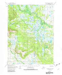
The Muklung Hills dominate the southern landscape of this interior Alaskan region, as mapped in the mid-1950s. This survey, compiled from aerial photographs by the Army Map Service, documents a complex network of waterways feeding into the Kokwok River, which snakes across the northern and eastern portions of the quadrangle. The hydrology of the area is further defined by the Iowithla River and several tributaries including Kenakuchak Creek and the aptly named Nameless Creek. Human presence is sparse in this period, noted only by a solitary Cabin in the northwest and the named landmark of Oksokuk. This map illustrates the untouched character of the Alaskan bush before significant modern development, emphasizing the natural drainage patterns and topographical rise of the hills above the surrounding wetlands.
Find a feature on this map
7 named features on this map. Tap any name to fly to it.
Don’t see what you’re looking for? This feature index may not catch every label — zoom into the map to look around manually.
Map Details
Editions of this 1954 Dillingham B-6 Map
2 editions found
Other maps of this area

1951 · Dillingham
USGS Topo · 1:250,000

1952 · Dillingham A-5
USGS Topo · 1:63,360

1952 · Dillingham A-6
USGS Topo · 1:63,360

1952 · Dillingham A-7
USGS Topo · 1:63,360

1954 · Dillingham
USGS Topo · 1:250,000

1954 · Dillingham C-6
USGS Topo · 1:63,360

1954 · Dillingham B-7
USGS Topo · 1:63,360
1954 · Dillingham B-5
USGS Topo · 1:63,360

1954 · Dillingham C-7
USGS Topo · 1:63,360

1954 · Dillingham C-5
USGS Topo · 1:63,360