
1954 Map of Dillingham C-5
USGS Topo · Published 1988About this map
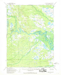
Klutuk Creek defines much of the central and southern drainage of this interior Alaskan landscape, meandering through a terrain marked by thousands of small kettle ponds and marshy wetlands. Surveyed in the mid-1950s using photogrammetric methods from aerial photography, the map highlights the intricate hydrography of the region north of Bristol Bay. To the north, Naputoli Creek flows across a series of ridges, reflecting a shift from the pond-strewn lowlands to more defined upland relief. The map illustrates a wilderness state before significant modern infrastructure, with land lines representing unsurveyed locations predetermined by the Bureau of Land Management under the Seward Meridian. This document preserves the natural character of the Dillingham interior during an era of extensive aerial surveying by the Army Map Service.
Find a feature on this map
2 named features on this map. Tap any name to fly to it.
Don’t see what you’re looking for? This feature index may not catch every label — zoom into the map to look around manually.
Map Details
Editions of this 1954 Dillingham C-5 Map
This is the sole edition of this map. No revisions or reprints were ever made.
Other maps of this area

1951 · Dillingham
USGS Topo · 1:250,000

1954 · Dillingham
USGS Topo · 1:250,000

1954 · Dillingham B-4
USGS Topo · 1:63,360

1954 · Dillingham C-6
USGS Topo · 1:63,360

1954 · Dillingham D-6
USGS Topo · 1:63,360
1954 · Dillingham D-5
USGS Topo · 1:63,360

1954 · Dillingham B-6
USGS Topo · 1:63,360

1954 · Dillingham D-4
USGS Topo · 1:63,360
1954 · Dillingham B-5
USGS Topo · 1:63,360

1954 · Dillingham C-4
USGS Topo · 1:63,360