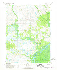
1954 Map of Dillingham B-5
USGS Topo · Published 1968About this map
The braided channels of the Nushagak River dominate this mid-century survey of the Alaska wilderness near Dillingham. This map reflects a landscape defined by its complex hydrology, where the large river system meets tributaries like the Kokwok River and Kuklong Creek. At the time of this 1954 annotation, the area remained largely unsurveyed on the ground, with land lines representing positions predetermined by the Bureau of Land Management rather than physical markers. The mapping itself was a product of the post-war era's technological shift, utilizing photogrammetric methods from aerial photographs taken in 1955. The sheet provides a clear view of the natural watercourses, including Klutuk Creek and the area designated as Lower, showing a territory where the river was the primary geographic feature long before significant road infrastructure reached this part of the Seward Meridian.
Find a feature on this map
6 named features on this map. Tap any name to fly to it.
Don’t see what you’re looking for? This feature index may not catch every label — zoom into the map to look around manually.
Map Details
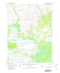
Editions of this 1954 Dillingham B-5 Map
2 editions found
Other maps of this area

1951 · Dillingham
USGS Topo · 1:250,000

1952 · Dillingham A-5
USGS Topo · 1:63,360

1952 · Dillingham A-4
USGS Topo · 1:63,360

1952 · Dillingham A-6
USGS Topo · 1:63,360

1954 · Dillingham
USGS Topo · 1:250,000

1954 · Dillingham B-4
USGS Topo · 1:63,360

1954 · Dillingham C-6
USGS Topo · 1:63,360

1954 · Dillingham B-6
USGS Topo · 1:63,360

1954 · Dillingham C-4
USGS Topo · 1:63,360

1954 · Dillingham C-5
USGS Topo · 1:63,360