Old Maps of Ekwok, Alaska
Explore 8 old maps of Ekwok, spanning from 1951 to today. These high-resolution historic maps reveal how streets, neighborhoods, landmarks, and natural features evolved over time — perfect for genealogy, metal detecting, research, and local history exploration.
What you can do with these maps:
- See how Ekwok changed over time: Compare historical maps to modern-day views to trace roads, homesites, rail lines & more.
- View detailed metadata: Each map includes creators, publishers, year, scale, and archive source.
- Overlay maps with satellite & LiDAR: Visualize the past alongside modern tools to explore terrain & human change.
- Trusted historical sources: Maps sourced from the USGS, Library of Congress, and other archives.
- Access maps your way: View online, download high-res files, or order prints for personal or research use.
Start exploring old maps of Ekwok to uncover forgotten places, hidden landmarks, and the deep history beneath your feet.
Ekwok, AK maps
(8)- 1951 Map of Dillingham, 1952 Print
 1951 Dillingham1952 Print · USGSDillingham and the Bristol Bay river systems are captured here in the early fifties, showing a remote landscape linked by water and seasonal camps. Researchers can trace early settlements and post offices at New Stuyahok, Ekwok, and Kvichak.
 - 1954 Map of Dillingham, 1967 Print
 1954 Dillingham1967 Print · USGSBristol Bay's interior river systems are mapped here in the mid-1950s, showing a landscape defined by water and winter travel. Researchers can trace remote settlements like Koliganek and Levelock or find family landmarks along the Nushagak River and Lake Aleknagik.3 unique versions available
 - 1954 Map of Dillingham B-4, 1968 Print
 1954 Dillingham B-41968 Print · USGSThe Nushagak River basin in the mid-1950s reveals a landscape of remote settlements and vital bush pilot outposts. Researchers can trace the early layout of New Stuyahok and Ekwok, or locate the historic Tunravik (Site) near the Tunravik Creek confluence.2 unique versions available
 - 1954 Map of Dillingham B-5, 1968 Print
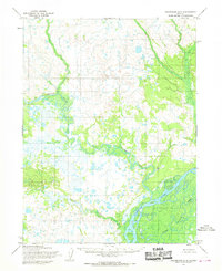 1954 Dillingham B-51968 Print · USGSThe braided river systems of southwest Alaska were documented in the mid-1950s using early aerial photography. Researchers can trace the complex wetlands and watercourses of the Nushagak River, Kokwok River, and Kuklong Creek across this wilderness sheet.2 unique versions available
 - 2019 Map of Dillingham B-4 NW, 2019 Print
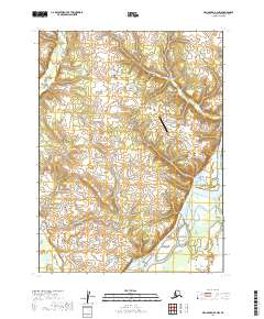 2019 Dillingham B-4 NW2019 Print · USGSThe braided waterways of the Dillingham Census Area come into sharp focus in this recent survey of Southwest Alaska. Researchers can trace the shifting channels of the Nushagak River and locate local landmarks like the New Stuyahok Airport and Spruce Street.
 - 2019 Map of Dillingham B-5 SE, 2019 Print
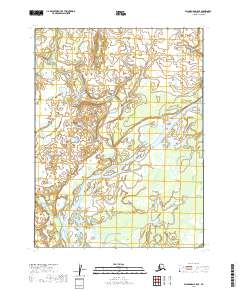 2019 Dillingham B-5 SE2019 Print · USGSThe village of Ekwok and the surrounding wilderness of the Nushagak basin are captured here in the late twenty-tens. Researchers can trace the winding paths of the Nushagak River, Kokwok River, and Lower Klutuk Creek across this remote riverine landscape.
 - 2019 Map of Dillingham B-4 SW, 2019 Print
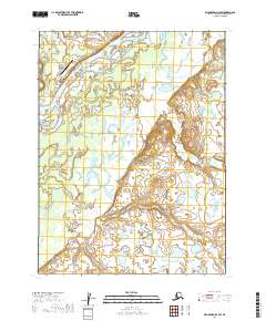 2019 Dillingham B-4 SW2019 Print · USGSThe village of Ekwok is documented in 2019 as it borders the wide Nushagak River in southwestern Alaska. Researchers can trace the local road network and identify the location of Ekwok Airport alongside the paths of Klutuk Cr.
 - 2019 Map of Dillingham B-5 NE, 2019 Print
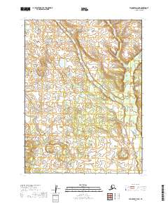 2019 Dillingham B-5 NE2019 Print · USGSIn the Dillingham Census Area during the late twenty-teens, this survey documents a nearly untouched wilderness of water and wetlands. Researchers can trace the winding course of Klutuk Cr and study the township lines for T9S R50W and T8S R49W.
End of results
Showing maps 1-8 of 8
Top cities near Ekwok
Frequently asked questions
- What are the different types of historical maps available for Ekwok?
- What is the oldest map of Ekwok?
- Where can I purchase historical maps of Ekwok for my home or office?
- Where can I download high-res historical maps of Ekwok?
- Are there historical topographic maps available for Ekwok?
- Is there historical aerial imagery available for Ekwok?
- Where are historical maps of Ekwok sourced from?