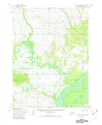
1954 Map of Dillingham B-5
USGS Topo · Published 1982About this map
The Nushagak River serves as the dominant hydrological feature of this 1954 landscape, reflecting the intricate braided channel patterns characteristic of southwestern Alaska. This survey, compiled from 1955 aerial photography and field-annotated in 1954, reveals a complex network of riparian corridors including the winding Kokwok River and the meandering Koklong Creek. The terrain is defined by a dense concentration of wetlands and small ponds, illustrating the seasonal drainage patterns of the Bristol Bay region before significant modern development. Evidence of early land management is visible through the recorded Corporate Boundary near the eastern edge of the sheet, while the courses of Klutuk Creek and Lower Klutuk Creek delineate the watershed's eastern reach.
Find a feature on this map
6 named features on this map. Tap any name to fly to it.
Don’t see what you’re looking for? This feature index may not catch every label — zoom into the map to look around manually.
Map Details
Editions of this 1954 Dillingham B-5 Map
2 editions found
Other maps of this area

1951 · Dillingham
USGS Topo · 1:250,000

1952 · Dillingham A-5
USGS Topo · 1:63,360

1952 · Dillingham A-4
USGS Topo · 1:63,360

1952 · Dillingham A-6
USGS Topo · 1:63,360

1954 · Dillingham
USGS Topo · 1:250,000

1954 · Dillingham B-4
USGS Topo · 1:63,360

1954 · Dillingham C-6
USGS Topo · 1:63,360

1954 · Dillingham B-6
USGS Topo · 1:63,360
1954 · Dillingham B-5
USGS Topo · 1:63,360

1954 · Dillingham C-4
USGS Topo · 1:63,360