
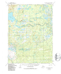
1954 Map of Dillingham D-6
USGS Topo · Published 1968About this map
Nuyakuk River meanders across this mid-century topographic survey, serving as the central hydrological artery of a landscape defined by water and wetlands. In the mid-1950s, human activity in this corner of the Alaska bush was sparse and utilitarian, represented by a single Cabin and Gaging Sta near the eastern shore of Tikchik Lake. The inclusion of Ruins along the riverbank indicates a former site of habitation or industry that had already begun to fade by the time the Army Map Service conducted its photogrammetric mapping from aerial photographs in 1953 and 1955. The terrain is characterized by intricate drainage patterns and countless small unnamed ponds, illustrating the complex geography of the Dillingham region before significant modern development.
Find a feature on this map
11 named features on this map. Tap any name to fly to it.
Don’t see what you’re looking for? This feature index may not catch every label — zoom into the map to look around manually.
Map Details
Editions of this 1954 Dillingham D-6 Map
2 editions found
Other maps of this area

1950 · Taylor Mountains
USGS Topo · 1:250,000

1951 · Taylor Mountains
USGS Topo · 1:250,000

1951 · Dillingham
USGS Topo · 1:250,000

1954 · Taylor Mountains
USGS Topo · 1:250,000

1954 · Dillingham
USGS Topo · 1:250,000

1954 · Dillingham C-6
USGS Topo · 1:63,360

1954 · Dillingham D-7
USGS Topo · 1:63,360
1954 · Dillingham D-5
USGS Topo · 1:63,360

1954 · Taylor Mountains A-5
USGS Topo · 1:63,360

1954 · Taylor Mountains A-6
USGS Topo · 1:63,360