
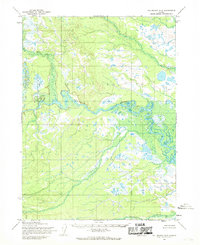
1954 Map of Taylor Mountains A-5
USGS Topo · Published 1968About this map
Klutuspuk Creek flows diagonally across this remote landscape, defining a wide glacial valley surrounded by the elevations of the Taylor Mountains. This mid-century survey by the Army Map Service documents a wilderness before the establishment of modern infrastructure, where the King Salmon River enters the frame in the upper northeast corner. The map reflects a period of systematic aerial reconnaissance, with topography derived from 1953 and 1955 photographs to chart the complex drainage patterns of the Seward Meridian. The Base Line serves as a critical surveying anchor through the center of the quadrangle, marking the transition between township ranges in a region then entirely without roads or trails.
Find a feature on this map
3 named features on this map. Tap any name to fly to it.
Don’t see what you’re looking for? This feature index may not catch every label — zoom into the map to look around manually.
Map Details
Editions of this 1954 Taylor Mountains A-5 Map
This is the sole edition of this map. No revisions or reprints were ever made.
Other maps of this area

1950 · Taylor Mountains
USGS Topo · 1:250,000

1951 · Taylor Mountains
USGS Topo · 1:250,000

1951 · Dillingham
USGS Topo · 1:250,000

1954 · Taylor Mountains
USGS Topo · 1:250,000

1954 · Dillingham
USGS Topo · 1:250,000

1954 · Dillingham D-6
USGS Topo · 1:63,360
1954 · Dillingham D-5
USGS Topo · 1:63,360

1954 · Taylor Mountains A-4
USGS Topo · 1:63,360

1954 · Taylor Mountains B-5
USGS Topo · 1:63,360

1954 · Dillingham D-4
USGS Topo · 1:63,360