
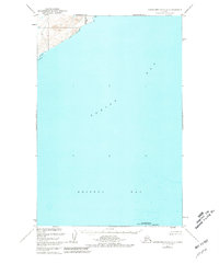
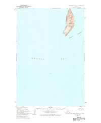
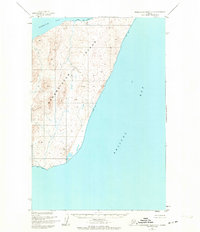
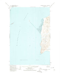
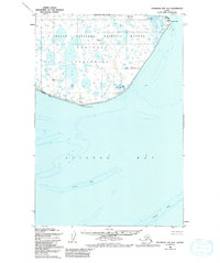
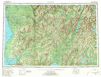
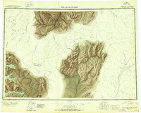
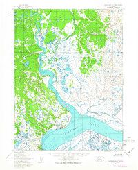
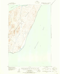
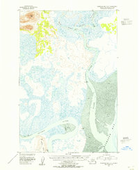
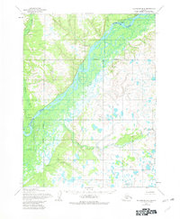
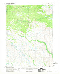
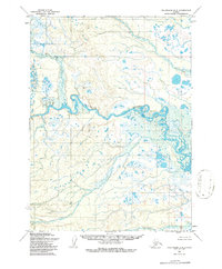
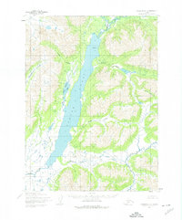
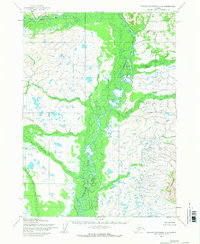
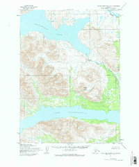
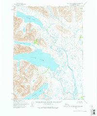
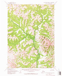
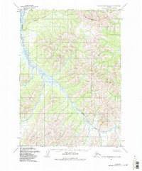
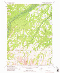
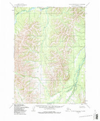
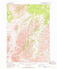
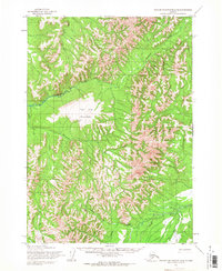
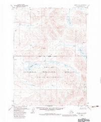
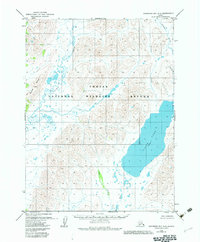
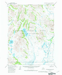
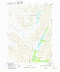
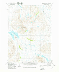
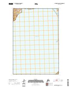
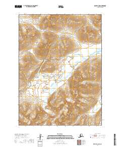
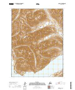
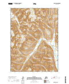
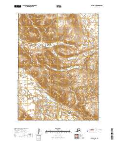
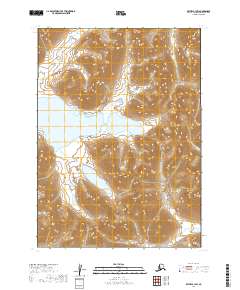
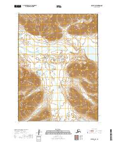
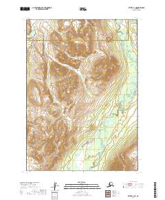
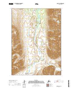
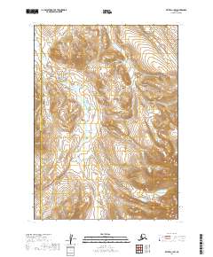
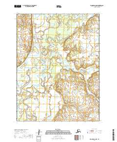
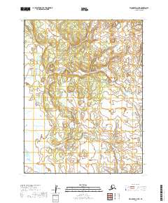
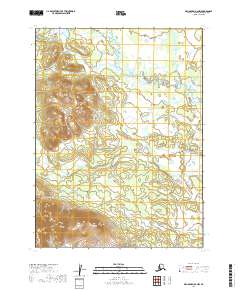
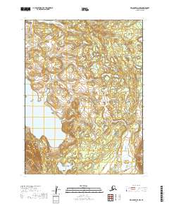
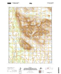
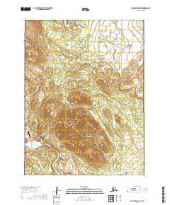
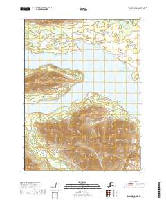
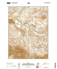
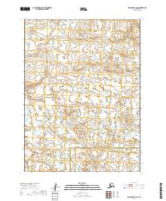
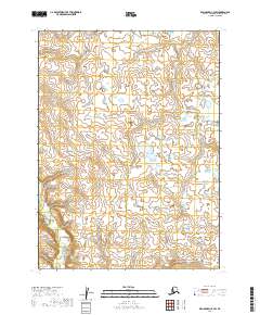
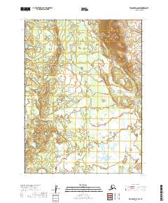
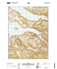
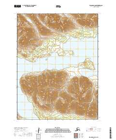
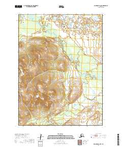
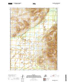
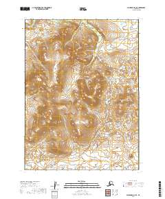
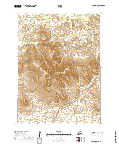
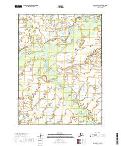
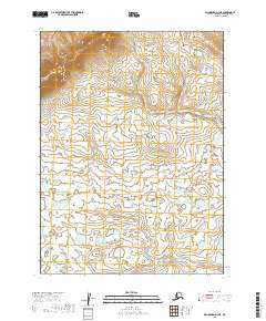
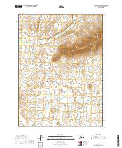
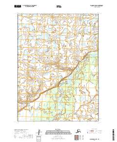
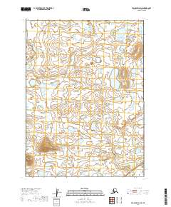
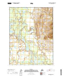
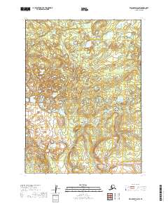
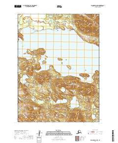
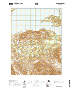
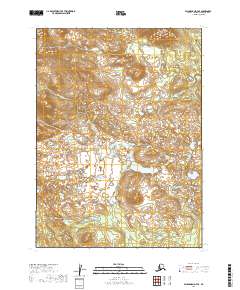
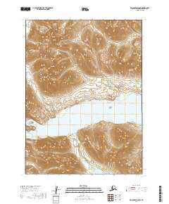
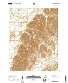
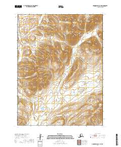
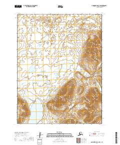
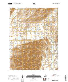
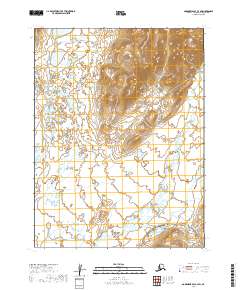
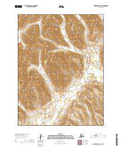
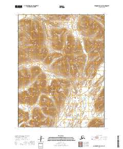
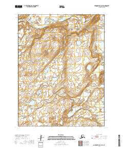
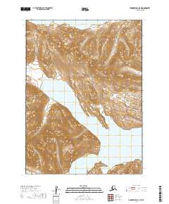
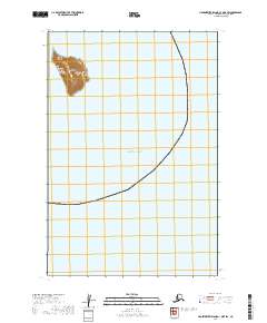
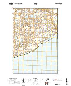
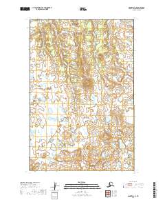
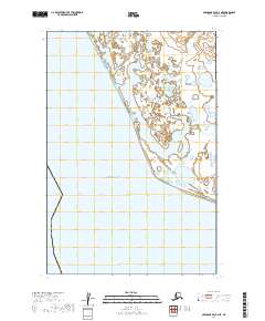
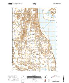
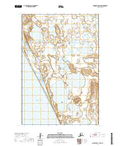
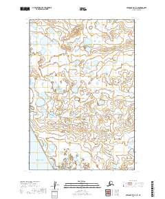
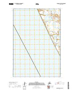
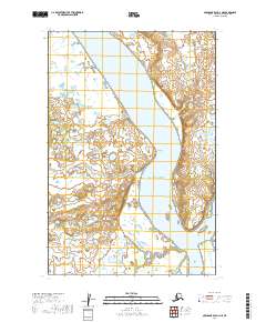
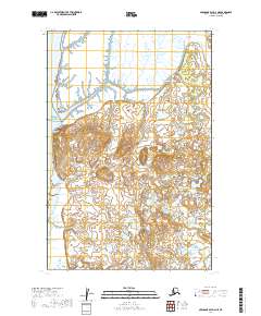
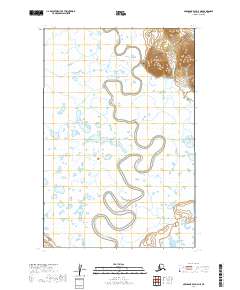
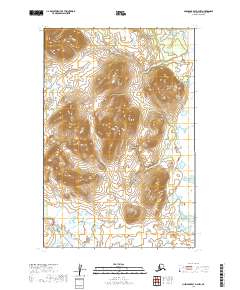
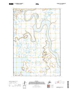
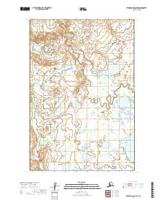
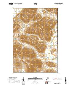
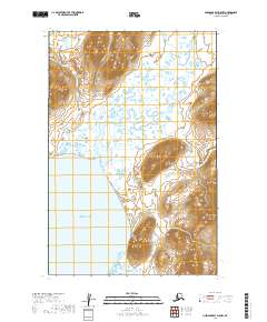
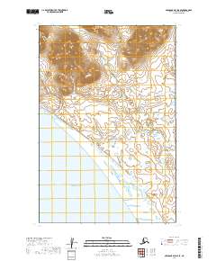
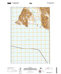
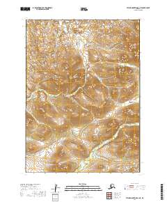
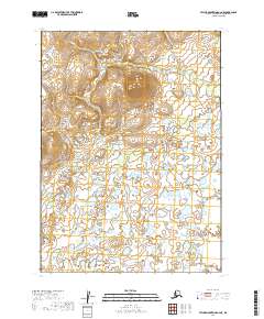
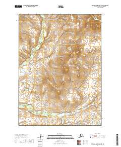
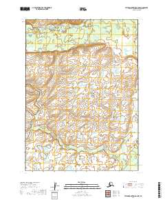
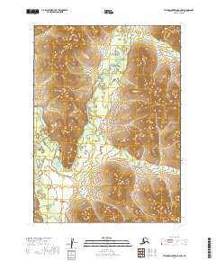
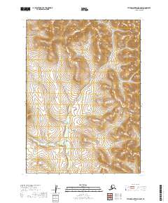
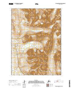
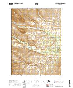
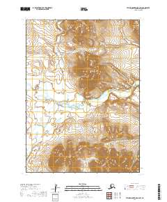
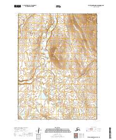
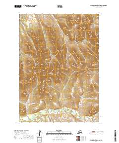
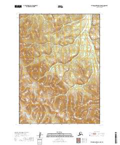
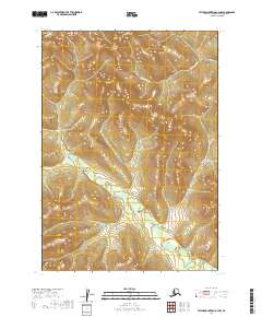
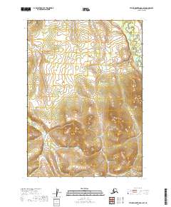
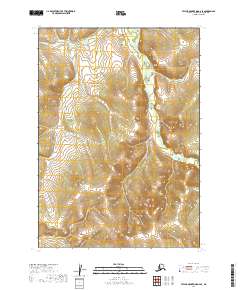
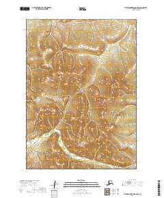
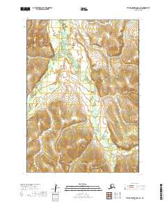
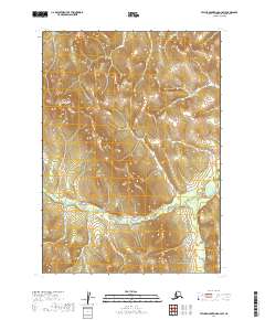
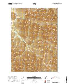
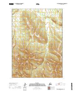
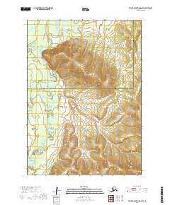
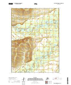
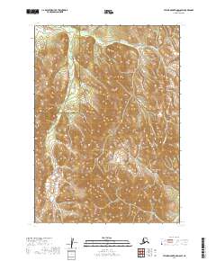
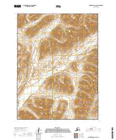
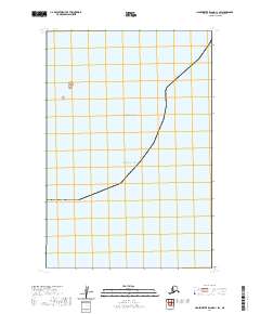
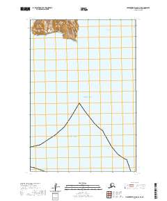
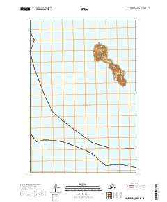
1950 Map of Taylor Mountains
USGS Topo · Published 1959About this map
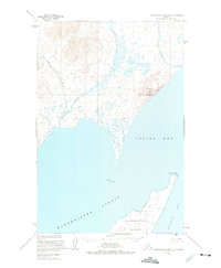
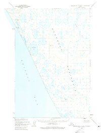
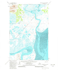
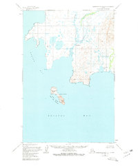
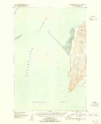
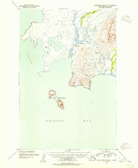
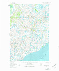
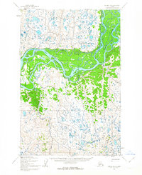
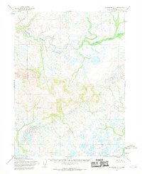
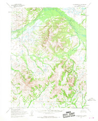
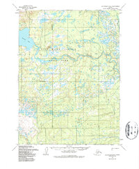
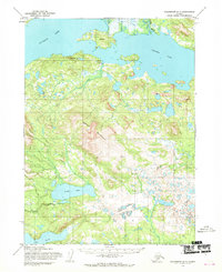
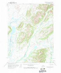
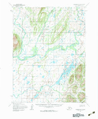
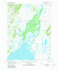
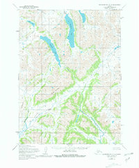
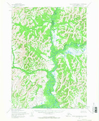
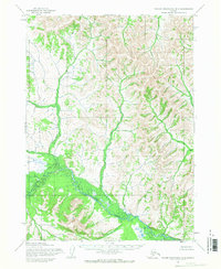
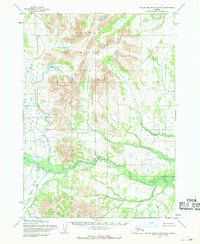
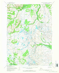
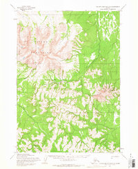
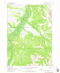
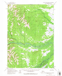
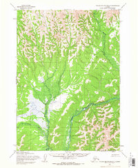
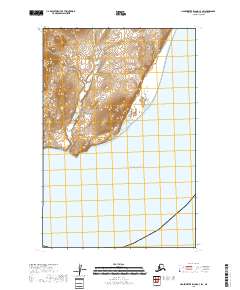
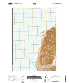
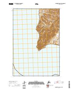
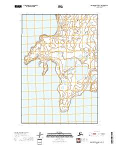
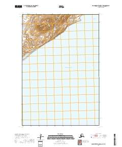
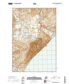
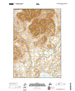
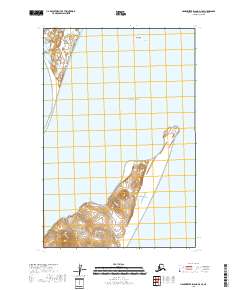
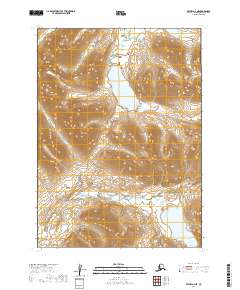
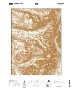
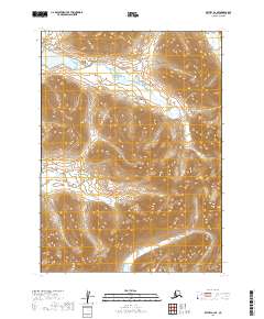
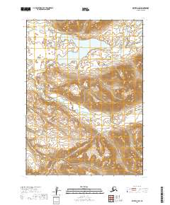
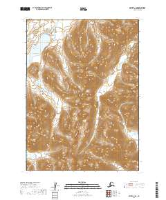
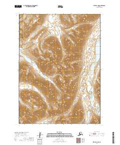
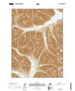
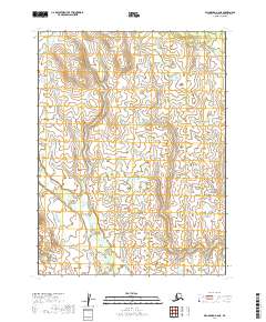
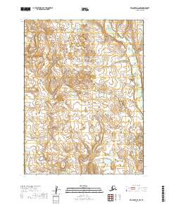
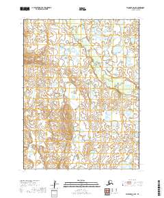
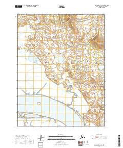
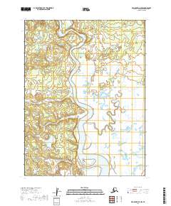
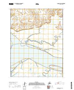
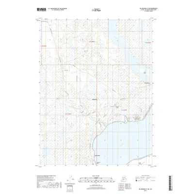
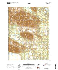
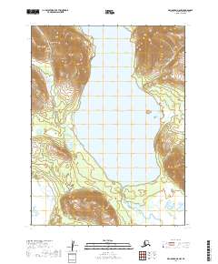
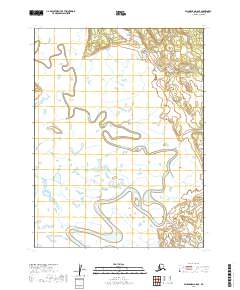
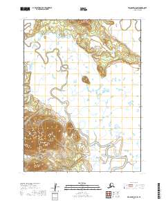
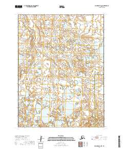
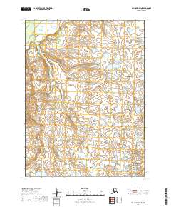
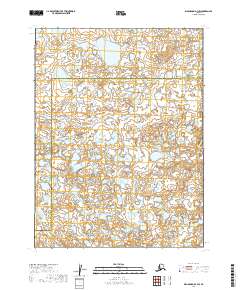
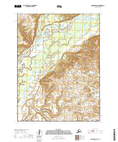
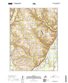
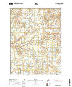
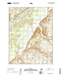
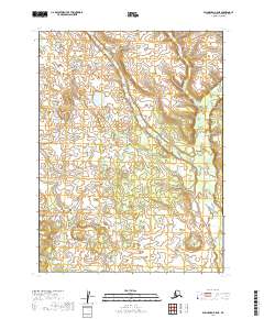
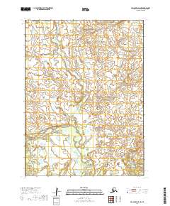
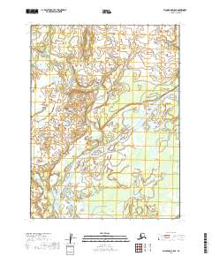
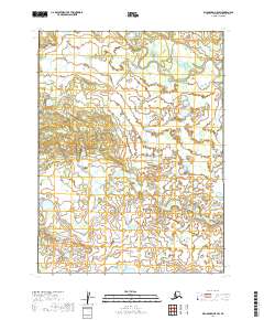
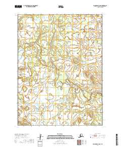
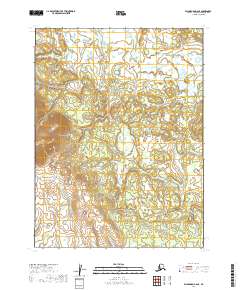
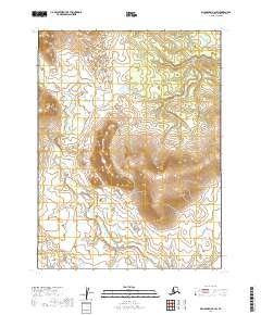
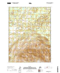
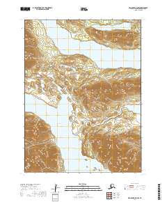
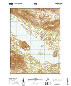
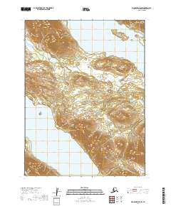
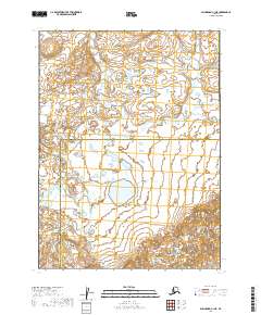
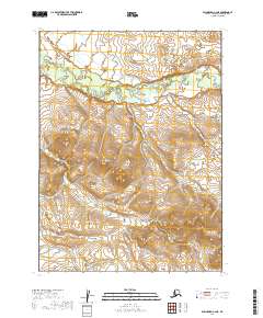
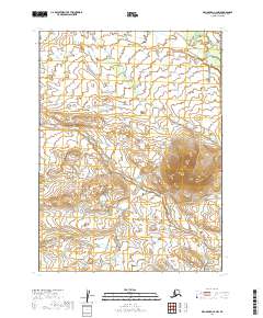
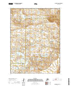
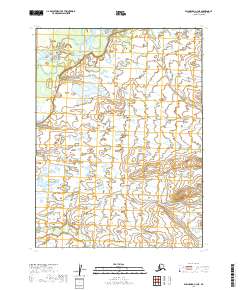
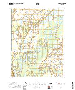
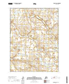
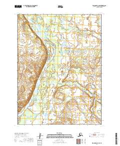
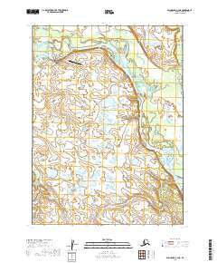
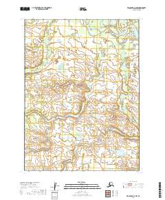
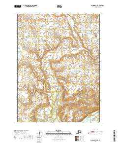
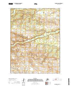
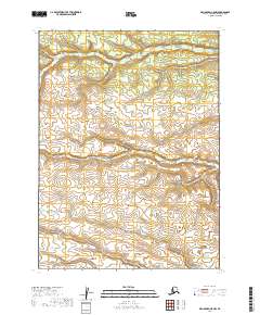
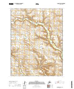
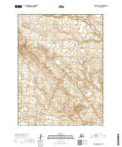
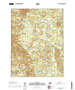
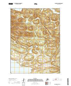
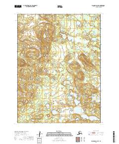
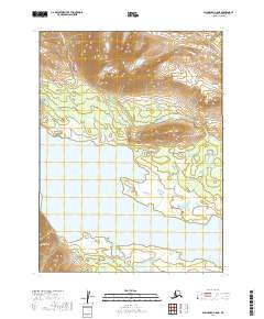
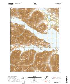
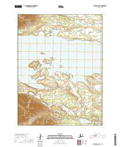
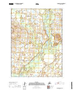
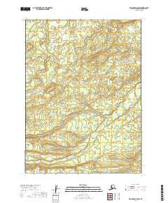
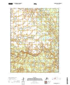
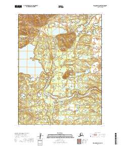
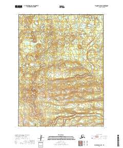
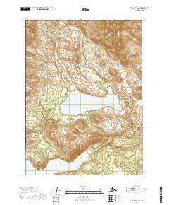
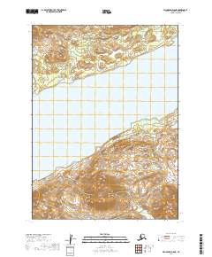
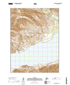
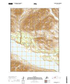
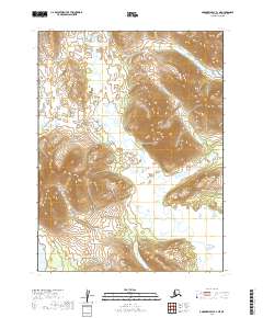
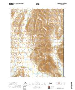
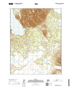
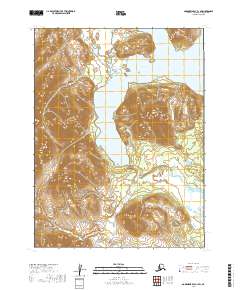
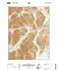
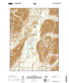
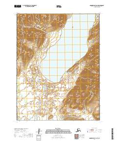
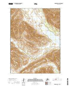
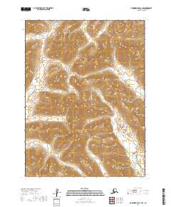
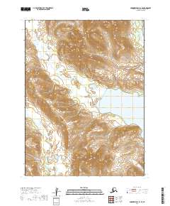
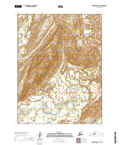
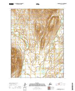
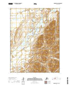
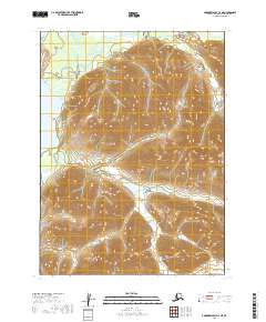
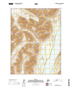
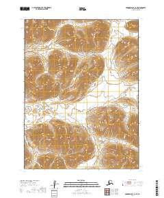
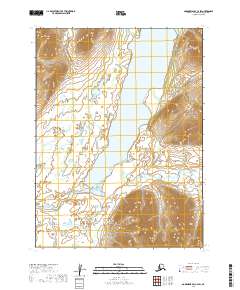
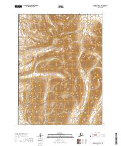
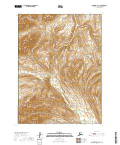
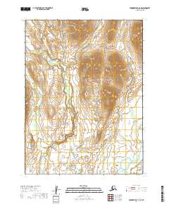
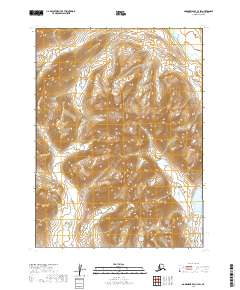
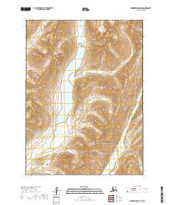
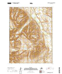
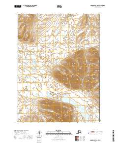
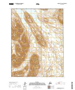
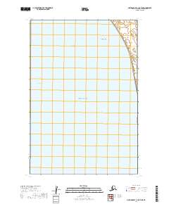
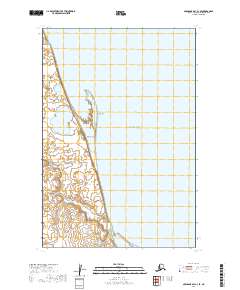
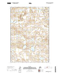
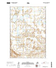
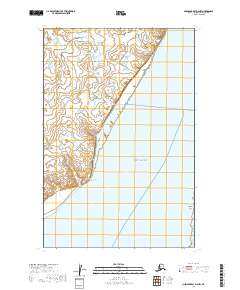
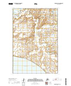
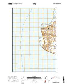
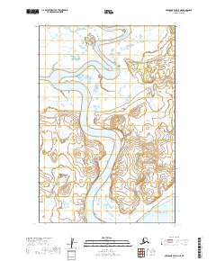
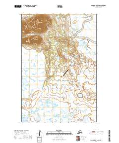
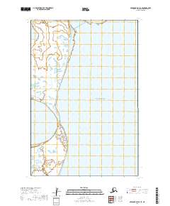
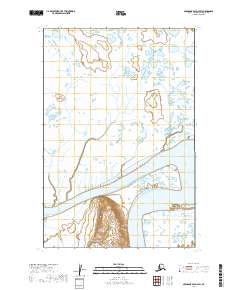
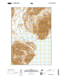
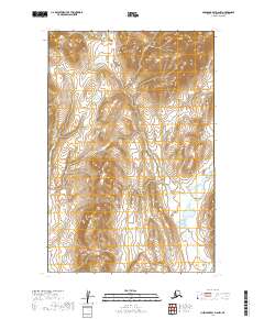
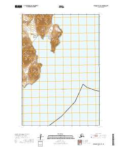
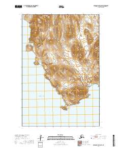
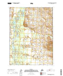
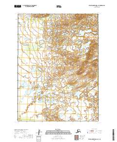
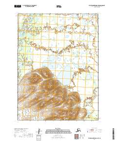
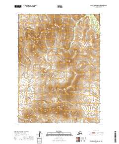
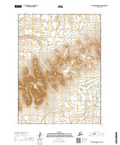
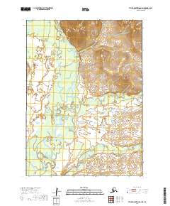
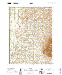
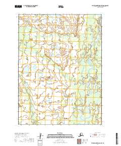
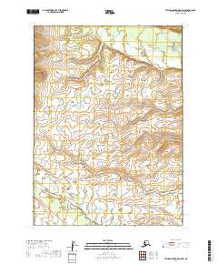
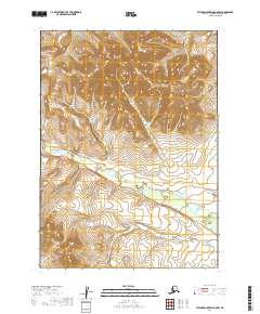
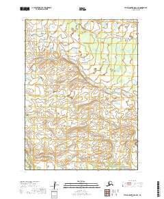
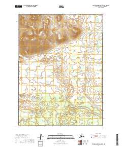
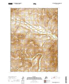
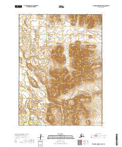
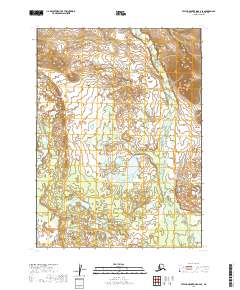
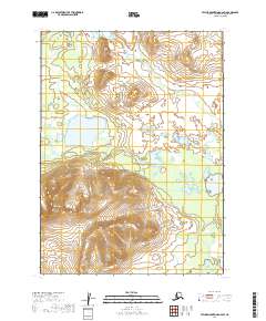
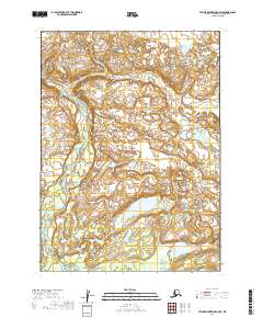
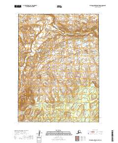
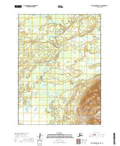
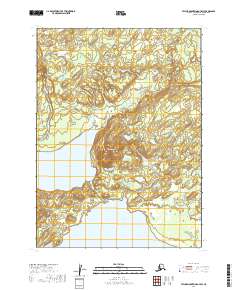
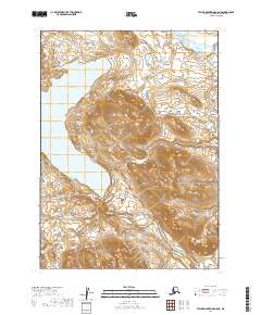
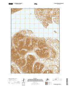
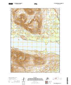
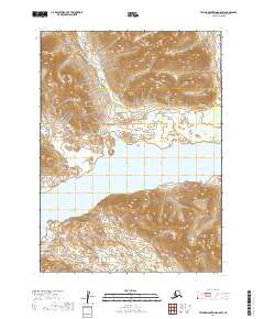
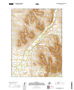
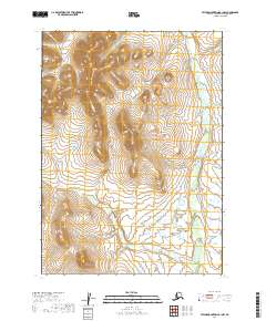
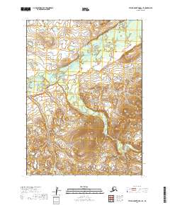
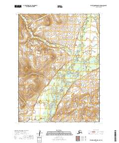
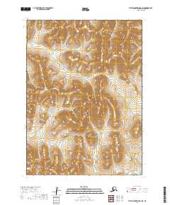
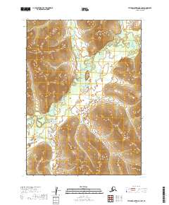
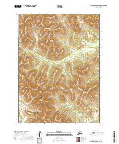
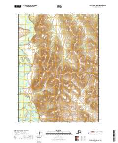
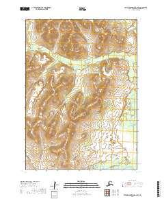
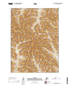
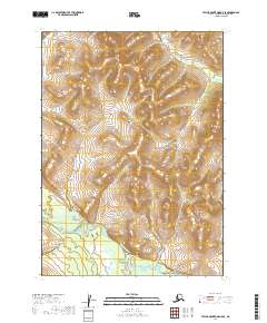
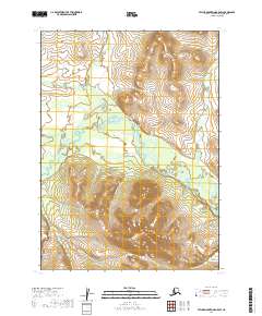
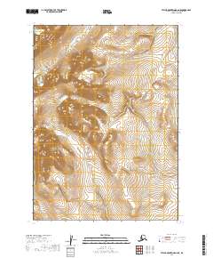
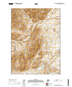
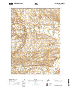
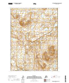
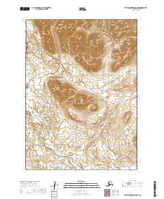
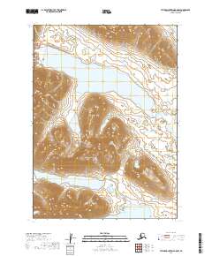
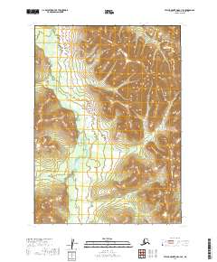
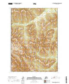
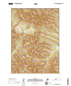
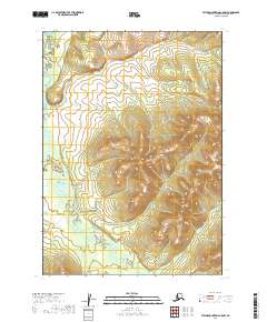
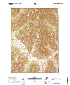
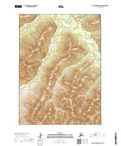
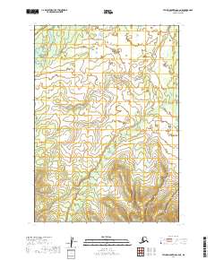
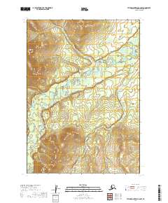
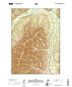
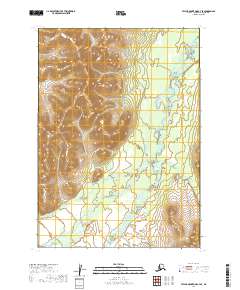
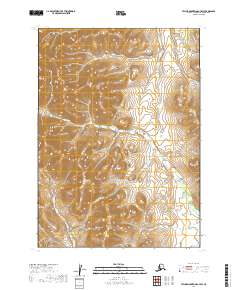
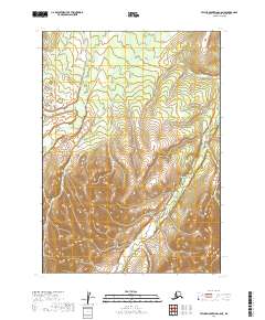
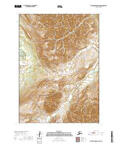
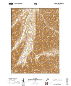
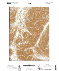
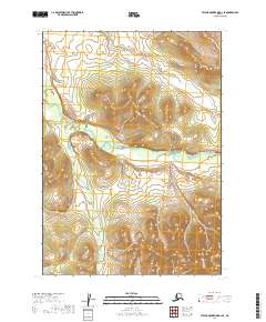
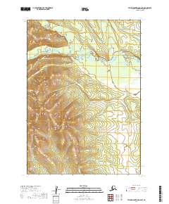
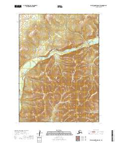
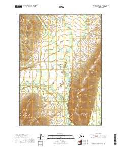
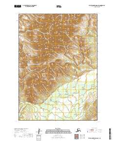
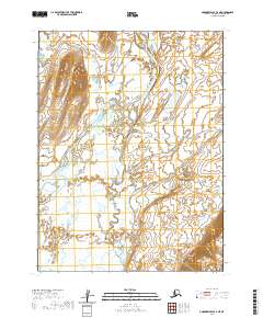
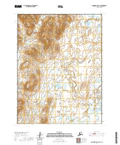
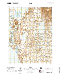
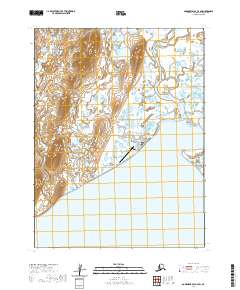
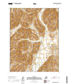
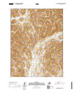
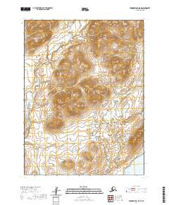
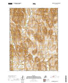
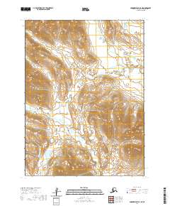
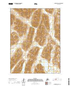
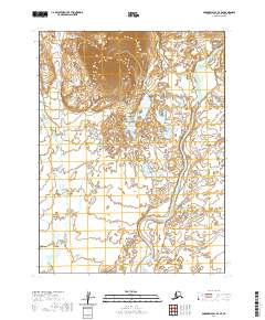
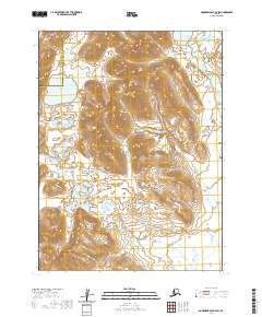
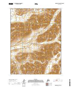
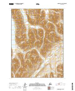
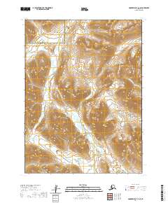
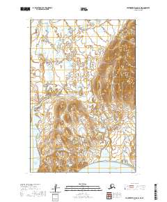
The remote interior of Southwest Alaska during the mid-century is defined here by the headwaters of several major river systems, including the Nushagak River and Holitna River. This 1950 survey, compiled from early 1940s photography and ground surveys, shows a landscape largely shaped by water and high peaks. Evidence of human presence is sparse but significant, centered on the settlement of Kashegelok and a long Winter Trail traversing the northwest corner near the Kuskokwim Mountains. The map provides a remarkable view of the complex interconnected Tikchik Lakes system in the southwest, including Chikuminuk Lake and Nuyakuk Lake. Tracing these watersheds reveals the traditional travel corridors that existed before modern aviation and infrastructure became dominant in the region, connecting remote outposts like a lone Cabin in the Nushagak Hills to the broader drainage basins.
Find a feature on this map
55 named features on this map. Tap any name to fly to it.
Don’t see what you’re looking for? This feature index may not catch every label — zoom into the map to look around manually.
Map Details
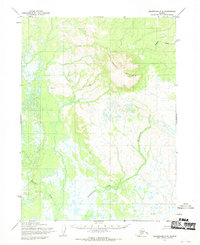
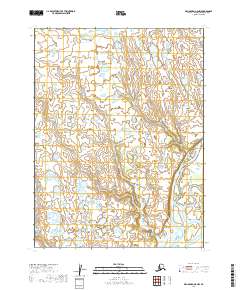
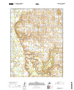
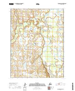
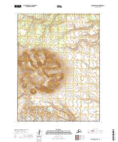
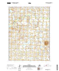
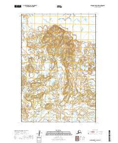
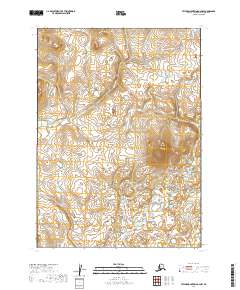
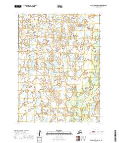
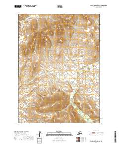
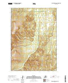
Editions of this 1950 Taylor Mountains Map
This is the sole edition of this map. No revisions or reprints were ever made.
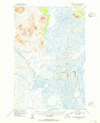
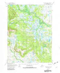
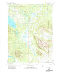
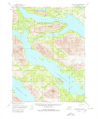
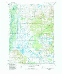
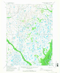
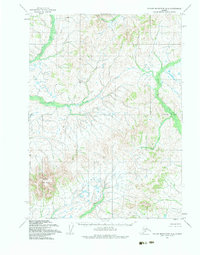
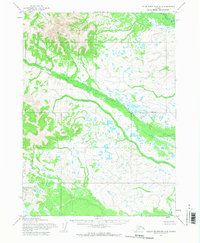
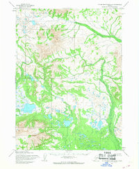
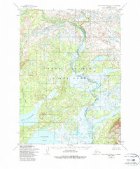
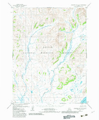
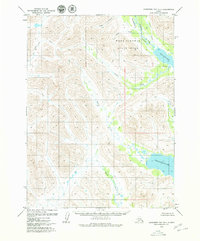
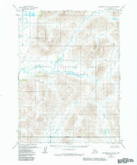
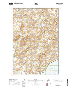
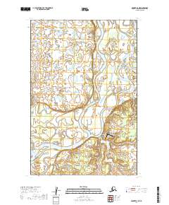
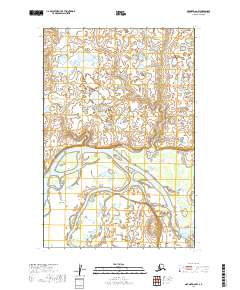
Historical Maps of Kashegelok Through Time
487 maps found
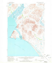
1947 Hagemeister Island D-2
Dillingham Borough, AK

1948 Hagemeister Island C-1
Dillingham Borough, AK
1948 Hagemeister Island C-2
Dillingham Borough, AK
1948 Hagemeister Island C-3
Dillingham Borough, AK
1948 Hagemeister Island C-4
Dillingham Borough, AK
1948 Hagemeister Island D-3
Dillingham Borough, AK
1948 Nushagak Bay C-4 And C-5
Dillingham Borough, AK
1948 Nushagak Bay D-3
Dillingham Borough, AK

1948 Nushagak Bay D-4
Dillingham Borough, AK
1950 Hagemeister Island D-1
Dillingham Borough, AK
1950 Nushagak Bay B-3
Dillingham Borough, AK
1950 Nushagak Bay B-4
Dillingham Borough, AK
1950 Nushagak Bay C-3
Dillingham Borough, AK
1950 Nushagak Bay C-4 And C-5
Dillingham Borough, AK
1950 Nushagak Bay D-5
Dillingham Borough, AK
1950 Nushagak Bay D-6
Dillingham Borough, AK
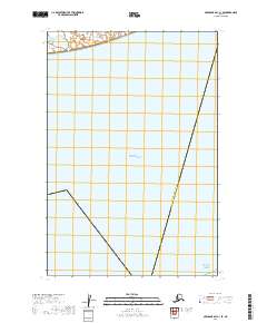
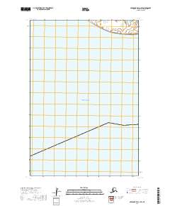
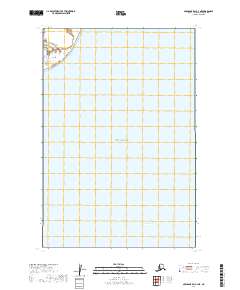
1950 Taylor Mountains
Dillingham Borough, AK
1951 Goodnews
Dillingham Borough, AK
1951 Hagemeister Island
Dillingham Borough, AK
1951 Taylor Mountains
Dillingham Borough, AK
1952 Dillingham A-4
Dillingham Borough, AK
1952 Dillingham A-5
Dillingham Borough, AK
1952 Dillingham A-6
Dillingham Borough, AK
1952 Dillingham A-7
Dillingham Borough, AK
1952 Dillingham A-8
Dillingham Borough, AK
1952 Hagemeister Island C-1
Dillingham Borough, AK
1952 Hagemeister Island C-2
Dillingham Borough, AK
1952 Hagemeister Island C-3
Dillingham Borough, AK
1952 Hagemeister Island C-4
Dillingham Borough, AK
1952 Hagemeister Island D-1
Dillingham Borough, AK
1952 Naknek D-5
Dillingham Borough, AK
1952 Naknek D-6
Dillingham Borough, AK
1952 Nushagak Bay C-1
Dillingham Borough, AK
1952 Nushagak Bay D-1
Dillingham Borough, AK
1952 Nushagak Bay D-2
Dillingham Borough, AK
1952 Nushagak Bay D-3
Dillingham Borough, AK
1952 Nushagak Bay D-4
Dillingham Borough, AK
1953 Hagemeister Island D-2
Dillingham Borough, AK
1954 Dillingham B-3
Dillingham Borough, AK
1954 Dillingham B-4
Dillingham Borough, AK

1954 Dillingham B-5
Dillingham Borough, AK
1954 Dillingham B-6
Dillingham Borough, AK
1954 Dillingham B-7
Dillingham Borough, AK
1954 Dillingham B-8
Dillingham Borough, AK
1954 Dillingham C-1
Dillingham Borough, AK
1954 Dillingham C-2
Dillingham Borough, AK
1954 Dillingham C-3
Dillingham Borough, AK
1954 Dillingham C-4
Dillingham Borough, AK
1954 Dillingham C-5
Dillingham Borough, AK
1954 Dillingham C-6
Dillingham Borough, AK
1954 Dillingham C-7
Dillingham Borough, AK
1954 Dillingham C-8
Dillingham Borough, AK
1954 Dillingham D-1
Dillingham Borough, AK
1954 Dillingham D-2
Dillingham Borough, AK
1954 Dillingham D-3
Dillingham Borough, AK
1954 Dillingham D-4
Dillingham Borough, AK
1954 Dillingham D-5
Dillingham Borough, AK
1954 Dillingham D-6
Dillingham Borough, AK
1954 Dillingham D-7
Dillingham Borough, AK
1954 Dillingham D-8
Dillingham Borough, AK
1954 Goodnews A-3
Dillingham Borough, AK
1954 Goodnews B-3
Dillingham Borough, AK
1954 Goodnews Bay A-4
Dillingham Borough, AK
1954 Goodnews Bay C-4
Dillingham Borough, AK
1954 Goodnews C-2
Dillingham Borough, AK
1954 Taylor Mountains A-1
Dillingham Borough, AK
1954 Taylor Mountains A-2
Dillingham Borough, AK
1954 Taylor Mountains A-3
Dillingham Borough, AK
1954 Taylor Mountains A-4
Dillingham Borough, AK
1954 Taylor Mountains A-5
Dillingham Borough, AK
1954 Taylor Mountains A-6
Dillingham Borough, AK
1954 Taylor Mountains A-7
Dillingham Borough, AK
1954 Taylor Mountains A-8
Dillingham Borough, AK
1954 Taylor Mountains B-1
Dillingham Borough, AK
1954 Taylor Mountains B-2
Dillingham Borough, AK
1954 Taylor Mountains B-3
Dillingham Borough, AK
1954 Taylor Mountains B-4
Dillingham Borough, AK
1954 Taylor Mountains B-5
Dillingham Borough, AK
1954 Taylor Mountains B-6
Dillingham Borough, AK
1954 Taylor Mountains B-7
Dillingham Borough, AK
1954 Taylor Mountains B-8
Dillingham Borough, AK
1954 Taylor Mountains C-1
Dillingham Borough, AK
1954 Taylor Mountains C-2
Dillingham Borough, AK
1954 Taylor Mountains C-3
Dillingham Borough, AK
1954 Taylor Mountains C-4
Dillingham Borough, AK
1954 Taylor Mountains C-5
Dillingham Borough, AK
1954 Taylor Mountains C-6
Dillingham Borough, AK
1954 Taylor Mountains C-7
Dillingham Borough, AK
1954 Taylor Mountains C-8
Dillingham Borough, AK
1954 Taylor Mountains D-1
Dillingham Borough, AK
1954 Taylor Mountains D-2
Dillingham Borough, AK
1954 Taylor Mountains D-3
Dillingham Borough, AK
1954 Taylor Mountains D-4
Dillingham Borough, AK
1954 Taylor Mountains D-5
Dillingham Borough, AK
1954 Taylor Mountains D-6
Dillingham Borough, AK
1954 Taylor Mountains D-7
Dillingham Borough, AK
1954 Taylor Mountains D-8
Dillingham Borough, AK
1954 Taylor Mountains
Dillingham Borough, AK
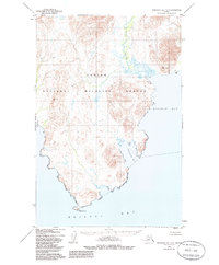
1957 Hagemeister Island
Dillingham Borough, AK
1979 Bethel A-1
Dillingham Borough, AK
1979 Bethel A-2
Dillingham Borough, AK
1979 Bethel B-1
Dillingham Borough, AK
1979 Bethel C-1
Dillingham Borough, AK
1979 Goodnews Bay A-1
Dillingham Borough, AK
1979 Goodnews Bay A-2
Dillingham Borough, AK
1979 Goodnews Bay A-5
Dillingham Borough, AK
1979 Goodnews Bay B-1
Dillingham Borough, AK
1979 Goodnews Bay B-2
Dillingham Borough, AK
1979 Goodnews Bay B-4
Dillingham Borough, AK
1979 Goodnews Bay C-1
Dillingham Borough, AK
1979 Goodnews Bay C-3
Dillingham Borough, AK
1979 Goodnews Bay D-1
Dillingham Borough, AK
1979 Goodnews Bay D-2
Dillingham Borough, AK
1979 Goodnews Bay D-3
Dillingham Borough, AK

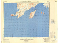
1979 Goodnews Bay
Dillingham Borough, AK
2018 Hagemeister Island C-3 NE
Dillingham Borough, AK
2018 Hagemeister Island C-3 NW
Dillingham Borough, AK
2018 Hagemeister Island C-3 SW
Dillingham Borough, AK
2018 Hagemeister Island C-4 NE
Dillingham Borough, AK
2018 Hagemeister Island C-4 SE
Dillingham Borough, AK
2018 Hagemeister Island D-1 NW
Dillingham Borough, AK
2018 Hagemeister Island D-2 NW
Dillingham Borough, AK
2018 Hagemeister Island D-3 NE
Dillingham Borough, AK
2018 Hagemeister Island D-3 NW
Dillingham Borough, AK
2018 Hagemeister Island D-3 SE
Dillingham Borough, AK
2018 Hagemeister Island D-3 SW
Dillingham Borough, AK

2019 Bethel A-1 NE
Dillingham Borough, AK
2019 Bethel A-1 NW
Dillingham Borough, AK
2019 Bethel A-1 SE
Dillingham Borough, AK
2019 Bethel A-1 SW
Dillingham Borough, AK
2019 Bethel A-2 NE
Dillingham Borough, AK
2019 Bethel A-2 NW
Dillingham Borough, AK
2019 Bethel A-2 SE
Dillingham Borough, AK
2019 Bethel A-2 SW
Dillingham Borough, AK
2019 Bethel A-3 SE
Dillingham Borough, AK
2019 Bethel B-1 NE
Dillingham Borough, AK
2019 Bethel B-1 NW
Dillingham Borough, AK
2019 Bethel B-1 SE
Dillingham Borough, AK
2019 Bethel B-1 SW
Dillingham Borough, AK
2019 Bethel B-2 SE
Dillingham Borough, AK
2019 Bethel C-1 NE
Dillingham Borough, AK
2019 Bethel C-1 SE
Dillingham Borough, AK
2019 Bethel C-1 SW
Dillingham Borough, AK
2019 Dillingham A-4 NW
Dillingham Borough, AK
2019 Dillingham A-4 SE
Dillingham Borough, AK
2019 Dillingham A-4 SW
Dillingham Borough, AK
2019 Dillingham A-5 NE
Dillingham Borough, AK
2019 Dillingham A-5 NW
Dillingham Borough, AK
2019 Dillingham A-5 SE
Dillingham Borough, AK
2019 Dillingham A-5 SW
Dillingham Borough, AK
2019 Dillingham A-6 NE
Dillingham Borough, AK
2019 Dillingham A-6 NW
Dillingham Borough, AK
2019 Dillingham A-6 SE
Dillingham Borough, AK
2019 Dillingham A-6 SW
Dillingham Borough, AK
2019 Dillingham A-7 NE
Dillingham Borough, AK
2019 Dillingham A-7 NW
Dillingham Borough, AK
2019 Dillingham A-7 SE
Dillingham Borough, AK
2019 Dillingham A-7 SW
Dillingham Borough, AK
2019 Dillingham A-8 NE
Dillingham Borough, AK
2019 Dillingham A-8 NW
Dillingham Borough, AK
2019 Dillingham A-8 SE
Dillingham Borough, AK
2019 Dillingham A-8 SW
Dillingham Borough, AK
2019 Dillingham B-3 NE
Dillingham Borough, AK
2019 Dillingham B-3 NW
Dillingham Borough, AK
2019 Dillingham B-3 SW
Dillingham Borough, AK
2019 Dillingham B-4 NE
Dillingham Borough, AK
2019 Dillingham B-4 NW
Dillingham Borough, AK
2019 Dillingham B-4 SE
Dillingham Borough, AK
2019 Dillingham B-4 SW
Dillingham Borough, AK
2019 Dillingham B-5 NE
Dillingham Borough, AK
2019 Dillingham B-5 NW
Dillingham Borough, AK
2019 Dillingham B-5 SE
Dillingham Borough, AK
2019 Dillingham B-5 SW
Dillingham Borough, AK
2019 Dillingham B-6 NE
Dillingham Borough, AK
2019 Dillingham B-6 NW
Dillingham Borough, AK
2019 Dillingham B-6 SE
Dillingham Borough, AK
2019 Dillingham B-6 SW
Dillingham Borough, AK
2019 Dillingham B-7 NE
Dillingham Borough, AK
2019 Dillingham B-7 NW
Dillingham Borough, AK
2019 Dillingham B-7 SE
Dillingham Borough, AK
2019 Dillingham B-7 SW
Dillingham Borough, AK
2019 Dillingham B-8 NE
Dillingham Borough, AK
2019 Dillingham B-8 NW
Dillingham Borough, AK
2019 Dillingham B-8 SE
Dillingham Borough, AK
2019 Dillingham B-8 SW
Dillingham Borough, AK
2019 Dillingham C-1 NE
Dillingham Borough, AK
2019 Dillingham C-1 NW
Dillingham Borough, AK
2019 Dillingham C-2 NE
Dillingham Borough, AK
2019 Dillingham C-2 NW
Dillingham Borough, AK
2019 Dillingham C-2 SE
Dillingham Borough, AK
2019 Dillingham C-2 SW
Dillingham Borough, AK
2019 Dillingham C-3 NE
Dillingham Borough, AK
2019 Dillingham C-3 NW
Dillingham Borough, AK
2019 Dillingham C-3 SE
Dillingham Borough, AK
2019 Dillingham C-3 SW
Dillingham Borough, AK
2019 Dillingham C-4 NE
Dillingham Borough, AK
2019 Dillingham C-4 NW
Dillingham Borough, AK
2019 Dillingham C-4 SE
Dillingham Borough, AK
2019 Dillingham C-4 SW
Dillingham Borough, AK
2019 Dillingham C-5 NE
Dillingham Borough, AK
2019 Dillingham C-5 NW
Dillingham Borough, AK
2019 Dillingham C-5 SE
Dillingham Borough, AK
2019 Dillingham C-5 SW
Dillingham Borough, AK
2019 Dillingham C-6 NE
Dillingham Borough, AK
2019 Dillingham C-6 NW
Dillingham Borough, AK
2019 Dillingham C-6 SE
Dillingham Borough, AK
2019 Dillingham C-6 SW
Dillingham Borough, AK
2019 Dillingham C-7 NE
Dillingham Borough, AK
2019 Dillingham C-7 NW
Dillingham Borough, AK
2019 Dillingham C-7 SE
Dillingham Borough, AK
2019 Dillingham C-7 SW
Dillingham Borough, AK
2019 Dillingham C-8 NE
Dillingham Borough, AK
2019 Dillingham C-8 NW
Dillingham Borough, AK
2019 Dillingham C-8 SE
Dillingham Borough, AK
2019 Dillingham C-8 SW
Dillingham Borough, AK
2019 Dillingham D-1 NE
Dillingham Borough, AK
2019 Dillingham D-1 NW
Dillingham Borough, AK
2019 Dillingham D-1 SE
Dillingham Borough, AK
2019 Dillingham D-1 SW
Dillingham Borough, AK
2019 Dillingham D-2 NE
Dillingham Borough, AK
2019 Dillingham D-2 NW
Dillingham Borough, AK
2019 Dillingham D-2 SE
Dillingham Borough, AK
2019 Dillingham D-2 SW
Dillingham Borough, AK
2019 Dillingham D-3 NE
Dillingham Borough, AK
2019 Dillingham D-3 NW
Dillingham Borough, AK
2019 Dillingham D-3 SE
Dillingham Borough, AK
2019 Dillingham D-3 SW
Dillingham Borough, AK
2019 Dillingham D-4 NE
Dillingham Borough, AK
2019 Dillingham D-4 NW
Dillingham Borough, AK
2019 Dillingham D-4 SE
Dillingham Borough, AK
2019 Dillingham D-4 SW
Dillingham Borough, AK
2019 Dillingham D-5 NE
Dillingham Borough, AK
2019 Dillingham D-5 NW
Dillingham Borough, AK
2019 Dillingham D-5 SE
Dillingham Borough, AK
2019 Dillingham D-5 SW
Dillingham Borough, AK
2019 Dillingham D-6 NE
Dillingham Borough, AK
2019 Dillingham D-6 NW
Dillingham Borough, AK
2019 Dillingham D-6 SE
Dillingham Borough, AK
2019 Dillingham D-6 SW
Dillingham Borough, AK
2019 Dillingham D-7 NE
Dillingham Borough, AK
2019 Dillingham D-7 NW
Dillingham Borough, AK
2019 Dillingham D-7 SE
Dillingham Borough, AK
2019 Dillingham D-7 SW
Dillingham Borough, AK
2019 Dillingham D-8 NE
Dillingham Borough, AK
2019 Dillingham D-8 NW
Dillingham Borough, AK
2019 Dillingham D-8 SE
Dillingham Borough, AK
2019 Dillingham D-8 SW
Dillingham Borough, AK
2019 Goodnews Bay A-1 NE
Dillingham Borough, AK
2019 Goodnews Bay A-1 NW
Dillingham Borough, AK
2019 Goodnews Bay A-1 SE
Dillingham Borough, AK
2019 Goodnews Bay A-1 SW
Dillingham Borough, AK
2019 Goodnews Bay A-2 NE
Dillingham Borough, AK
2019 Goodnews Bay A-2 NW
Dillingham Borough, AK
2019 Goodnews Bay A-2 SE
Dillingham Borough, AK
2019 Goodnews Bay A-2 SW
Dillingham Borough, AK
2019 Goodnews Bay A-3 NE
Dillingham Borough, AK
2019 Goodnews Bay A-3 NW
Dillingham Borough, AK
2019 Goodnews Bay A-3 SE
Dillingham Borough, AK
2019 Goodnews Bay A-3 SW
Dillingham Borough, AK
2019 Goodnews Bay B-1 NE
Dillingham Borough, AK
2019 Goodnews Bay B-1 NW
Dillingham Borough, AK
2019 Goodnews Bay B-1 SE
Dillingham Borough, AK
2019 Goodnews Bay B-1 SW
Dillingham Borough, AK
2019 Goodnews Bay B-2 NE
Dillingham Borough, AK
2019 Goodnews Bay B-2 NW
Dillingham Borough, AK
2019 Goodnews Bay B-2 SE
Dillingham Borough, AK
2019 Goodnews Bay B-2 SW
Dillingham Borough, AK
2019 Goodnews Bay B-3 NE
Dillingham Borough, AK
2019 Goodnews Bay B-3 NW
Dillingham Borough, AK
2019 Goodnews Bay B-3 SE
Dillingham Borough, AK
2019 Goodnews Bay B-3 SW
Dillingham Borough, AK
2019 Goodnews Bay C-1 NE
Dillingham Borough, AK
2019 Goodnews Bay C-1 NW
Dillingham Borough, AK

2019 Goodnews Bay C-1 SE
Dillingham Borough, AK
2019 Goodnews Bay C-1 SW
Dillingham Borough, AK
2019 Goodnews Bay C-2 NE
Dillingham Borough, AK
2019 Goodnews Bay C-2 NW
Dillingham Borough, AK
2019 Goodnews Bay C-2 SE
Dillingham Borough, AK
2019 Goodnews Bay C-2 SW
Dillingham Borough, AK
2019 Goodnews Bay C-3 NE
Dillingham Borough, AK
2019 Goodnews Bay C-3 NW
Dillingham Borough, AK
2019 Goodnews Bay C-3 SE
Dillingham Borough, AK
2019 Goodnews Bay C-3 SW
Dillingham Borough, AK
2019 Goodnews Bay D-1 NE
Dillingham Borough, AK
2019 Goodnews Bay D-1 NW
Dillingham Borough, AK
2019 Goodnews Bay D-1 SE
Dillingham Borough, AK
2019 Goodnews Bay D-1 SW
Dillingham Borough, AK
2019 Goodnews Bay D-2 NE
Dillingham Borough, AK
2019 Goodnews Bay D-2 NW
Dillingham Borough, AK
2019 Goodnews Bay D-2 SE
Dillingham Borough, AK
2019 Goodnews Bay D-2 SW
Dillingham Borough, AK
2019 Goodnews Bay D-3 NE
Dillingham Borough, AK
2019 Goodnews Bay D-3 SE
Dillingham Borough, AK
2019 Goodnews Bay D-3 SW
Dillingham Borough, AK
2019 Hagemeister Island C-1 OE E NW
Dillingham Borough, AK
2019 Hagemeister Island C-1 OE E SW
Dillingham Borough, AK
2019 Naknek C-6 NW
Dillingham Borough, AK
2019 Naknek D-5 NE
Dillingham Borough, AK
2019 Naknek D-5 NW
Dillingham Borough, AK
2019 Naknek D-5 SE
Dillingham Borough, AK
2019 Naknek D-5 SW
Dillingham Borough, AK
2019 Naknek D-6 NE
Dillingham Borough, AK
2019 Naknek D-6 NW
Dillingham Borough, AK
2019 Naknek D-6 SE
Dillingham Borough, AK
2019 Naknek D-6 SW
Dillingham Borough, AK
2019 Nushagak Bay B-3 NE
Dillingham Borough, AK
2019 Nushagak Bay B-3 NW
Dillingham Borough, AK
2019 Nushagak Bay B-4 NE
Dillingham Borough, AK
2019 Nushagak Bay B-4 NW
Dillingham Borough, AK
2019 Nushagak Bay C-1 NE
Dillingham Borough, AK
2019 Nushagak Bay C-1 NW
Dillingham Borough, AK
2019 Nushagak Bay C-1 OE W NE
Dillingham Borough, AK
2019 Nushagak Bay C-1 SE
Dillingham Borough, AK
2019 Nushagak Bay C-1 SW
Dillingham Borough, AK
2019 Nushagak Bay C-3 NE
Dillingham Borough, AK
2019 Nushagak Bay C-3 NW
Dillingham Borough, AK
2019 Nushagak Bay C-3 SE
Dillingham Borough, AK
2019 Nushagak Bay C-3 SW
Dillingham Borough, AK
2019 Nushagak Bay C-4 NE
Dillingham Borough, AK
2019 Nushagak Bay C-4 NW
Dillingham Borough, AK
2019 Nushagak Bay C-4 SE
Dillingham Borough, AK
2019 Nushagak Bay C-4 SW
Dillingham Borough, AK
2019 Nushagak Bay C-5 NE
Dillingham Borough, AK
2019 Nushagak Bay D-1 NE
Dillingham Borough, AK
2019 Nushagak Bay D-1 NW
Dillingham Borough, AK
2019 Nushagak Bay D-1 SE
Dillingham Borough, AK
2019 Nushagak Bay D-1 SW
Dillingham Borough, AK
2019 Nushagak Bay D-2 NE
Dillingham Borough, AK
2019 Nushagak Bay D-2 NW
Dillingham Borough, AK
2019 Nushagak Bay D-2 SE
Dillingham Borough, AK
2019 Nushagak Bay D-2 SW
Dillingham Borough, AK
2019 Nushagak Bay D-3 NE
Dillingham Borough, AK
2019 Nushagak Bay D-3 NW
Dillingham Borough, AK
2019 Nushagak Bay D-3 SE
Dillingham Borough, AK
2019 Nushagak Bay D-3 SW
Dillingham Borough, AK
2019 Nushagak Bay D-4 NE
Dillingham Borough, AK
2019 Nushagak Bay D-4 NW
Dillingham Borough, AK
2019 Nushagak Bay D-4 SE
Dillingham Borough, AK
2019 Nushagak Bay D-4 SW
Dillingham Borough, AK
2019 Nushagak Bay D-5 NE
Dillingham Borough, AK
2019 Nushagak Bay D-5 NW
Dillingham Borough, AK
2019 Nushagak Bay D-5 SE
Dillingham Borough, AK
2019 Nushagak Bay D-5 SW
Dillingham Borough, AK
2019 Nushagak Bay D-6 NE
Dillingham Borough, AK
2019 Nushagak Bay D-6 NW
Dillingham Borough, AK
2019 Nushagak Bay D-6 SE
Dillingham Borough, AK
2019 Nushagak Bay D-6 SW
Dillingham Borough, AK
2019 Taylor Mountains A-1 NE
Dillingham Borough, AK
2019 Taylor Mountains A-1 NW
Dillingham Borough, AK
2019 Taylor Mountains A-1 SE
Dillingham Borough, AK
2019 Taylor Mountains A-1 SW
Dillingham Borough, AK
2019 Taylor Mountains A-2 NE
Dillingham Borough, AK
2019 Taylor Mountains A-2 NW
Dillingham Borough, AK
2019 Taylor Mountains A-2 SE
Dillingham Borough, AK

2019 Taylor Mountains A-2 SW
Dillingham Borough, AK
2019 Taylor Mountains A-3 NE
Dillingham Borough, AK
2019 Taylor Mountains A-3 NW
Dillingham Borough, AK
2019 Taylor Mountains A-3 SE
Dillingham Borough, AK
2019 Taylor Mountains A-3 SW
Dillingham Borough, AK
2019 Taylor Mountains A-4 NE
Dillingham Borough, AK
2019 Taylor Mountains A-4 NW
Dillingham Borough, AK
2019 Taylor Mountains A-4 SE
Dillingham Borough, AK
2019 Taylor Mountains A-4 SW
Dillingham Borough, AK
2019 Taylor Mountains A-5 NE
Dillingham Borough, AK
2019 Taylor Mountains A-5 NW
Dillingham Borough, AK
2019 Taylor Mountains A-5 SE
Dillingham Borough, AK
2019 Taylor Mountains A-5 SW
Dillingham Borough, AK
2019 Taylor Mountains A-6 NE
Dillingham Borough, AK
2019 Taylor Mountains A-6 NW
Dillingham Borough, AK
2019 Taylor Mountains A-6 SE
Dillingham Borough, AK
2019 Taylor Mountains A-6 SW
Dillingham Borough, AK
2019 Taylor Mountains A-7 NE
Dillingham Borough, AK
2019 Taylor Mountains A-7 NW
Dillingham Borough, AK
2019 Taylor Mountains A-7 SE
Dillingham Borough, AK
2019 Taylor Mountains A-7 SW
Dillingham Borough, AK
2019 Taylor Mountains A-8 NE
Dillingham Borough, AK
2019 Taylor Mountains A-8 NW
Dillingham Borough, AK
2019 Taylor Mountains A-8 SE
Dillingham Borough, AK
2019 Taylor Mountains A-8 SW
Dillingham Borough, AK
2019 Taylor Mountains B-1 NE
Dillingham Borough, AK
2019 Taylor Mountains B-1 NW
Dillingham Borough, AK
2019 Taylor Mountains B-1 SE
Dillingham Borough, AK
2019 Taylor Mountains B-1 SW
Dillingham Borough, AK
2019 Taylor Mountains B-2 NE
Dillingham Borough, AK
2019 Taylor Mountains B-2 NW
Dillingham Borough, AK
2019 Taylor Mountains B-2 SE
Dillingham Borough, AK
2019 Taylor Mountains B-2 SW
Dillingham Borough, AK
2019 Taylor Mountains B-3 NE
Dillingham Borough, AK
2019 Taylor Mountains B-3 NW
Dillingham Borough, AK
2019 Taylor Mountains B-3 SE
Dillingham Borough, AK
2019 Taylor Mountains B-3 SW
Dillingham Borough, AK
2019 Taylor Mountains B-4 NE
Dillingham Borough, AK
2019 Taylor Mountains B-4 NW
Dillingham Borough, AK
2019 Taylor Mountains B-4 SE
Dillingham Borough, AK
2019 Taylor Mountains B-4 SW
Dillingham Borough, AK
2019 Taylor Mountains B-5 NE
Dillingham Borough, AK
2019 Taylor Mountains B-5 NW
Dillingham Borough, AK
2019 Taylor Mountains B-5 SE
Dillingham Borough, AK
2019 Taylor Mountains B-5 SW
Dillingham Borough, AK
2019 Taylor Mountains B-6 NE
Dillingham Borough, AK
2019 Taylor Mountains B-6 NW
Dillingham Borough, AK
2019 Taylor Mountains B-6 SE
Dillingham Borough, AK
2019 Taylor Mountains B-6 SW
Dillingham Borough, AK
2019 Taylor Mountains B-7 NE
Dillingham Borough, AK
2019 Taylor Mountains B-7 NW
Dillingham Borough, AK
2019 Taylor Mountains B-7 SE
Dillingham Borough, AK
2019 Taylor Mountains B-7 SW
Dillingham Borough, AK
2019 Taylor Mountains B-8 NE
Dillingham Borough, AK
2019 Taylor Mountains B-8 NW
Dillingham Borough, AK
2019 Taylor Mountains B-8 SE
Dillingham Borough, AK
2019 Taylor Mountains B-8 SW
Dillingham Borough, AK
2019 Taylor Mountains C-1 NE
Dillingham Borough, AK
2019 Taylor Mountains C-1 NW
Dillingham Borough, AK
2019 Taylor Mountains C-1 SE
Dillingham Borough, AK
2019 Taylor Mountains C-1 SW
Dillingham Borough, AK
2019 Taylor Mountains C-2 NE
Dillingham Borough, AK
2019 Taylor Mountains C-2 NW
Dillingham Borough, AK
2019 Taylor Mountains C-2 SE
Dillingham Borough, AK
2019 Taylor Mountains C-2 SW
Dillingham Borough, AK
2019 Taylor Mountains C-3 NE
Dillingham Borough, AK
2019 Taylor Mountains C-3 NW
Dillingham Borough, AK
2019 Taylor Mountains C-3 SE
Dillingham Borough, AK
2019 Taylor Mountains C-3 SW
Dillingham Borough, AK
2019 Taylor Mountains C-4 NE
Dillingham Borough, AK
2019 Taylor Mountains C-4 NW
Dillingham Borough, AK
2019 Taylor Mountains C-4 SE
Dillingham Borough, AK
2019 Taylor Mountains C-4 SW
Dillingham Borough, AK
2019 Taylor Mountains C-5 NE
Dillingham Borough, AK
2019 Taylor Mountains C-5 NW
Dillingham Borough, AK
2019 Taylor Mountains C-5 SE
Dillingham Borough, AK
2019 Taylor Mountains C-5 SW
Dillingham Borough, AK
2019 Taylor Mountains C-6 NE
Dillingham Borough, AK
2019 Taylor Mountains C-6 NW
Dillingham Borough, AK
2019 Taylor Mountains C-6 SE
Dillingham Borough, AK
2019 Taylor Mountains C-6 SW
Dillingham Borough, AK
2019 Taylor Mountains C-7 NE
Dillingham Borough, AK
2019 Taylor Mountains C-7 NW
Dillingham Borough, AK
2019 Taylor Mountains C-7 SE
Dillingham Borough, AK
2019 Taylor Mountains C-7 SW
Dillingham Borough, AK
2019 Taylor Mountains C-8 NE
Dillingham Borough, AK
2019 Taylor Mountains C-8 NW
Dillingham Borough, AK
2019 Taylor Mountains C-8 SE
Dillingham Borough, AK
2019 Taylor Mountains C-8 SW
Dillingham Borough, AK
2019 Taylor Mountains D-1 SE
Dillingham Borough, AK
2019 Taylor Mountains D-1 SW
Dillingham Borough, AK
2019 Taylor Mountains D-2 SE
Dillingham Borough, AK
2019 Taylor Mountains D-2 SW
Dillingham Borough, AK
2019 Taylor Mountains D-3 SE
Dillingham Borough, AK
2019 Taylor Mountains D-3 SW
Dillingham Borough, AK
2019 Taylor Mountains D-4 NE
Dillingham Borough, AK
2019 Taylor Mountains D-4 NW
Dillingham Borough, AK
2019 Taylor Mountains D-4 SE
Dillingham Borough, AK
2019 Taylor Mountains D-4 SW
Dillingham Borough, AK
2019 Taylor Mountains D-5 SE
Dillingham Borough, AK
2019 Taylor Mountains D-5 SW
Dillingham Borough, AK
2019 Taylor Mountains D-6 SE
Dillingham Borough, AK
2019 Taylor Mountains D-6 SW
Dillingham Borough, AK
2019 Taylor Mountains D-7 SE
Dillingham Borough, AK
2019 Taylor Mountains D-7 SW
Dillingham Borough, AK
2019 Taylor Mountains D-8 SE
Dillingham Borough, AK
2019 Taylor Mountains D-8 SW
Dillingham Borough, AK
2020 Goodnews Bay A-4 NE
Dillingham Borough, AK
2020 Goodnews Bay A-4 NW
Dillingham Borough, AK
2020 Goodnews Bay A-4 SE
Dillingham Borough, AK
2020 Goodnews Bay A-4 SW
Dillingham Borough, AK
2020 Goodnews Bay A-5 NE
Dillingham Borough, AK
2020 Goodnews Bay A-5 NW
Dillingham Borough, AK
2020 Goodnews Bay A-5 SE
Dillingham Borough, AK
2020 Goodnews Bay A-5 SW
Dillingham Borough, AK
2020 Goodnews Bay B-4 NE
Dillingham Borough, AK
2020 Goodnews Bay B-4 NW
Dillingham Borough, AK
2020 Goodnews Bay B-4 SE
Dillingham Borough, AK
2020 Goodnews Bay B-4 SW
Dillingham Borough, AK
2020 Goodnews Bay B-5 SE
Dillingham Borough, AK
2020 Goodnews Bay C-4 NE
Dillingham Borough, AK
2020 Goodnews Bay C-4 SE
Dillingham Borough, AK
2020 Goodnews Bay C-4 SW
Dillingham Borough, AK
2020 Hagemeister Island C-1 NE
Dillingham Borough, AK
2020 Hagemeister Island C-1 NW
Dillingham Borough, AK
2020 Hagemeister Island C-1 SE
Dillingham Borough, AK
2020 Hagemeister Island C-1 SW
Dillingham Borough, AK
2020 Hagemeister Island C-2 NE
Dillingham Borough, AK
2020 Hagemeister Island D-1 NE
Dillingham Borough, AK
2020 Hagemeister Island D-1 SE
Dillingham Borough, AK
2020 Hagemeister Island D-1 SW
Dillingham Borough, AK
2020 Hagemeister Island D-2 SE
Dillingham Borough, AK
2023 Dillingham A-7 SW
Dillingham Borough, AK