
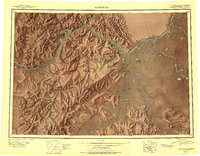
1950 Map of Sleetmute
USGS Topo · Published 1950About this map
The Kuskokwim River serves as the primary artery for settlement and commerce throughout this mid-century Alaskan interior landscape. Numerous established outposts and seasonal hubs line the riverbanks, including Mellicks Trading Post, Parents Trading Post, and McDonalds Trading Post, illustrating the central role of river trade in the region's economy. The presence of the Iditarod Winter Trail crossing the western landscape near Kolmakof Fort (Ruins) highlights the historical overland transport networks used when the waterways froze. Small communities like Napaimiut, Sleetmute, and Stony River Village are scattered along the major confluences of the Stony River and Holitna River, while high-altitude landmarks such as Canoe Mountain and Barometer Mtn provide significant navigational reference points above the valley floors.
Find a feature on this map
96 named features on this map. Tap any name to fly to it.
Don’t see what you’re looking for? This feature index may not catch every label — zoom into the map to look around manually.
Map Details
Editions of this 1950 Sleetmute Map
2 editions found
Other maps of this area

1946 · Lake Clark
USGS Topo · 1:250,000

1947 · Russian Mission
USGS Topo · 1:250,000

1949 · McGrath
USGS Topo · 1:250,000

1950 · Russian Mission
USGS Topo · 1:250,000

1950 · McGrath
USGS Topo · 1:250,000

1950 · Bethel
USGS Topo · 1:250,000

1950 · Taylor Mountains
USGS Topo · 1:250,000

1951 · Lake Clark
USGS Topo · 1:250,000

1951 · Taylor Mountains
USGS Topo · 1:250,000

1951 · Holy Cross
USGS Topo · 1:250,000