
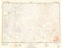
1950 Map of Bethel
USGS Topo · Published 1950About this map
The Kuskokwim River serves as the dominant geographic spine of this mid-century Alaskan interior, winding past a cluster of established riverside settlements including Bethel, Akiachak, and Akiak. To the west, the landscape is a dense network of sloughs and lakes near Napaiskak and Lomavik, while the east rises sharply into the high elevations of the Kilbuck Mountains. This transition from the delta-like flats of the Eek River to the peaks of Mt Plummer and Marvel Dome highlights a wilderness defined by its waterways. The presence of a Winter Trail connecting northern settlements reflects the seasonal nature of travel in a region where the Kisaralik River and Kwithluk River provided primary access to the interior before modern road infrastructure. This 1950 compilation integrates early aerial photography with ground surveys dating back to 1914.
Find a feature on this map
50 named features on this map. Tap any name to fly to it.
Don’t see what you’re looking for? This feature index may not catch every label — zoom into the map to look around manually.
Map Details
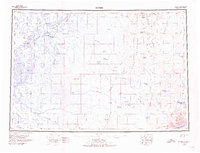
Editions of this 1950 Bethel Map
3 editions found
Other maps of this area

1947 · Russian Mission
USGS Topo · 1:250,000

1950 · Russian Mission
USGS Topo · 1:250,000

1950 · Sleetmute
USGS Topo · 1:250,000

1950 · Taylor Mountains
USGS Topo · 1:250,000

1951 · Marshall
USGS Topo · 1:250,000

1951 · Taylor Mountains
USGS Topo · 1:250,000

1951 · Kuskokwim Bay
USGS Topo · 1:250,000

1951 · Dillingham
USGS Topo · 1:250,000

1951 · Goodnews
USGS Topo · 1:250,000

1951 · Baird Inlet
USGS Topo · 1:250,000