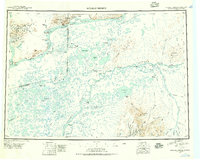
1947 Map of Russian Mission
USGS Topo · Published 1957About this map
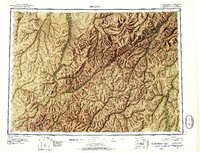
The Yukon River and Kuskokwim River anchor this mid-century portrait of Southwest Alaska, revealing a landscape defined by seasonal travel and remote outposts. Small settlements and camps like Dogfish Village, Russian Mission, and Aniak are connected by a network of river sloughs and overland winter trails. The presence of Kako Air Field and several isolated shelter cabins underscores the logistical challenges of the era, while the transition from the low-lying Paimiut Slough to the Kilbuck Mountains in the southeast highlights the varied terrain.
Find a feature on this map
130 named features on this map. Tap any name to fly to it.
Don’t see what you’re looking for? This feature index may not catch every label — zoom into the map to look around manually.
Map Details
Editions of this 1947 Russian Mission Map
2 editions found

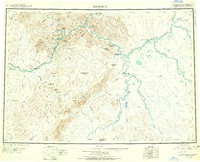
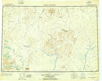
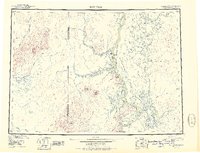
Other maps of this area

1950 · Russian Mission
USGS Topo · 1:250,000
1950 · Sleetmute
USGS Topo · 1:250,000

1950 · Bethel
USGS Topo · 1:250,000

1950 · Taylor Mountains
USGS Topo · 1:250,000

1951 · Marshall
USGS Topo · 1:250,000
1951 · Taylor Mountains
USGS Topo · 1:250,000
1951 · Holy Cross
USGS Topo · 1:250,000
1951 · Iditarod
USGS Topo · 1:250,000

1951 · Baird Inlet
USGS Topo · 1:250,000

1951 · Holy Cross A-5
USGS Topo · 1:63,360