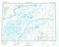
1947 Map of Russian Mission
USGS Topo · Published 1976About this map
The Yukon River and Kuskokwim River dominate this mid-century survey of the Alaskan interior, revealing a landscape defined by seasonal movement and riverine settlements. This era captures the transition between traditional ways of life and increasing aviation connectivity, evidenced by Kako Air Field and the Nyac Airfield near the mining settlement of Nyac. Distinctive native settlements like Dogfish Village, Russian Mission, and Chuathbaluk are documented along the major waterways, alongside smaller sites such as Tundra George and Phillips Bros. The intricate network of sloughs and lakes, including the expansive Whitefish Lake and Arhymot Lake, illustrates the complex drainage of the Yukon-Kuskokwim Delta. Between the river systems, the Portage Mountains and Paimiut Hills rise above the wetlands, serving as critical landmarks for travelers navigating via the Winter Trail.
Find a feature on this map
163 named features on this map. Tap any name to fly to it.
Don’t see what you’re looking for? This feature index may not catch every label — zoom into the map to look around manually.
Map Details
Editions of this 1947 Russian Mission Map
2 editions found
Other maps of this area

1947 · Russian Mission
USGS Topo · 1:250,000

1950 · Russian Mission
USGS Topo · 1:250,000

1950 · Sleetmute
USGS Topo · 1:250,000

1950 · Bethel
USGS Topo · 1:250,000

1950 · Taylor Mountains
USGS Topo · 1:250,000

1951 · Marshall
USGS Topo · 1:250,000

1951 · Taylor Mountains
USGS Topo · 1:250,000

1951 · Holy Cross
USGS Topo · 1:250,000

1951 · Iditarod
USGS Topo · 1:250,000

1951 · Baird Inlet
USGS Topo · 1:250,000