
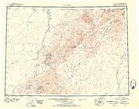
1951 Map of Iditarod
USGS Topo · Published 1952About this map
The Iditarod River and Innoko River systems define this remote interior landscape during the mid-century transition in Alaskan mining. The map captures the vital transportation network of the era, where the settlement of Iditarod serves as a central hub connected to Dikeman by the winding river and a series of seasonal routes including the Winter Trail and Summer Trail. These paths provided essential access to gold-rich districts surrounding Flat and Discovery when river navigation was frozen or impossible.
Find a feature on this map
67 named features on this map. Tap any name to fly to it.
Don’t see what you’re looking for? This feature index may not catch every label — zoom into the map to look around manually.
Map Details
Editions of this 1951 Iditarod Map
4 editions found
Other maps of this area

1947 · Russian Mission
USGS Topo · 1:250,000

1949 · McGrath
USGS Topo · 1:250,000

1950 · Medfra
USGS Topo · 1:250,000

1950 · Russian Mission
USGS Topo · 1:250,000

1950 · Sleetmute
USGS Topo · 1:250,000

1950 · McGrath
USGS Topo · 1:250,000

1951 · Ophir
USGS Topo · 1:250,000

1951 · Unalakleet
USGS Topo · 1:250,000

1951 · Holy Cross
USGS Topo · 1:250,000

1951 · Lime Hills
USGS Topo · 1:250,000