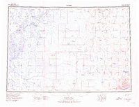
1950 Map of Bethel
USGS Topo · Published 1976About this map
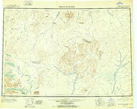
The Kuskokwim River serves as the central artery for this mid-century survey, anchoring a network of riverside settlements and sloughs including Akiachak, Akiak, and Nunapitchuk. The landscape transitions from the delta lowlands surrounding Bethel and Oscarville to the prominent heights of the Kilbuck Mountains and the Eek Mountains in the east. Notable for genealogists and local historians is the identification of Willie Petes Graveyard Point near the main river channel, alongside early aviation infrastructure like the Bethel Municipal Airport.
Find a feature on this map
101 named features on this map. Tap any name to fly to it.
Don’t see what you’re looking for? This feature index may not catch every label — zoom into the map to look around manually.
Map Details
Editions of this 1950 Bethel Map
3 editions found
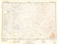
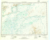
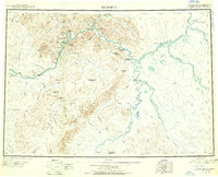
Other maps of this area
1947 · Russian Mission
USGS Topo · 1:250,000

1950 · Russian Mission
USGS Topo · 1:250,000
1950 · Sleetmute
USGS Topo · 1:250,000

1950 · Bethel
USGS Topo · 1:250,000

1950 · Taylor Mountains
USGS Topo · 1:250,000

1951 · Marshall
USGS Topo · 1:250,000
1951 · Taylor Mountains
USGS Topo · 1:250,000

1951 · Kuskokwim Bay
USGS Topo · 1:250,000

1951 · Dillingham
USGS Topo · 1:250,000

1951 · Goodnews
USGS Topo · 1:250,000