
1954 Map of Taylor Mountains A-4
USGS Topo · Published 1968About this map
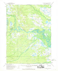
The Nushagak River dominates this interior Alaskan landscape, meandering through a broad floodplain characterized by intricate oxbow lakes and marshy terrain. Surveyed in the mid-1950s, the map reveals a remote wilderness where human presence is marked only by isolated Cabins and ruins along the riverbanks, suggesting seasonal use or long-abandoned outposts. In the northern reaches, the King Salmon River joins the Nushagak system, while the southeastern corner is anchored by the rising slopes of Sleitat Mountain. Tributaries like Klutulspak Creek and Vukpalik Creek feed into the central valley, illustrating the complex drainage patterns of this subarctic environment. This 1954 fieldwork captures the region before extensive modern development, documented during a period when land lines were predetermined by the Bureau of Land Management but remained largely unsurveyed on the ground.
Find a feature on this map
9 named features on this map. Tap any name to fly to it.
Don’t see what you’re looking for? This feature index may not catch every label — zoom into the map to look around manually.
Map Details
Editions of this 1954 Taylor Mountains A-4 Map
This is the sole edition of this map. No revisions or reprints were ever made.
Other maps of this area

1950 · Taylor Mountains
USGS Topo · 1:250,000

1951 · Taylor Mountains
USGS Topo · 1:250,000

1951 · Dillingham
USGS Topo · 1:250,000

1954 · Taylor Mountains
USGS Topo · 1:250,000

1954 · Dillingham
USGS Topo · 1:250,000

1954 · Dillingham D-3
USGS Topo · 1:63,360
1954 · Dillingham D-5
USGS Topo · 1:63,360

1954 · Taylor Mountains B-5
USGS Topo · 1:63,360

1954 · Dillingham D-4
USGS Topo · 1:63,360
1954 · Taylor Mountains A-3
USGS Topo · 1:63,360