
1954 Map of Dillingham D-4
USGS Topo · Published 1968About this map
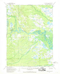
The Nushagak River dominates this southwestern Alaskan landscape, carving a wide, braided path through a network of wetlands and tundra. Surveyed during the mid-1950s, the terrain is defined by the convergence of the Nukakuk River and the main channel, where seasonal or semi-permanent Cabins and a small Cem are situated. These features suggest a point of local significance for transport or subsistence near the river bend. To the east, the topography rises sharply at Ketok Mountain, providing a distinct landmark above the surrounding lowlands. Numerous smaller water bodies, including Harris Creek, Cranberry Creek, and Napotalik Creek, feed into the larger river system, illustrating the complex drainage patterns of the Dillingham region before significant modern development.
Find a feature on this map
8 named features on this map. Tap any name to fly to it.
Don’t see what you’re looking for? This feature index may not catch every label — zoom into the map to look around manually.
Map Details
Editions of this 1954 Dillingham D-4 Map
This is the sole edition of this map. No revisions or reprints were ever made.
Other maps of this area

1950 · Taylor Mountains
USGS Topo · 1:250,000

1951 · Taylor Mountains
USGS Topo · 1:250,000

1951 · Dillingham
USGS Topo · 1:250,000

1954 · Taylor Mountains
USGS Topo · 1:250,000

1954 · Dillingham
USGS Topo · 1:250,000

1954 · Dillingham C-3
USGS Topo · 1:63,360

1954 · Dillingham D-3
USGS Topo · 1:63,360
1954 · Dillingham D-5
USGS Topo · 1:63,360

1954 · Taylor Mountains A-4
USGS Topo · 1:63,360
1954 · Taylor Mountains A-3
USGS Topo · 1:63,360