
1954 Map of Dillingham C-3
USGS Topo · Published 1968About this map
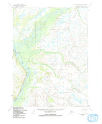
Nushagak River and Mulchatna River converge in this remote Alaskan wilderness, creating a complex network of braided channels and marshes. This 1954 survey by the Army Map Service reveals a landscape defined by water, where the small settlement of Nunachuak and scattered Cabins serve as the primary human identifiers along the riverbanks. The mapping reflects a pre-statehood era when land lines were often predetermined by the Bureau of Land Management rather than established on the ground. Beyond the major rivers, Nunachuak Creek winds through the tundra, illustrating the intricate drainage patterns of the Dillingham region before significant modern development reached these interior waterways.
Find a feature on this map
5 named features on this map. Tap any name to fly to it.
Don’t see what you’re looking for? This feature index may not catch every label — zoom into the map to look around manually.
Map Details
Editions of this 1954 Dillingham C-3 Map
2 editions found
Other maps of this area

1951 · Dillingham
USGS Topo · 1:250,000

1954 · Dillingham
USGS Topo · 1:250,000

1954 · Dillingham B-4
USGS Topo · 1:63,360

1954 · Dillingham D-2
USGS Topo · 1:63,360
1954 · Dillingham B-2
USGS Topo · 1:63,360

1954 · Dillingham B-3
USGS Topo · 1:63,360

1954 · Dillingham D-3
USGS Topo · 1:63,360

1954 · Dillingham C-2
USGS Topo · 1:63,360

1954 · Dillingham D-4
USGS Topo · 1:63,360

1954 · Dillingham C-4
USGS Topo · 1:63,360